Quincy Shores Reservation

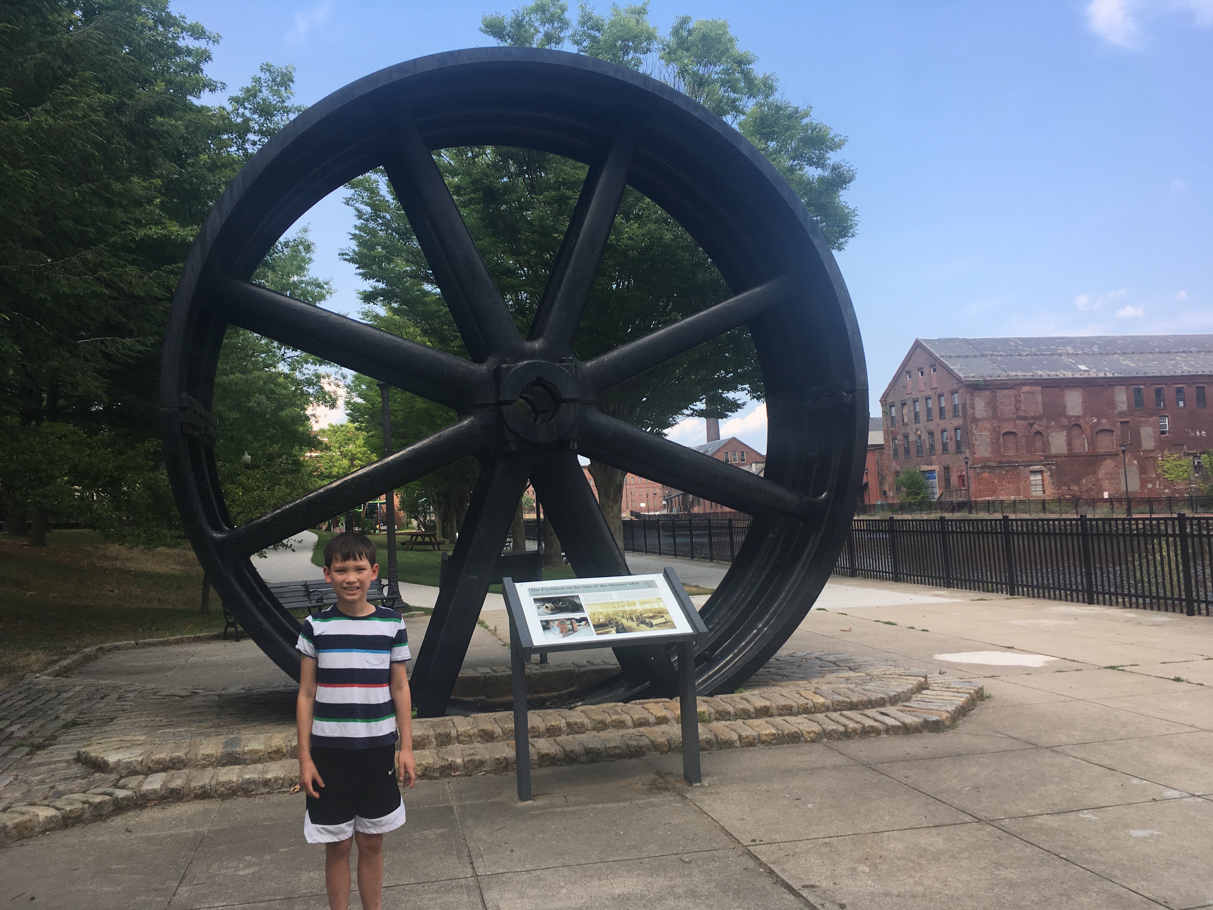
January 1, 2020 Windy

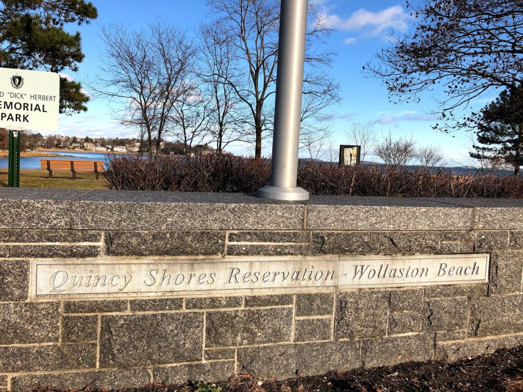
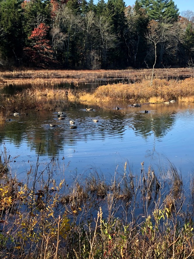
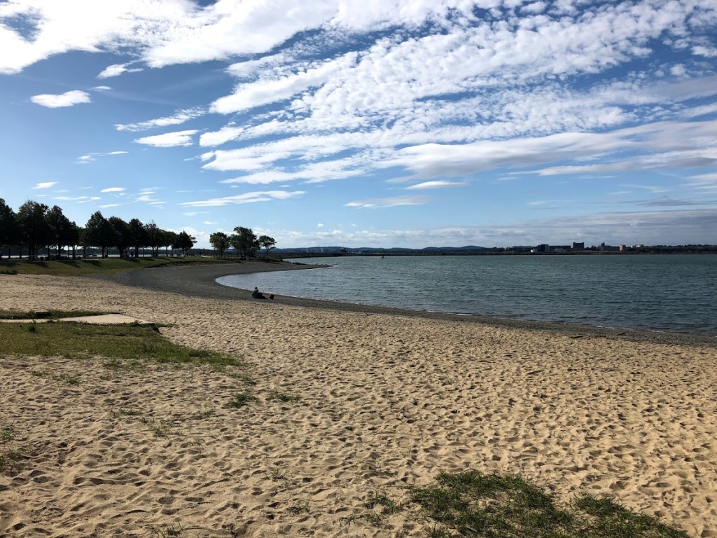
We took a walk along the largest beach on the Boston Harbor – Wollaston Beach – on a brisk and windy day. We parked near Caddy Park where there’s a playground and a few picnic tables. Caddy Park is actually a marsh across the Quincy Shore Drive from the beach. There are some trails in the marsh, but we didn’t venture in.

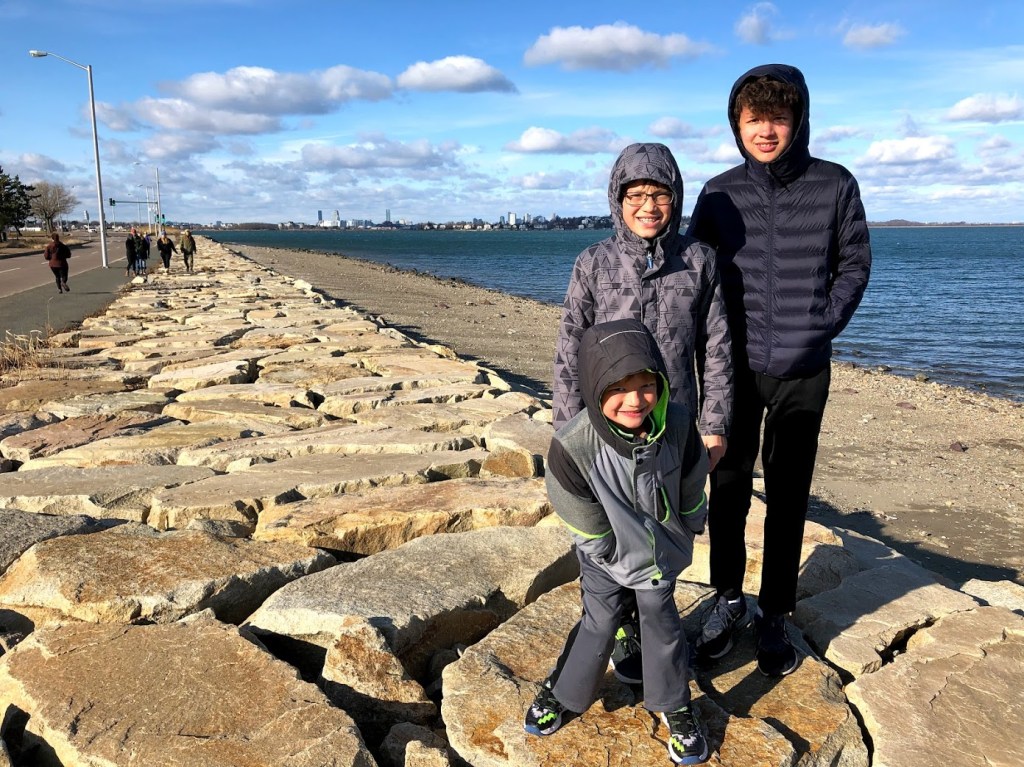
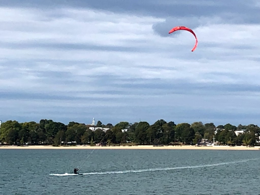
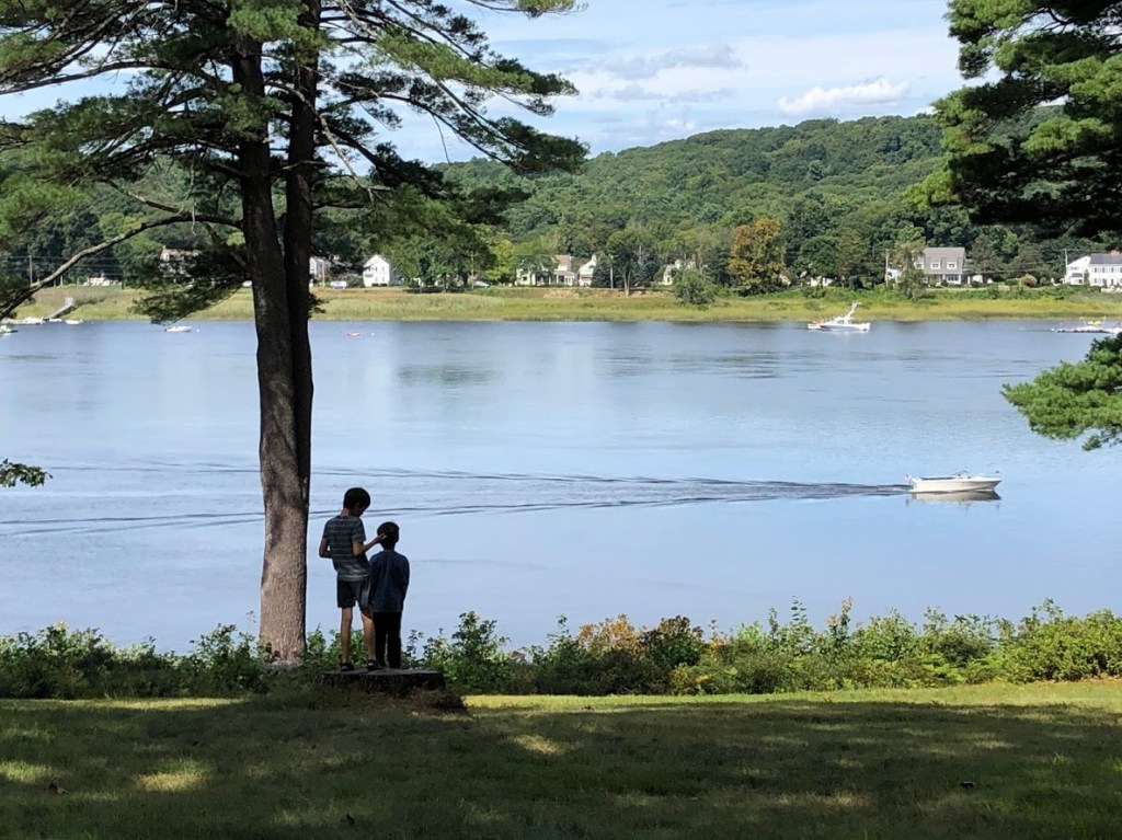
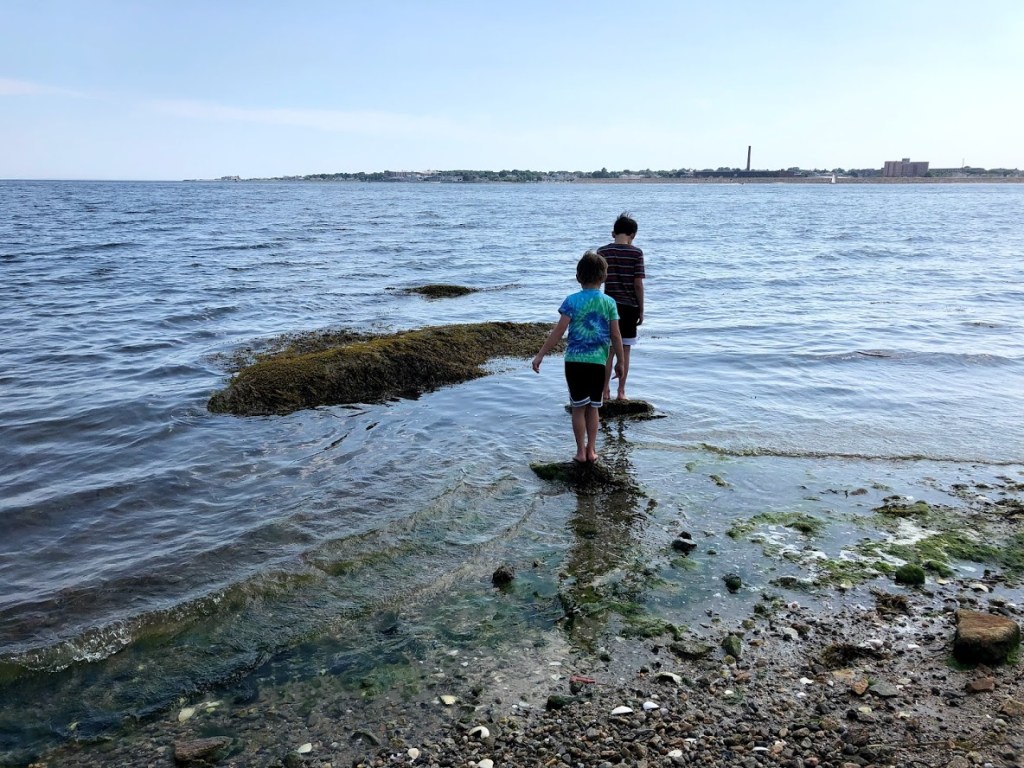
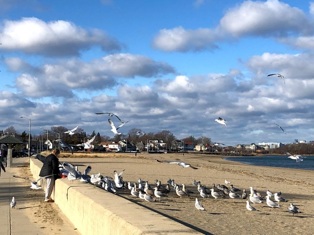
The boardwalk along Quincy Shore Drive and the beach was nicely paved. One side has parking and bus stops; the other side has some shops and restaurants. The whole walk was about 2.3 miles one way. In the winter the accesses to the beach were closed. Some people were walking on the beach, while we also saw people feeding the seagulls.

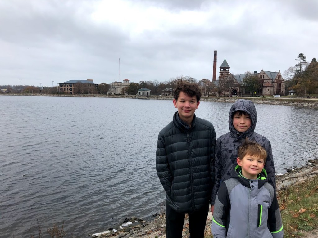
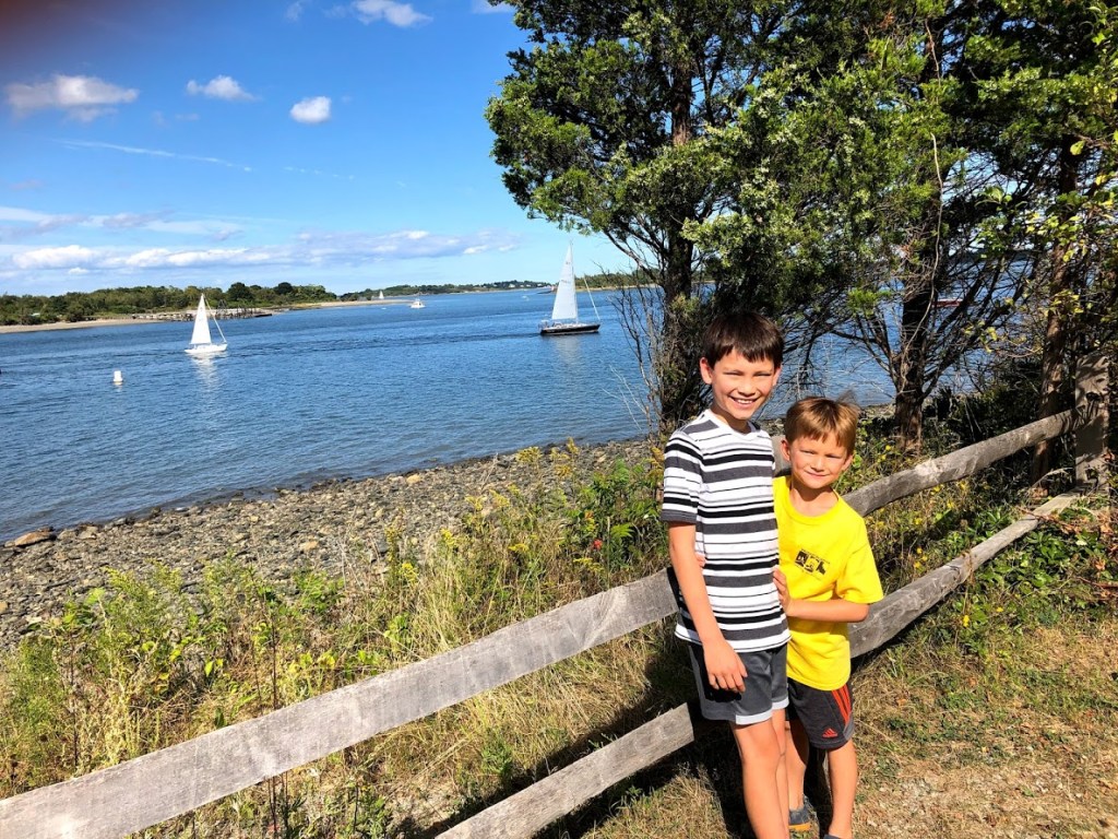
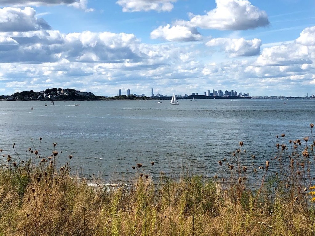
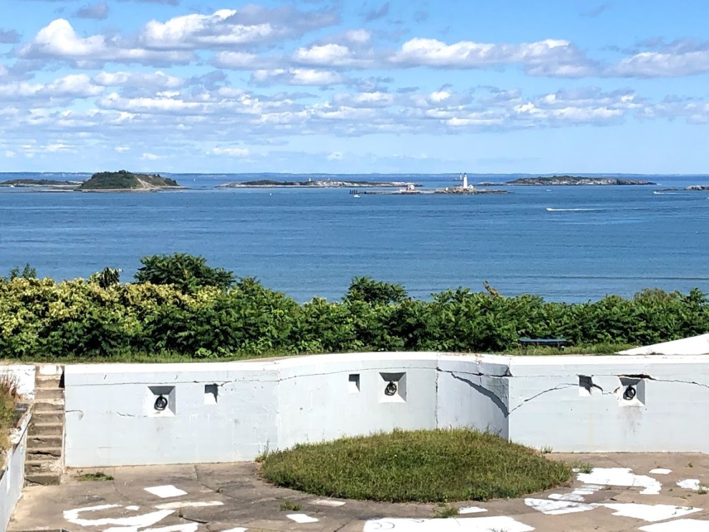
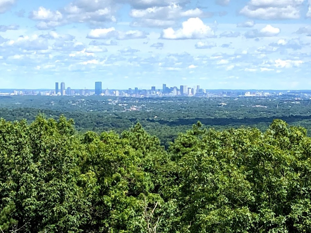
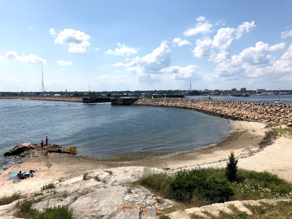
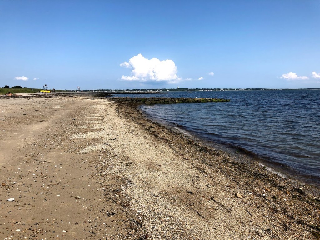
I personally think the beach looked quite rocky. The views were good though. Some of the Boston Harbor Islands as well as the Boston Head Light are visible. Towards the city, the taller buildings of Boston can also be identified.

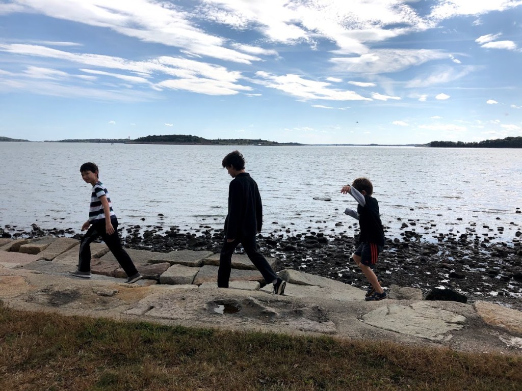
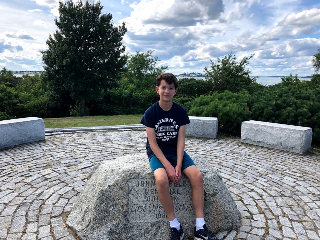
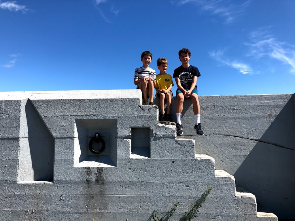
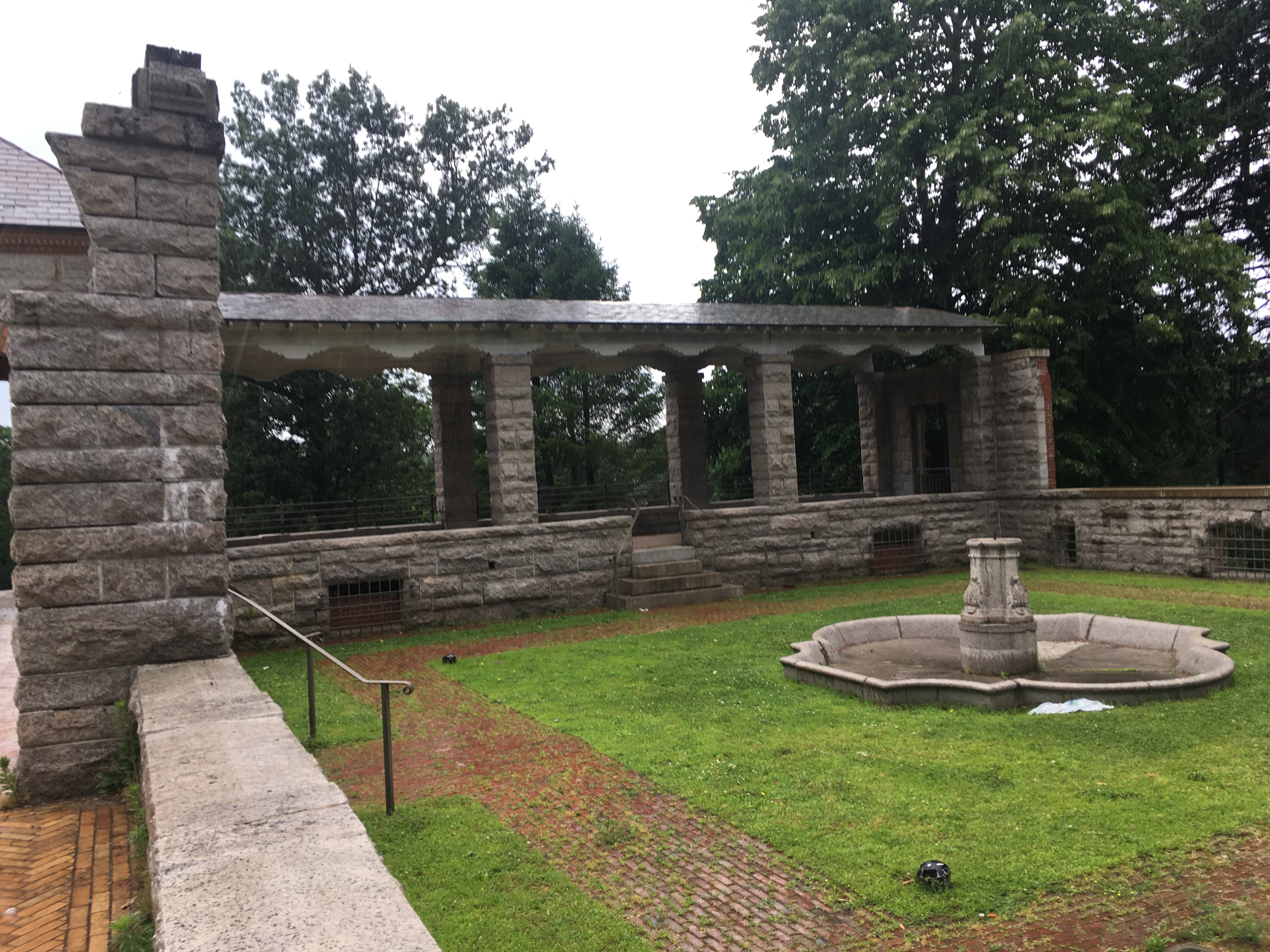
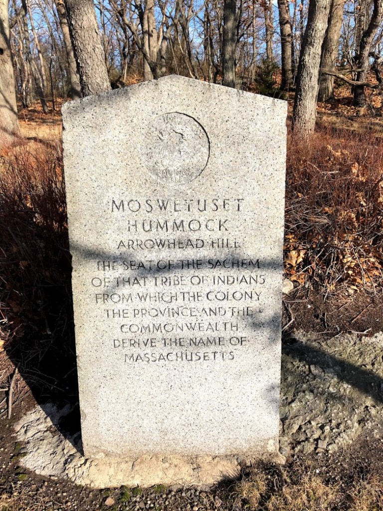
At the end of this walk, we came upon a little hill called Moswetuset Hummock. This is the site of the first encounter of Myles Standish with the local native sachem, or leader, Chikatawbut, in 1621 and cited as a source for the name of Massachusetts.

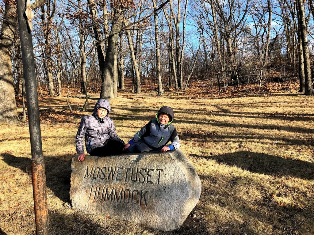
This hill was where the Native Americans camped and fished in the summer (in the winter, they retreated to the Blue Hills). From the Hummock there’s a good view of the beach and the harbor.

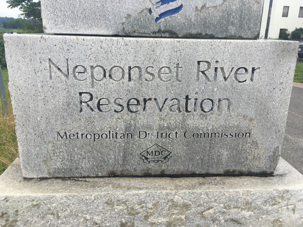
The Quincy Shores Reservation and Wollaston Beach are close to the city and convenient to visit, but the setting is quite commercial, and there’s not a whole lot to see other than the beach.

  • The best part of this walk was the small hummock once used by Native Americans. The beach is fairly thin and rocky.
  • Wollaston Beach is rocky. It’s a pleasant walk, but not much.
  • Sooo boring. Cold and windy. I now believe in hell.
  • Walking on the seawall was ok, and the trees were grey.
  • I liked the path. There was a random signpost right on the path. I liked walking on the wall too.

For more information, Quincy Shores Reservation official site

Western Gateway Heritage Park

November 30, 2019 Cold

This park consists of a visitor center located in a former railroad yard in North Adams, in Western Massachusetts. The exhibits relate to the role that the town played in the construction of the Hoosac Tunnel, a nearly 5 mile tunnel that was in 1875 the longest tunnel in North America. The tunnel extends from North Adams on the west side to emerge in the town of Florida on the east side.

The visitor center has a wide variety of exhibits and artifacts. Miles enjoyed the miniature of the town.

Much of the museum is devoted to the actual excavation of the tunnel and the machines used to do the work. There are also some samples of different rocks from the excavation that the kids could touch.

The tunnel is still in use mainly for freight trains. While the west portal is in the woods, we heard that the eastern portal is more easily visible in Florida, although we didn’t make a trip to find it (although we did enjoy passing through Florida on our trip). Unlike the Florida of Sunshine State fame, this small town sits on top of a mountain and was fairly snow-covered at the time.

This state park has a good visitor center and could be a fun stop for anyone interested in railroad history and exhibits. It is also close to Natural Bridge, which we visited on the same day.

  • A quiet visitor center with plenty of exhibits and a few hands-on activities.
  • This is a small visitor center. While it’s educational, there’s not much else on premise.
  • The museum was pretty nice but no one was in it. This is because there wasn’t much to see other than the museum.
  • I learned a lot in this state park. Such as the tunnel is the longest in the east coast back then!
  • The tunnel was long but in the museum it’s pretty short.

For more information: Western Gateway Heritage Park official site.

Roxbury Heritage State Park

November 23, 2019 Sunny/Cold

Roxbury Heritage State Park is located a few minutes away from a section of the Southwest Corridor Park, which we visited on the same day. This park was a convenient detour. The main grounds consist the Dillaway-Thomas House, which was recently renovated.

There are two floors to the house. On the first floor, one room is decorated in the colonial style of the 1700s. There were period furniture, toys, and models of colonial era food such as Roxbury Russet apples.

Roxbury Russet apples, the oldest apples cultivated in the United States

The house is situated on top of a hill, with clear views to the Boston Harbor. This location was very strategic during the Revolutionary War. Here, the park ranger was explaining how the house was used as an American headquarter during the War and Siege of Boston.

Here is a period desk with quill and parchment. Miles is Mrs. Thomas writing to her husband Commander John Thomas during the War.

The next room was decorated in the 19th century style. There were different artifacts from the Industrial Revolution, such as this original Edison Phonograph.

We got a demonstration of how this worked. The kids had to crank up the phonograph to start the action. This room also contained some exhibits from prominent Roxbury residents during that time, including a small display case dedicated to Malcolm X.

The upstairs rooms were mostly for community meetings and had exhibits about Roxbury during the Civil Rights movement and the present day. We were in a hurry so didn’t linger.

The house is in good shape and the exhibits are brand new. The park ranger was extremely friendly.

  • This site is recently renovated and well done, with a few hands-on exhibits that kids will enjoy.
  • This place has a variety of things to keep kids interested in history.
  • This building was top-notch, but I expect it doesn’t get too many visitors. What a shame nobody wants to visit Roxbury.
  • I liked the record player so much!
  • The tree in front of it, there was only one.

For more information: Roxbury Heritage State Park official site.

Chestnut Hill Reservation

November 17, 2019 Cold, Flurries

Chestnut Hill Reservoir is located at Cleveland Circle near Boston College, a busy intersection filled with student apartments, restaurants, and shops. The reservoir is an oasis in this crowded area. The DCR operates a skating rink, a pool, and maintains a trail around the reservoir. There is plenty of parking along Beacon Street on one side of the reservoir. Across Beacon Street, there is also a museum – “Water Works” – which is associated with the history of the reservoir.

The trail is gravel packed, flat, and about 1.5 miles. There are many entrances to the trail like this.

It’s very pleasant to walk around the reservoir, even on a cold day with flurries. There are always many joggers and Moms with strollers on the trail. Here is a view towards the museum .

There are islands in the reservoir and swans, ducks, and geese swim freely.

We stopped by the museum “Water Works”.

Chestnut Hill Reservoir with Water Works in the background

This museum is free (suggested donations). It houses three enormous engines that used to pump the water from the reservoir to supply the City of Boston in the 19th century. We took an excellent 1/2-hour tour to see these engines, and learned about the history and steam engine technology.

These engines worked well into the 20th century, until the aqueduct technology improved sufficiently such that Boston can source the water directly from Quabbin Reservoir without pumping. The tour was actually very good, and the museum also has an upstairs viewing area where the kids can play.

The trail, together with the museum, is well worth a visit.

  • The reservoir is interesting and the museum is a local, underappreciated gem.
  • The trail is flat and easy in all seasons. The museum is interesting.
  • It was kind of weird because the museum basically said we were drinking goose poop water. But the machines were kind of cool, and the reservoir was nice and peaceful.
  • The museum is nice and interesting. And the reservoir was cool.
  • We saw swans and that’s all.

For more information: Chestnut Hill Reservation official site

Brook Farm Historic Site

November 10, 2019 Sunny

History

Brook Farm Historic Site was a utopian experiment in communal living in the 1840s. It was founded by former Unitarian minister George Ripley and his wife Sophia Ripley at the Ellis Farm in West Roxbury in 1841, and was inspired in part by the ideals of New England Transcendentalism. Founded as a joint stock company, it promised its participants a portion of the profits from the farm in exchange for performing an equal share of the work. Brook Farmers believed that by sharing the workload, ample time would be available for leisure activities and intellectual pursuits. Among the original shareholders were journalist Charles A. Dana and author Nathaniel Hawthorne, who served together as the first directors of agriculture. Ralph Waldo Emerson, Bronson Alcott, Margaret Fuller, Elizabeth Peabody, Theodore Parker, and Orestes A. Brownson were among its interested visitors.

The Site

Brook Farm was named for the brook that ran near the roadside and that eventually went to the Charles River. It was surrounded by low hills and its meadows and sunny slopes were diversified by orchard, quiet groves and denser pine woods. The original buildings were almost all burned down. The only building left standing on the site is the Print Shop, but is not associated with the utopian community. However, even the Print Shop has fallen into disrepair and is all boarded up, although signs of restoration can be seen through the windows.

The Print Shop

The Trail

Not a lot remained on the site. A trail leads from the small parking area beyond the Print Shop to the Charles River. A side trail leads to the nearby Millennium Park. The trail is flat and narrow, and we walked past several cemeteries.

Along the trail were fields and swampy areas as we got closer to the river. Eventually, we reached the outskirt of UMASS Mount Ida College campus, and we could see the river from there. The terrain became a little hilly at that point, which gave us good views of the river.

Charles River

Across the Charles River is actually the Cutler Park Reservation that we visited before.

Brook Farm had a significant place in American intellectual history. It was one of the three important sites related to New England Transcendentalism (the other two are Walden Pond and Fruitlands in Harvard MA). Unfortunately it fell into dissolution, and this site is largely unknown in the general public.

  • Although once an important site, there’s not much left to visit. Some of the adjacent woods seem scattered with piles of debris, which was disappointing to see.
  • Historically significant, although not much left on the site. The walk was unexceptional.
  • The walk was really boring and the overall experience was super lame. Not surprising no one else wanted to visit this deserted wasteland of a state park.
  • It was very barren and he house was creepy.
  • The house is cool but we didn’t get to go inside it.

For more information: Brook Farm Historic Site official site

Walden Pond State Reservation

November 10, 2019 Sunny

Walden Pond in Concord, MA was made famous through the writings of Henry David Thoreau in Walden; or, Life in the Woods in which he describes his experiences living on the north shore of the pond starting in the summer of 1845. Thoreau lived a mostly solitary existence there for around 2 years.

Today the pond is a beautiful and popular destination, especially in the summer for the small beach, and in the fall for the colorful foliage.

Our first stop on this November day was a short film at the visitor center. Afterwards, we visited an accurate reproduction of Thoreau’s cabin, a very small one-room structure with simple furniture, a wood stove, and an attached woodshed.

Miles was amazed how barren and simple it was. It’s hard to imagine that what we saw was all that Thoreau owned. Miles stopped at the writing desk to meditate on the visitor log.

We crossed the road and down the path to the small beach, the starting point for our walk around the pond. From there, we continued hugging the shore to the north side of the pond, pictured in the background of the picture below.

Just past a marshy area next to the pond, the path leads away from the shore a small distance to markers that show the original cabin location. Having just seen the reproduction, it was easy to imagine the cabin on this spot, and a stone marked the chimney foundation.

Immediately beside the foundation markers is a striking site – a pile of stones, some plain and some adorned, placed there by visitors over the years. A sign also shows one of the more famous quotes from the opening of Thoreau’s book Walden.

Continuing around the pond offers several great views.

When we visited in the fall, the water was strikingly clear, seemingly invisible apart from the ripples.

Returning to the visitor center, we learned more about the history of the area and the pond. Miles also learned how Thoreau took detailed depth measurements from a small boat, using a knotted rope.

Our last stop was the small gift shop next to the visitor center, which had a great selection of books by Thoreau and related thinkers of his time.

Walden Pond State Reservation has always been a favorite for our family and visitors, who enjoy the history, scenery, and recreation that the pond offers.

  • Walden is a really lovely and well-kept destination, but can be overrun by visitors during the summer.
  • One of my favorite places. The visitor’s center is very good at introducing Thoreau’s ideas. The pond is pristine.
  • We’ve been to this place a bunch of times and every time it’s very boring… just a museum about some guy who lived by a lake because he liked nature. Plus there’s NO CELLULAR SERVICE!!! What a stupid wasteland.
  • The movie was really cool and the walk was nice.
  • I like going in the cabin. The pond is beautiful.

For more information: Walden Pond State Reservation official site

Borderland State Park

November 3, 2019 Sunny

Borderlands State Park is a large preserve in the towns of Easton and Sharon southwest of Boston. The natural areas encompass the Ames Mansion (circa 1910), and several movies have used the grounds or mansion for film scenes.

The day we visited, the park was buzzing with families, and appears to be a well-known local attraction. We first stopped by the well-kept visitor center with exhibits and restrooms. From there we decided to walk around Leach Pond, heading first toward the edge of the pond to a stone lodge. This lodge was used in the filming of the 2008 movie “Shutter Island”.

Behind the lodge we found an area with benches and a great view of the main sections of the pond.

We then continued on a wide, flat trail around the pond. A few sections had benches.

At the boundary with the Upper Leach Pond the trail crosses a small bridge and follows a narrow strip of land to the other side of the pond. For a longer walk you could continue around the entire pond, pictured below left.

From the other side, we emerged in a scrubby but very colorful area of the pond.

We soon crossed a large field that was originally part of the Smith Farm (circa 1880) and came upon the old farmhouse, neatly restored, and some rusty farm tools and plows.

The trail then followed a wide, straight path along a marshy area of the pond with plenty of ducks swimming near the shore.

A forested trail eventually led back to the old Ames Mansion, pictured below. The stone house was solid and grand. Looking through the windows, we could see a large, formal library inside.

After a tour around the house we headed back to the visitor center, passing some disc golf goals.

Borderland State Park has a great mixture of scenery, history, and recreational opportunities. It was a real gem among the parks we’ve visited.

  • The great visitor center, variety of scenery, and the old mansion made this an outstanding park.
  • This park has everything – lake, woodland, historic mansion, etc. A gem.
  • The mansion was cool… my favorite part was the porta-potty. The lake was fun but Ryan (↓) kept throwing rocks at me, so that was a bummer :/
  • The mansion was very interesting and the lake was nice
  • I like the lake. The disc golf is pretty cool.

For more information: Borderland State Park official site

Blackstone River and Canal Heritage State Park

October 20, 2019 Sunny

This state park is along the midpoint of a canal that was used to transport goods in the 1800s from the Worcester area south to ports in Providence, Rhode Island. It’s also within the Blackstone River Valley National Heritage Corridor, a park dedicated to the early years of the American Industrial Revolution.

We visited the River Bend Farm with the park, to learn about the history of the canal, and to walk the canal towpath.

The farm is by a wider and peaceful section of the canal.

Once you cross the bridge you can join the path, which is mainly for pedestrians.

There is a 1.5 mile section you can follow along the canal south from the farm, but we walked a shorter path north to the dam.

After this we drove a few minutes to check out the Blackstone River Greenway. This is a really well-maintained, flat path that follows an old railroad bed.

The riding is easy and passes through forested areas, open sections, across old bridges spanning rivers, and past small towns.

There are very few road crossings, which makes it great for younger cyclists. We took the path south a few miles into Blackstone Village, where we stopped for lunch. This small town is just on the border with Rhode Island.

Unfortunately, Ryan had a bicycle accident on the return trip, in which he knocked out a front adult tooth, so this emergency cast a shadow on our visit. 😦

However, we can say that the State Park is well worth a visit, especially during fall foliage season. And if you’re in the mood for cycling, the Blackstone River Greenway comes highly recommended. Just be sure to wear a helmet and stay on the path.

  • The canal and towpath make for a picturesque walk. The bikeway was well-maintained, flat, with interesting scenery.
  • The visitor’s center was educational. The pond and path was beautiful in the fall. The bike path was awesome.
  • The visitor center smelled like… musty stuff! But the path was pretty cool, so it wasn’t bad.
  • Walking on the path was nice but the visitor center was smelly
  • I liked the canal but the water was cold.

For more information: Blackstone River and Canal Heritage State Park official site.

Quabbin Reservoir

October 13, 2019 Sunny

Quabbin Reservoir is the largest inland body of water in Massachusetts, and serves over 3 million people in Boston and other suburbs. It holds about 412 billion gallons and has an area of nearly 39 square miles.

We drove the length of it from north to south, catching glimpses from the mountainous terrain just west as we came down US 202, on our way to the Quabbin Visitor Center at the south tip of the reservoir.

Although the visitor center is small, there are a few interesting exhibits covering the history of the reservoir as well as short photo albums showing black and white pictures of the towns that were flooded and lost to history as part of reservoir expansion in the 1930’s.

For us, a key attraction was viewing the reservoir and walking across the enormous earthen Winsor Dam, built around 1940. It’s one of the largest such dams in the Eastern U.S. and is roughly 1/2 mile across.

As you walk across, on one side is the water and on the other, a steep grass hill flowing down into forest below, seen below.

Reaching the other side you find another marker for the dam.

If you continue just a little farther past the dam you reach an interesting bridge with beautiful views of the Quabbin Reservoir Spillway far below.

On our way back, we decided to walk along the base of the dam and then run up the side to the top. The kids loved running zigzagging up and down the dam a few times, and were really worn out after a few runs. Other kids joined them – it was irresistible.

Although swimming and boating are not allowed, Quabbin is a great place for hiking and biking. Be sure to stop by the visitor center and dam to appreciate the history and scale of the engineering work that built out the reservoir.

  • A scenic reservoir with a special earthen dam and great views.
  • Running up and down the big dam was so much fun fir the kids!
  • I ran up and down the hill ’till I couldn’t no more. I also saw small red beetles with black dots on them, so that was pretty epic.
  • I really liked running up and down the big hill
  • I liked running down the hill. I like the bridge.

For more information: Quabbin Reservoir official site

Castle Island, Pleasure Bay, M Street Beach and Carson Beach

October 6, 2019 Windy

Castle Island is a peninsula in South Boston that’s the site of a fort, and now has a playground and beach adjacent to it.

There’s a loop around the small “bay” (Pleasure Bay), but we took the shorter paved loop around the island instead, which is about 1 mile. The first section goes past a beach.

Although the beach was empty, we did see a few parasailers racing back and forth across the water, carried by the strong winds.

Farther around the island you can see many of the Boston Harbor Islands in the distance as well as Deer Island.

There are also several memorials on the far side of the island.

A Korean War Memorial
The Donald McKay memorial is for a shipbuilder who built several famous clipperships nearby

There are free tours of the interior of the fort on Saturday and Sunday (check the schedule before you come), but for our visit we followed the path around the outside.

Castle Island and the surrounding area is great fun on a hot summer day, when you can visit the playground, beach, have a picnic, or enjoy some fried seafood at Sullivan’s. But it’s also worth a visit in the off-season for the changing scenery and laid-back feel.

  • Great views all around, with history and some good food (in the summer).
  • Nice views. Good facilities. The kids loved it.
  • I enjoyed the walk but overall it wasn’t amazing… close to the shore and the ports.
  • It was windy but me like view. Very cool. and playground. Eppik.
  • I liked the playground. But it’s not an island.

For more information: Castle Island official site.

Webb Memorial State Park

September 8, 2019 Sunny

This park rests on a peninsula that extends about 1/2 mile into Hingham Bay with trails around the edge and water views all around. It also has plenty of parking, restrooms, and a picnic area. It is both a state park and the only mainland section of the Boston Harbor Islands National Recreation Area.

We visited on a warm, sunny day and took the loop around the water’s edge.

Reaching the end of the peninsula you can see other Boston Harbor Islands near you and there were plenty of sailboats when we visited.

The views toward Boston are also spectacular, with a clear view of the city skyline. We could also see airplanes on their descent into Logan.

Continuing on the level path we came to a rocky beach where the kids skipped stones for a while. Although the water seemed pretty chilly to us, a woman did go in and take a dip (you can see her in the distance). We also saw the T ferries from Boston to Hull pass by and bring some wake crashing on the shore.

On top of a small hill farther along we found a memorial to a local man named John Cole, who was a big-hearted Christian man in the community who was a selfless and true friend to his neighbors. It was really a lovely and peaceful section of the park.

We enjoyed Webb Memorial very much. The fresh air and great water views make it feel more like a Boston harbor island than a peninsula, and it was easy to visit. A very pleasant way to spend a summer afternoon.

  • This park had great views of the Harbor Islands and several peaceful memorials. It really felt like an island.
  • This is really a beautiful park. Compact with great views. Too bad the beach is rocky.
  • The beach was cool and we skipped stones at the ocean surface, so it was pretty cool (‘v’)
  • The beach is good and the memorials and the trail, but I got wet.
  • I like the beach.

For more information: Webb Memorial State Park official site.

Fort Revere Park

September 8, 2019 Sunny

Fort Revere Park contains two seacoast fortifications. During the American Revolution, it was first fortified by Patriot forces to protect Boston Harbor.

The path leading up to the park was not well maintained. When we arrived at the top of what is known as Telegraph Hill, the views from the remains of the fort were breathtaking. We can see Boston Light on Little Brewster Island, and the other islands in the Boston Harbor.

View of Boston Light on Little Brewster Island

The fort fell out of use after the Revolution War until World War I, when quarters and storehouses were built. However, nowadays, the buildings are in a decrepit state. Stairs are very worn, and rather dangerous to walk on. The rooms are dark and damp, and the walls are full of graffiti.

The kids enjoyed running through the tunnels and pretending that the rooms were haunted. Although there were no guns or cannons left, they imagined they were at battle.

There is also a water tower, but it’s also in disrepair and is closed to public. Not much remained of this fascinating place.

  • The harbor views including the Brewster islands and lighthouse make this worth visiting, but the fort itself is really rundown.
  • The views are nice, but this place really need a restoration.
  • Lots of graffiti and broken parts of the building. Bad condition overall. But still really cool.
  • The view of the peninsula was great and it was interesting.
  • I liked the creepy parts and the space where the cannon had been was cool.

For more information: Fort Revere Park official site.

Maudslay State Park

September 1, 2019 Sunny

Maudslay is a very pretty state park in Newburyport, MA right on the Merrimack River that separates the state from New Hampshire to the north. It has some ruins of an old estate and gardens, along with trails that wind through stands of mountain laurel and rhododendrons.

We started along a wide trail that passed over a stone bridge and then into a forested area along the river.

The views along the Merrimack are really great and you can go right down to the shore.

Continuing along a trail by the river we eventually came to the ruins of the Mosely Estate.

The view from this house must have been magnificent. It’s quiet today with a dramatic slope toward the river and a few benches to rest on. The boys found a large tree stump to play on as we rested a bit.

Continuing beyond this, we came to some old gardens, the best preserved of which were the Italian gardens, with roses and fountains.

Leaving this area we returned on a carriage path to the main parking lot.

  • This park has a lot of variety, fresh air, and beautiful river views. It’s a real gem that captures some of the grandeur of times past.
  • Beautiful gardens, great views. A little run down.
  • The park was fun. Lots of dogs. Green grass, beautiful gardens, etc.
  • The path was wide and the gardens were good.
  • The garden was cool. If you look at it, it is amazing.

For more information: Maudslay State Park official site

Blue Hills Reservation

August 10, 2019 Sunny

This is a large state park about 10 miles south of Boston. It consists of hills with trails, mainly for hiking, but also has a ski slope in the winter months. At the foot of the hills you can find the nearby Houghton’s Pond Recreation Area, another state park. Within it, there is also the Trailside Museum, our first stop.

Although it’s small, it has plenty of live animals (frogs, snakes, owls, etc.) within, along with a viewing area of a small pond. Outside are further animal exhibits with eagles, vultures, deer, and foxes. When we visited the turtle and otter exhibits were under construction.

We took the popular and short (2 mile) Red Dot Trail from the museum parking lot. It climbs steeply for a while and reaches the the Eliot Tower, with great views of downtown Boston.

Continuing along a short path, we quickly reached the other star attraction here, the old Blue Hill Observatory. Founded in 1885, it’s the oldest weather observatory currently in use.

Although you can climb the tower on a guided tour for a small fee, we decided to browse the small but interesting gift shop. It’s packed with all sorts of flying toys as well as a great selection of kites, which you’re allowed to unpack and fly from the hillside next to the observatory.

After resting a bit, we descended along the paved Summit Road, and then rejoined the Red Dot Trail for the remainder of the hike.

  • This park offers great views for minimal effort but you can also explore the extensive trail network. On a hot day, stop off at Houghton’s Pond next door to cool off.
  • Nice view of the city on a clear day.
  • Just a normal hike… If you’re looking for something fun to do, don’t go here. You’ll only waste your free time :/
  • It was good and the visitor center was great.
  • I liked the museum. The observatory was cool. It was pretty when we looked out from the tower.

For more information: Blue Hills Reservation official site

Fall River Heritage State Park

August 4, 2019 Sunny

This state park consists mainly of an antique carousel, visitor center, and boardwalk along the river. It sits under the Braga Bridge that carries traffic along I-195.

The day we visited, the carousel and visitor center were both closed, so we just took a walk to enjoy the views of Battleship Cove, the largest collection of World War II era naval ships in the world.

Continuing past the bend around the visitor center, the boardwalk extends toward a marina and a waterfront restaurant, visible in the photo below. In the middle distance is a small, shaded area with some picnic tables.

Apparently the sunset views are quite lovely here. But if you come, be sure to check the hours for the visitor center and carousel. And do try to visit Battleship Cove if you have the time.

  • Short boardwalk with good views of World War II battleships and a small marina.
  • The boardwalk was nicely done.
  • The visitor center was closed but the battleship was cool.
  • I like the battleship. The cove was beautiful.

For more information: Fall River Heritage State Park official site.

Fort Phoenix State Reservation

August 4, 2019 Sunny

This is a small park in Fairhaven. It was originally built around the Revolutionary War and served as a military installation until just after the Civil War.

The parking to the right is for the Fort, while the recreational areas and beach are to the left. We decided to explore the remains of the fort, and the kids enjoyed scrambling over the smooth rocks.

There are also stone walls to run around and which follow the contour of the land, along with a number of old cannons, one of which is from Revolutionary War times.

The water views here and sea breeze are really pleasant. Off to the side is a channel for boats to pass through, including ferries from New Bedford bound for Nantucket, The Vineyard, and other islands.

The kids enjoyed hopping along the giant rocks seen above down to the water, which looked clear and cool.

After walking a bit, we had to turn back since we couldn’t cross over to the New Bedford bike path on the opposite side.

We head over to check out the beach, which was small, with several bored-looking lifeguards watching just a few kids. It seemed pretty rocky but the kids enjoyed wading into the warm water.

Fort Phoenix is a small but beautiful park that is well-maintained, has plenty of parking, and great water views. It has the beach, space to play or read in the shade, as well as some history to enjoy.

  • A small park that packs a lot of variety. Come for the water views on a sunny day.
  • Aside from the beach which is small and rocky, this park is wonderful.
  • The ocean was good and there was a drawbridge.
  • The flat path was cool. The beach was fun. Even though we didn’t swim.

For more information: Fort Phoenix State Reservation official site.

Holyoke Heritage State Park

July 20, 2019 Sunny

Holyoke Heritage State Park is in the center of town along a canal. The grounds consist of a Visitor’s Center, a Merry-Go-Round, a Children’s Museum, a Volleyball Hall of Fame, as well as a canal walk.

The Visitor’s Center has exhibits about the history of Holyoke, including a replica of the immigration stations on Ellis Island, and details on industrial mills in Holyoke. Holyoke was a center of paper making in the 1800s. The Visitor’s Center is pretty small.

Right in front of the Visitor’s Center, inside this building below, was the Merry-go-Round.

Outside the Visitor’s Center there was a splash pad, and just beyond that was the canal.

Canal

On both banks of the canal stood historic mill buildings. Unfortunately, most of the mill buildings on the side of the Visitor’s Center were burned down, so the City put in a playground and an old flywheel that was used to power the steam engines in the mills.

Flywheel

On the other bank the buildings were decrepit. Many were empty and run down.

The Children’s Museum and the Volleyball Hall of Fame are nearby, but we didn’t have time to visit them.

  • The carousel was the highlight. The canal walk was disappointing, with some old mills gone and now just grassy lots.
  • Not much to see at the visitor’s center, and outside along the canal the buildings were run down.
  • The carousel was fun. but overall it was a bit boring.
  • I like the carousel. The wheel looks cool.

For more information: Holyoke Heritage State Park official site

Lawrence Heritage State Park

June 30, 2019 Thunderstorms

Lawrence Heritage State Park has four different parts. The Pemberton Park between the canal and the Merrimack River commemorates the 145 people who lost their lives in the Pemberton Mill disaster of 1860. The Riverfront Park and Riverside Park are on opposite sides of the Merrimack. The Greycourt State Park in nearby Methuen contains the grounds, gate house, and ruins of the Tenney Castle.

Lawrence Heritage State Park headquarters has a museum that is dedicated to the history of the Lawrence cotton mills and labor movement in the Industrial Revolution.

Lawrence Heritage State Park Headquarters

The visitor center has a pretty good exhibit. The kids loved exploring all the “old technology”, such as a rotary telephone, a typewriter, and a sewing machine.

Old telephone
Typewriter

We learned about the Pemberton Mill disaster that claimed the lives of 140+ people, and the labor movement of 1912 that eventually led to overtime pay.

We then took a walk outside along the canal and saw the Pemberton Mill that was rebuilt, and along the Merrimack River that had more mills and dormitories converted into apartments and condos.

Ayer Mill Bell Tower

The clock tower you see above is the largest mill clock tower in the world, with faces that are nearly the size of Big Ben’s. It really stands out on the skyline.

The other park we visited was the Greycourt State Park that had the ruins of the Tenney Castle. This castle was built by an industrialist and “city father” of Methuen called Charles H. Tenney in 1890, but was burned down in different fires in the 1970s.

Ruins of Tenney Castle

The grounds were pretty and would have been a beautiful place for pictures, but really not a whole lot to see here.

  • The canal walk is short but has a series of bridges and imposing mills. But the walk is short and lacks signs for points of interest. This is a diamond in the rough and will certainly improve with investment.
  • The museum was nicely done. The walk along the canal and the Merrimack was alright, but the buildings were not in good shape.
  • The museum was boring, just some old stuff, and the buildings around there were in bad shape.
  • The museum was good but it was kind of boring. I liked the castle.
  • The castle looked cool. I like playing with the telephone.

For more information: Lawrence Heritage State Park official site

Neponset River Reservation

June 29, 2019 Thunderstorm

This walk along the river is connected to the John Paul II Park and can be reached by continuing from that park under I-93 on a flat, even bike path.

There are numerous murals along the way, such as the one here.

Some are also poetic, and all are in good shape, without a hint of graffiti vandalism.

The walk takes you by fields with a splash park, and follows along the Neponset River, which is crossed by an interesting old drawbridge.

Past this bridge you have great views of the river on your left and an old cemetery on the right.

It’s a nice, easy path for younger walkers or riders, without many other pedestrians or cyclists.

Eventually you reach the site of an old industrial mill and the former Baker chocolate factory, where you can watch the fast moving water move over rocks and past willow trees, or stop for a rest.

If you’re interested in history, be sure to turn left (south) on Adams street, walk a block, and see the Milton Landing historical marker, which commemorates a document that inspired the Declaration of Independence.

Once you’re finished, you can return the same way, or you can take the old trolley for free from the Milton stop up to Cedar Grove, or another station near your parking spot. Just be sure to get off by Ashmont.

This pleasant walk has plenty of variety for everyone, and is a great way to see nature as well as explore some urban areas.

  • Lots of interesting murals, flat path, and some bathrooms (port a potties) along the way. Ends around a scenic bridge and rapids. Good path for walking or biking.
  • I would definitely come back biking the trail. The scenery was varied and interesting. There’s a free trolley that goes along the trail from Mattapan to Cedar Grove.
  • There are beautiful murals along the trail. There is also a trolley (no cost!) that runs next to the path.
  • I liked the trail because it was paved and the trolley was fun.
  • The river was beautiful. It was fun riding the trolley back to our starting point.

For more information: Neponset River Reservation official site

Pilgrim Memorial State Park

June 16, 2019 Cloudy/Showers

We parked along shore a bit north of this site, which allowed for a short stroll along the shoreline before reaching the main tourist attractions. The first site that caught our eyes was a small pirate ship for rent.

Also from this spot you can see an unusual site – a rowboat perched on top of a restaurant.

As you wander along the seawall you approach the site of the Mayflower II (a replica ship which was away during our visit, and not returning till May 2020). But at least we get a bonus state pier sign, which normally would lead to the Mayflower and a chance to explore the ship.

The actual Plymouth Rock is somewhat disappointing, sheltered in a grand pavilion, but clearly cracked down the middle. It was actually identified by an elder as the original spot where the Mayflower passengers arrived much later – in 1741 – but the story is somewhat doubtful. It split in 1774 as it was being dragged to the town square.

The famed Plymouth Rock

After you see the Rock, you can cross the street and climb a grassy hill for views of the harbor. The Indian chief Massasoit looks out on the water as well and is happy to pose for pictures.

From here, wander inland a few blocks, passing old houses, to a main shopping district with plenty of restaurants. Or just follow along the shore and enjoy the water views.

  • Although Plymouth Rock is somewhat disappointing, the waterfront is great to stroll and there’s plenty of history in town and the nearby Plimoth Plantation. Or you can just load up on the souvenirs, fudge, and saltwater taffy.
  • There’s not a lot to see. The Mayflower is in Connecticut until next year. The waterfront was nicely done but touristy.
  • It’s pretty boring and there is nothing to do. Not nearly as impressive as you might think.
  • Just a rock. Next to the ocean is good.
  • It looked cool. There’s not that much stuff that you can do.

For more information: Pilgrim Memorial State Park official site