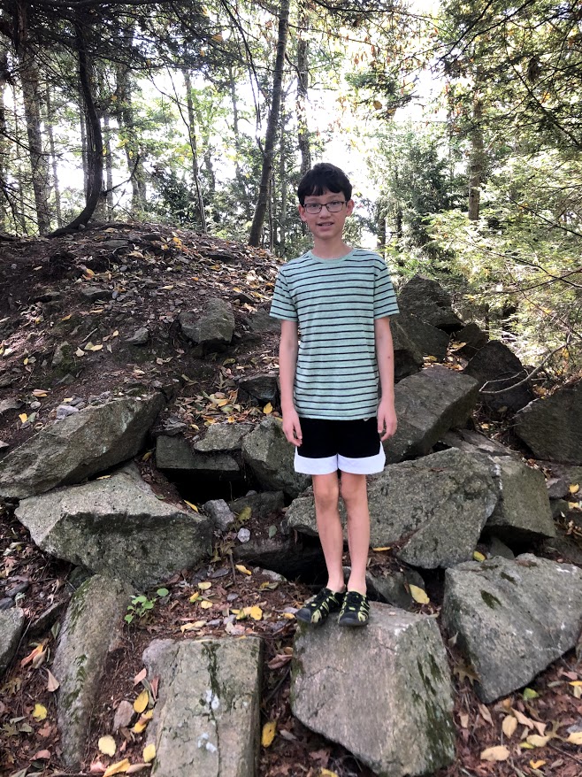
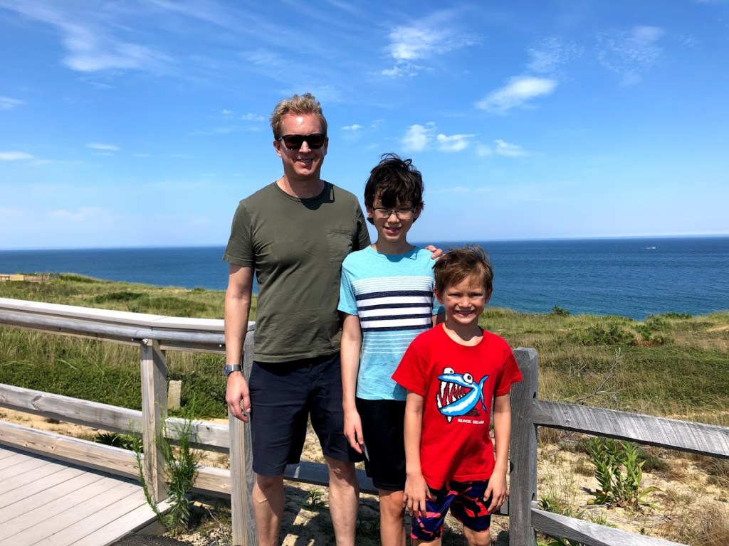
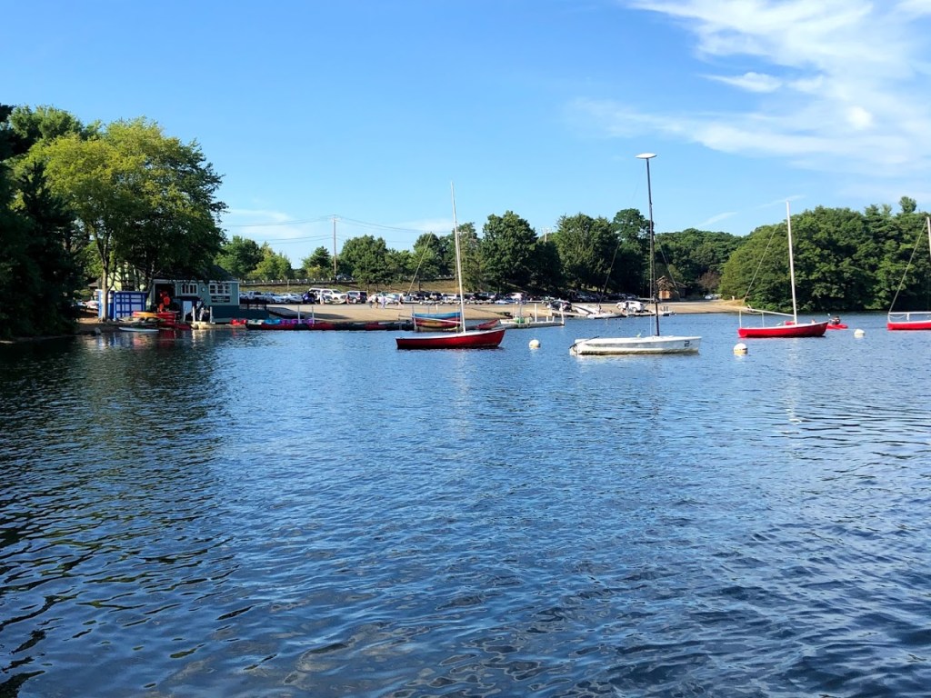
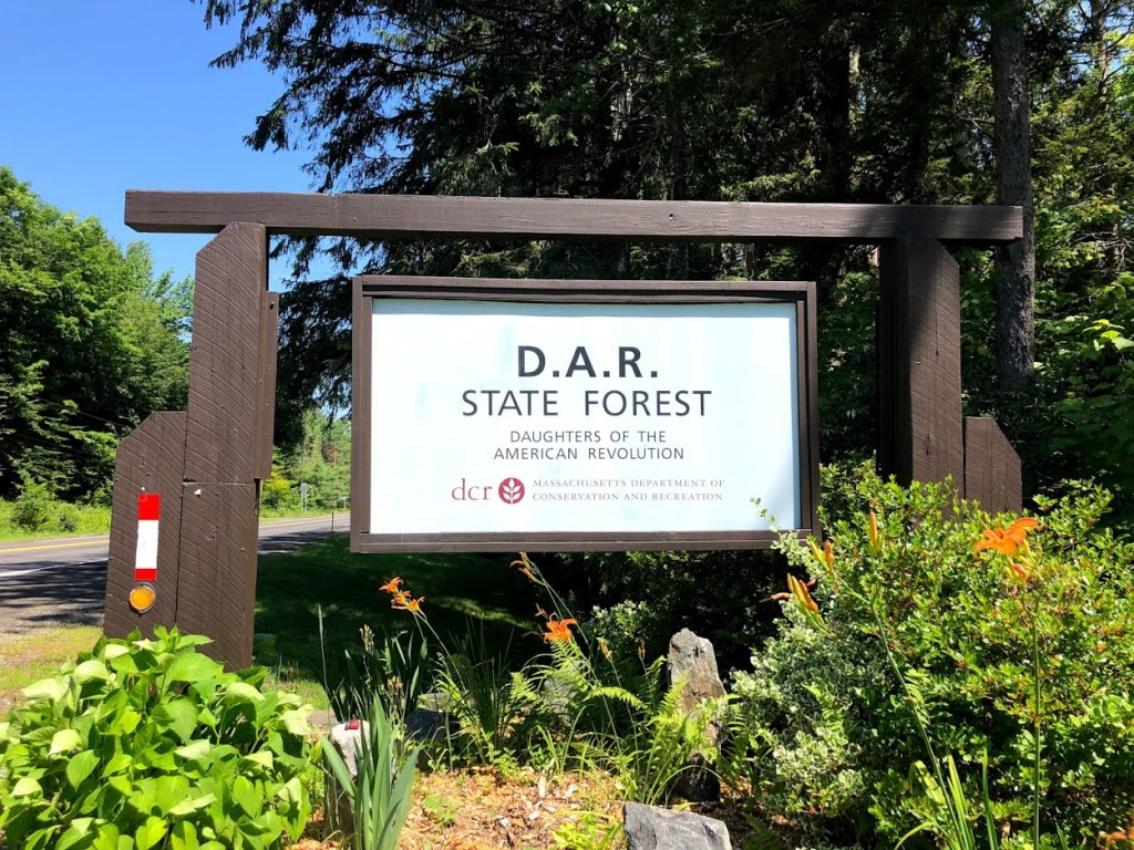
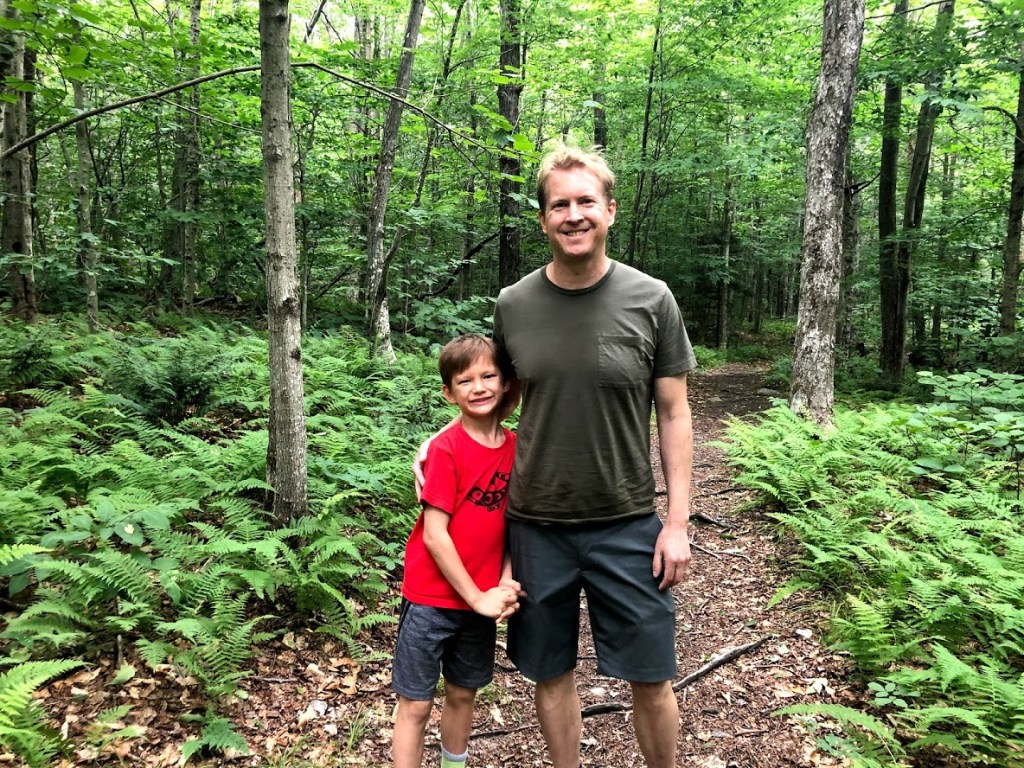
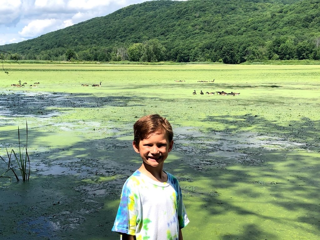
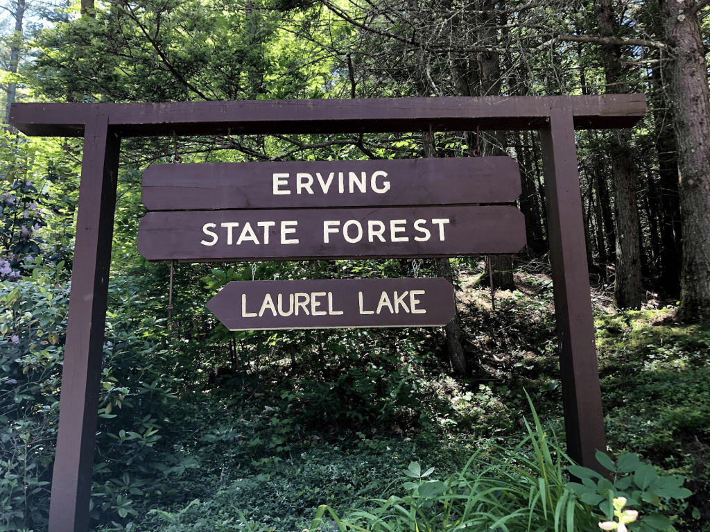
This state forest is off Route 2 in central Massachusetts, in the town of Erving. It consists mainly of Laurel Lake and a forested area with a few short hikes into the woods.
We visited in a relatively cool June and just past the peak of the blooms.
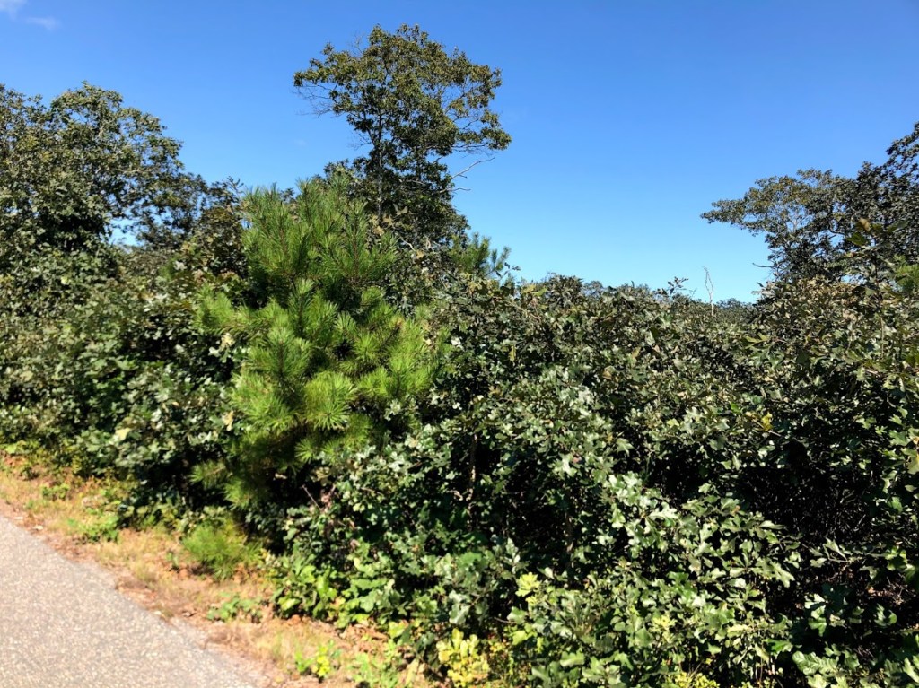
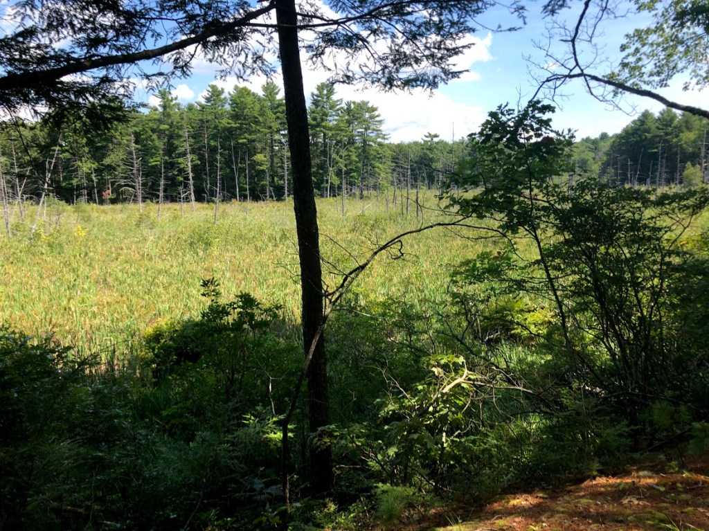
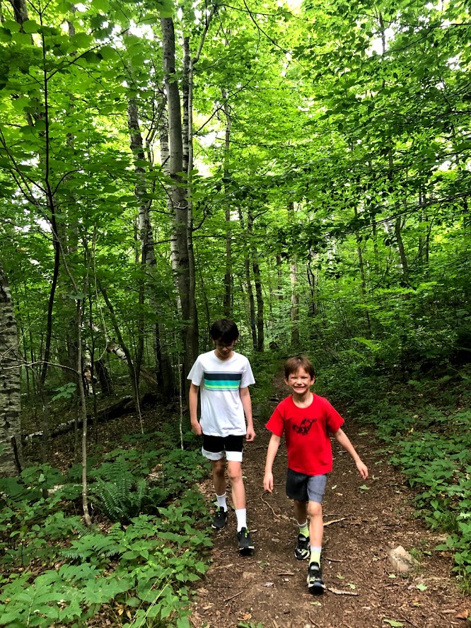
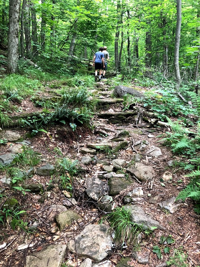
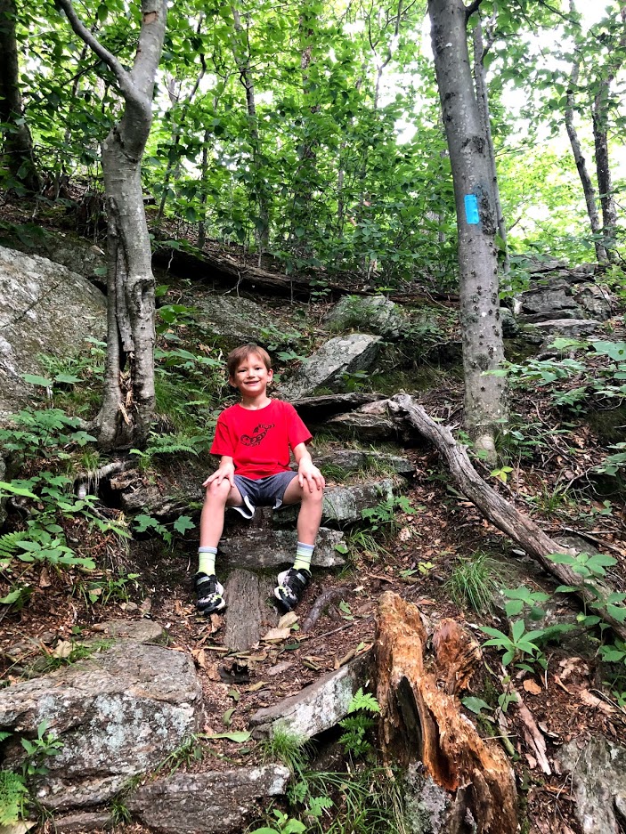
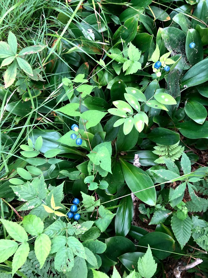
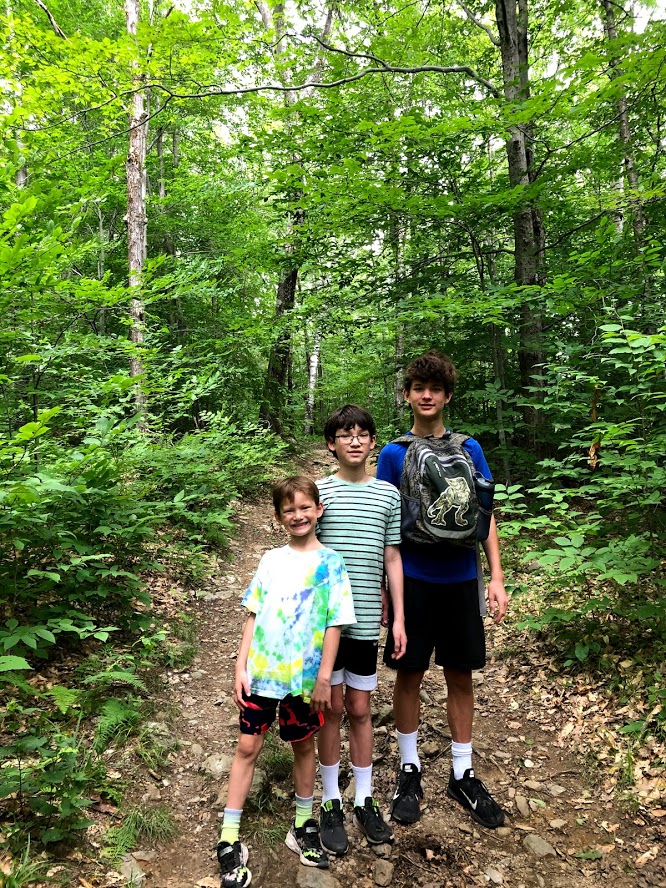
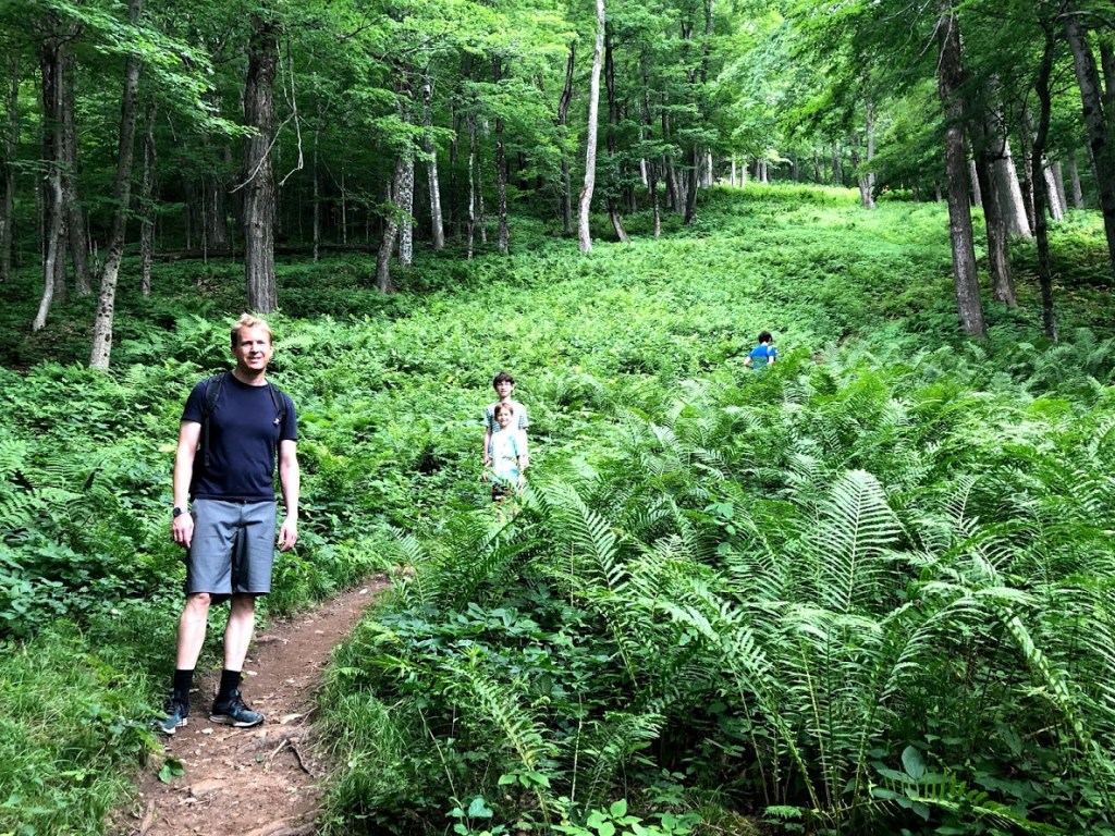
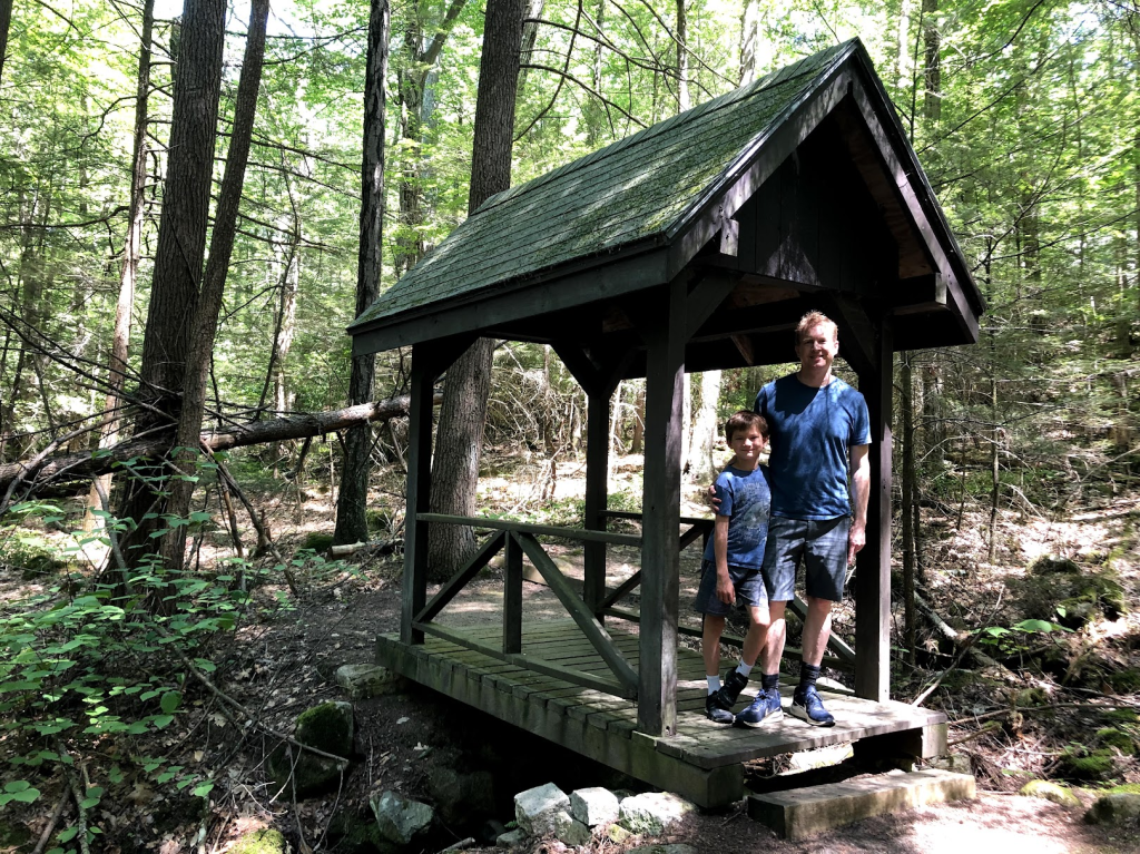
The trail starts off gently but soon climbs the hillside, cutting through giant stands of mountain laurels.
It was lovely to wander up the hillside but it set our hearts pumping. Much of the trail is narrow like below.
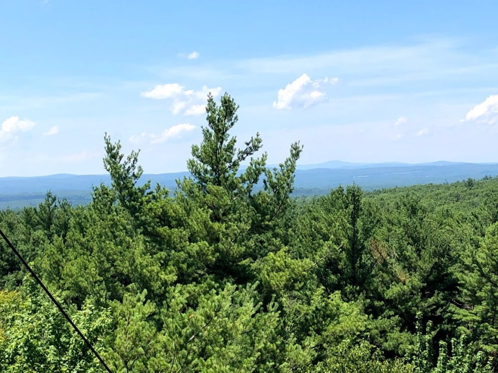
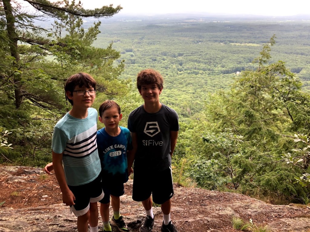
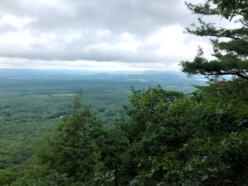
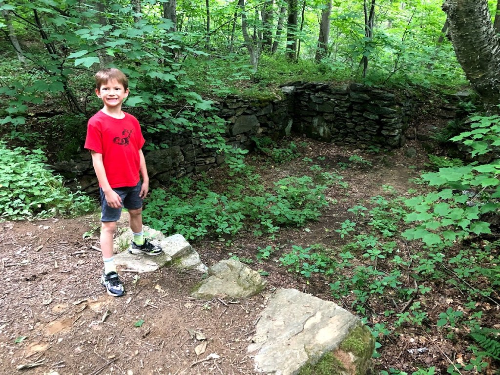
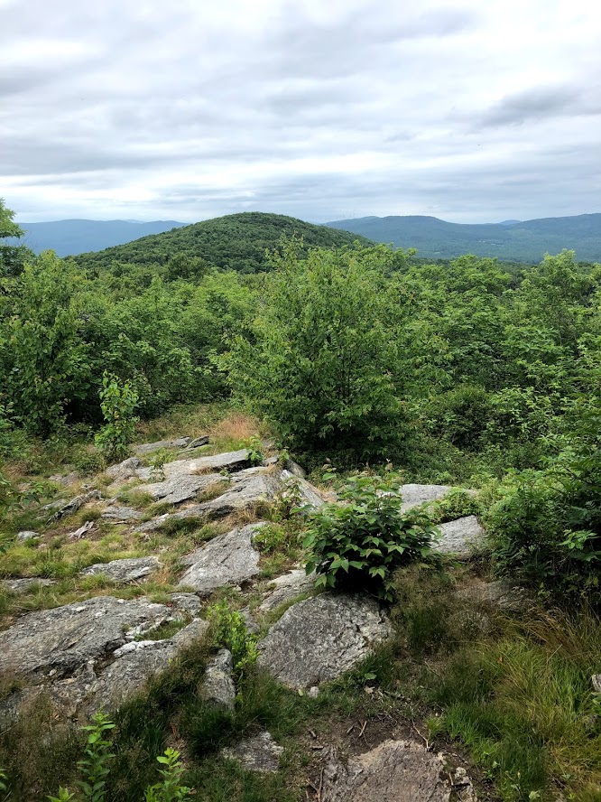
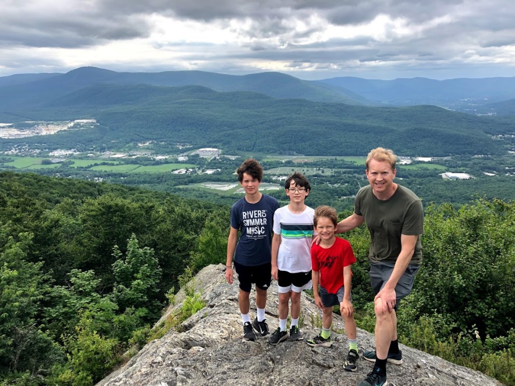
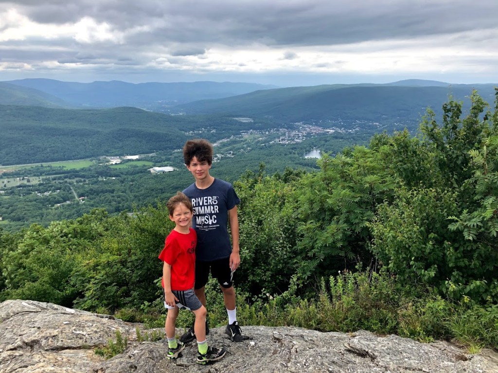
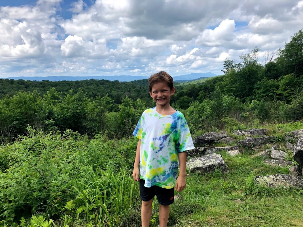
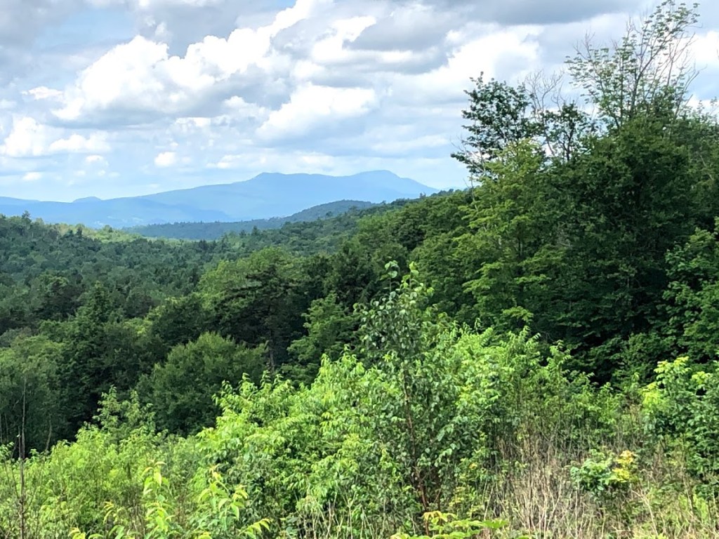
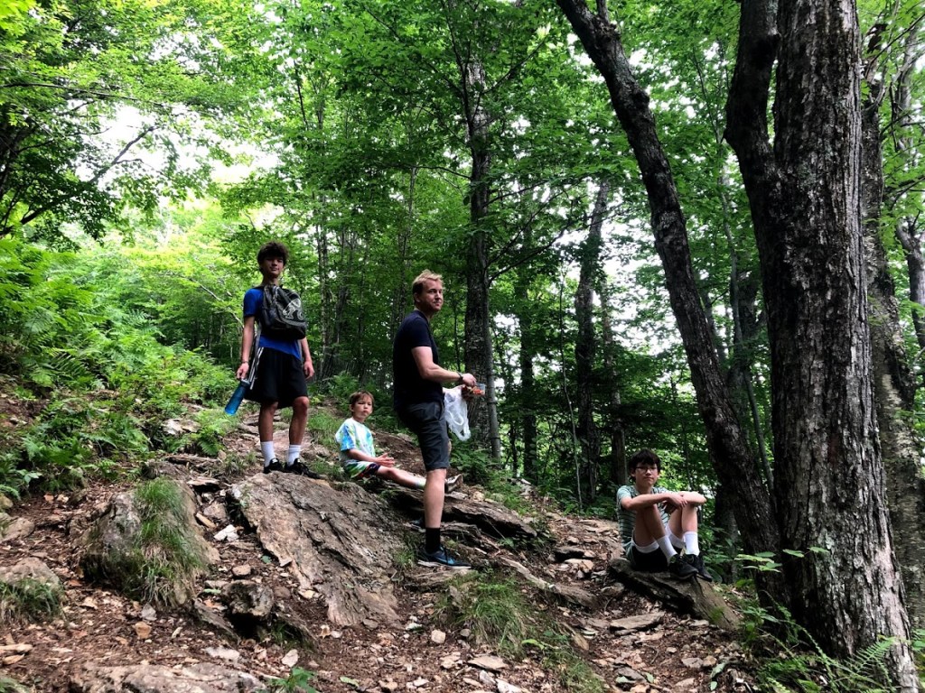
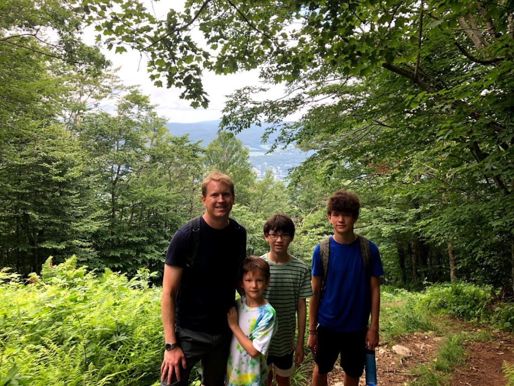
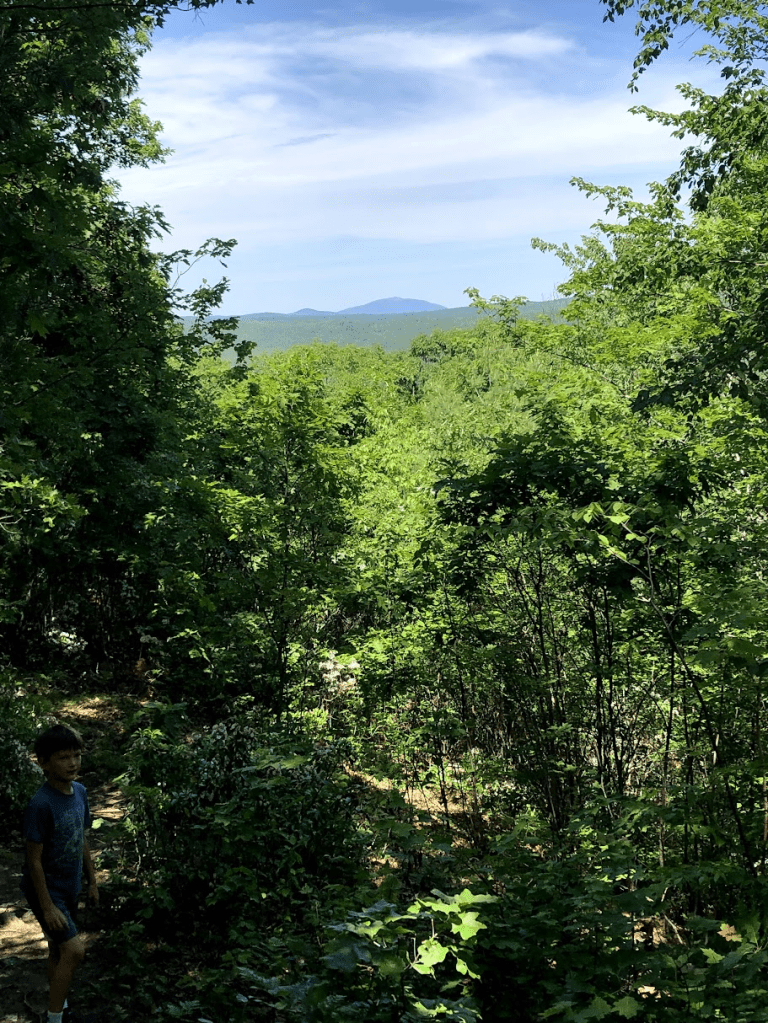
After reaching the peak, there are some open views to the south, and also to the northeast, where you can see Mt. Monadnock in the distance.
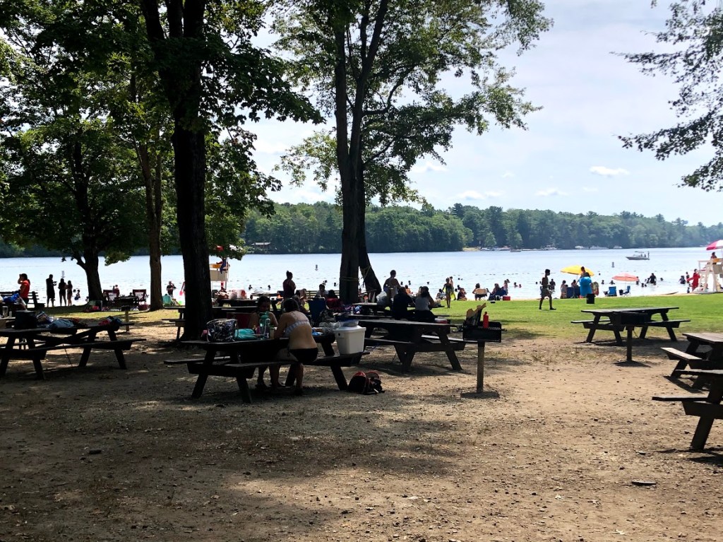
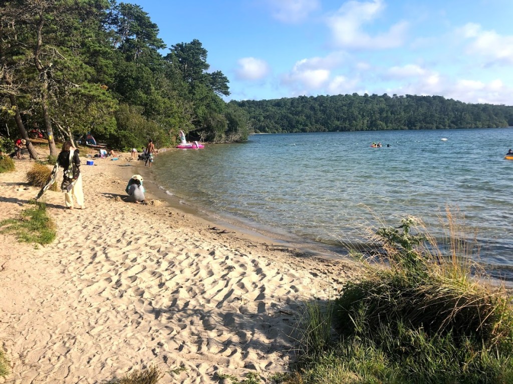
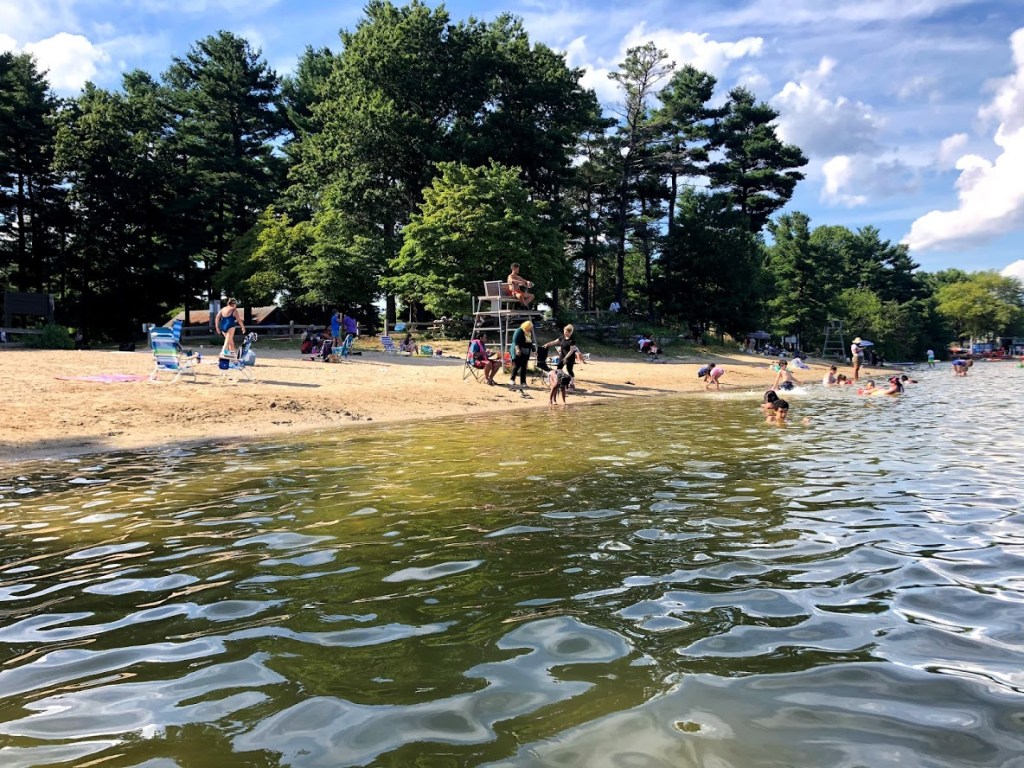
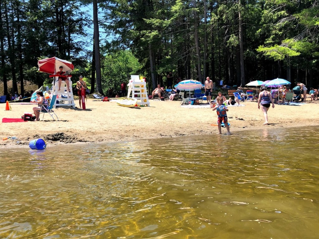
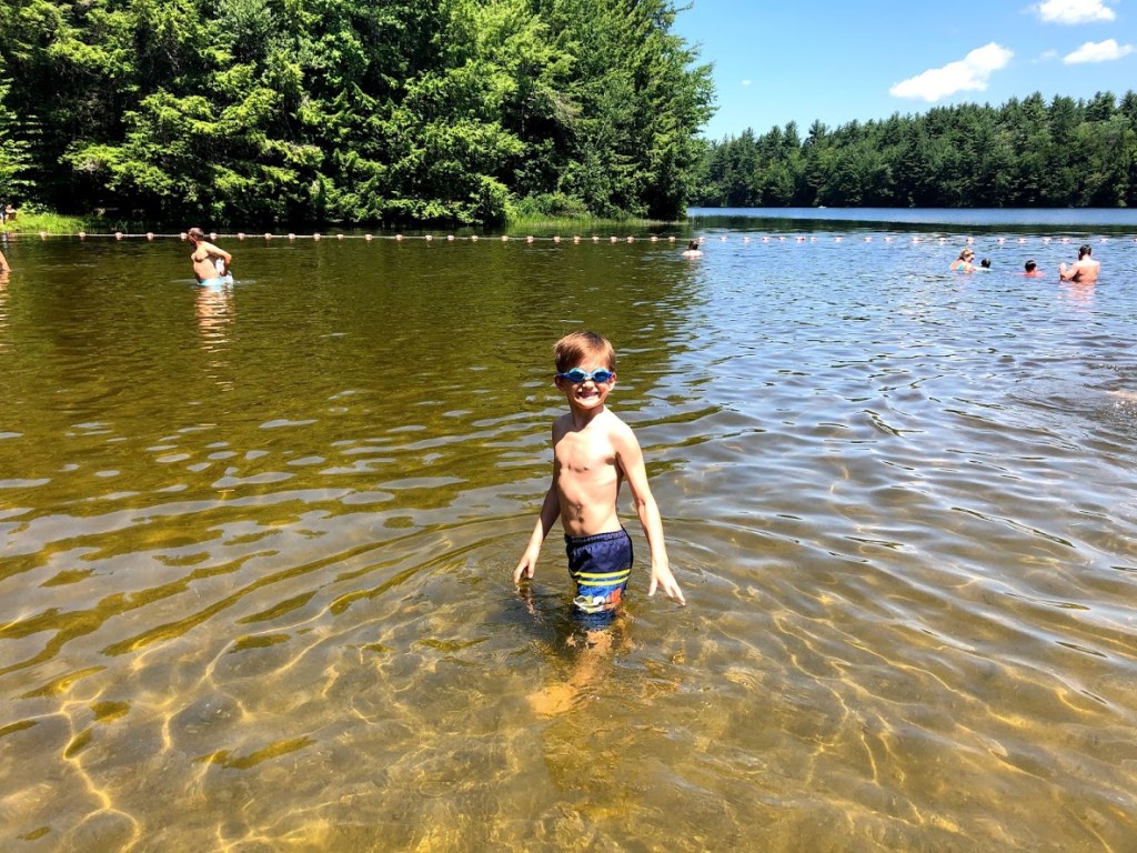
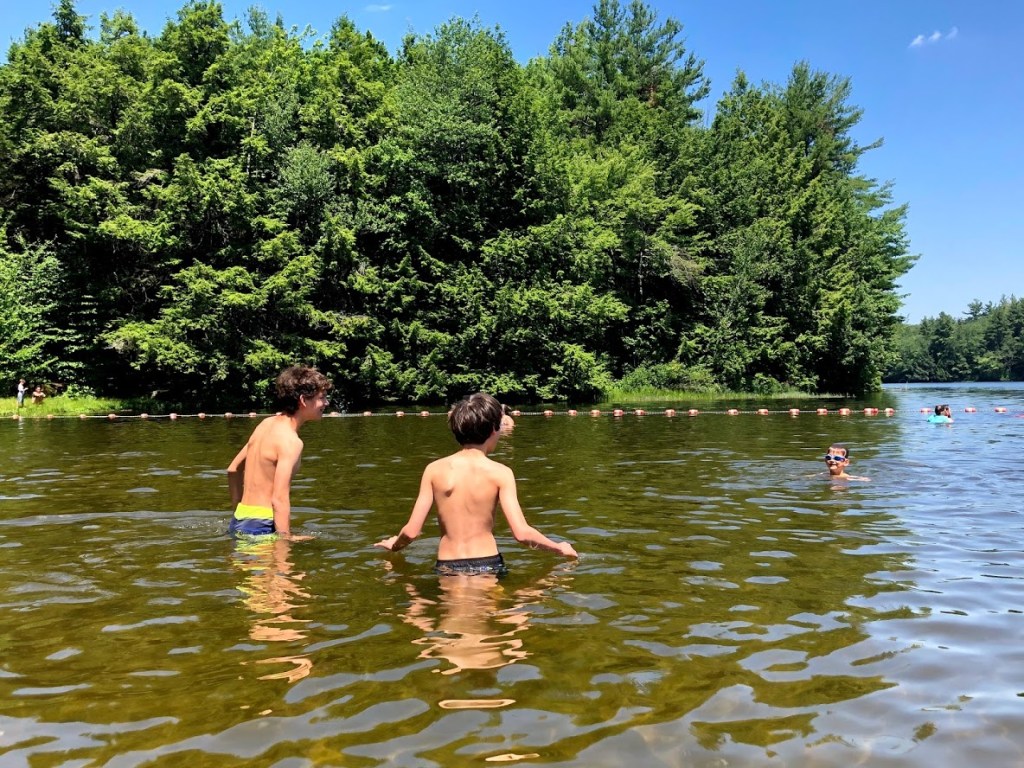
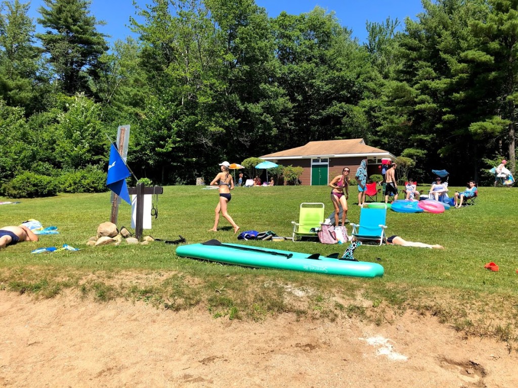
The hike returns to the parking lot, where we changed and headed to the lake for a swim. The facilities are well kept and include separate bathrooms and changing rooms.
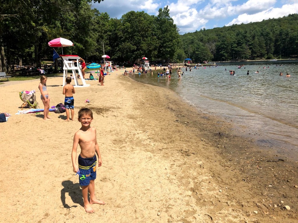
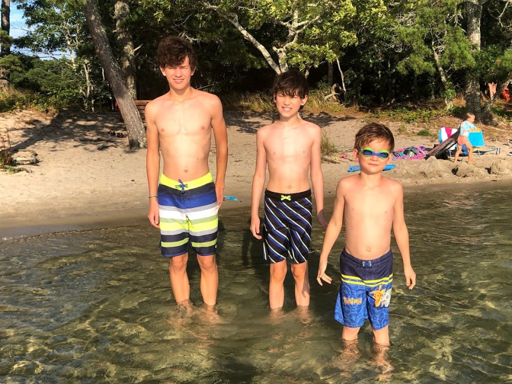
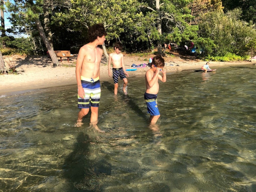
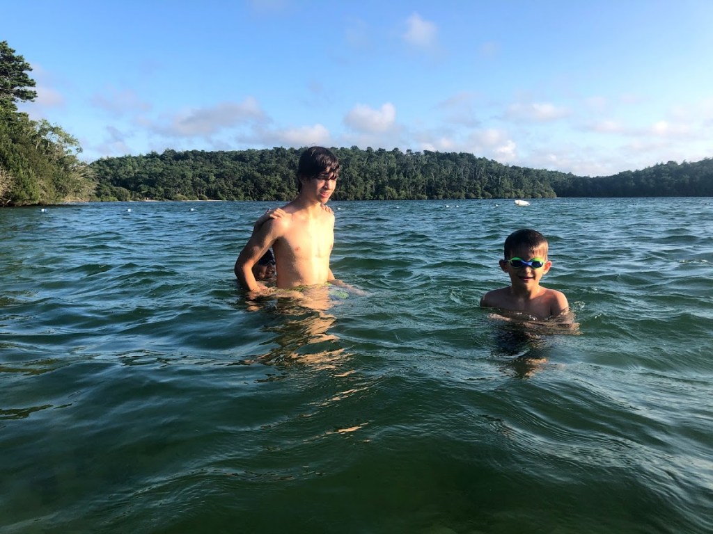
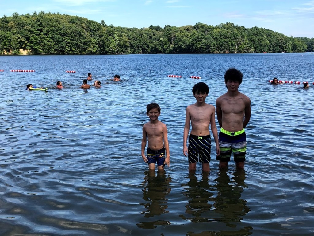
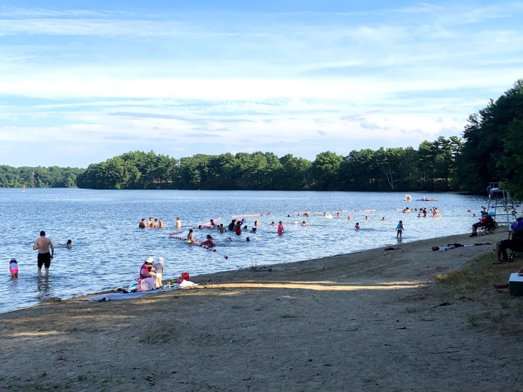
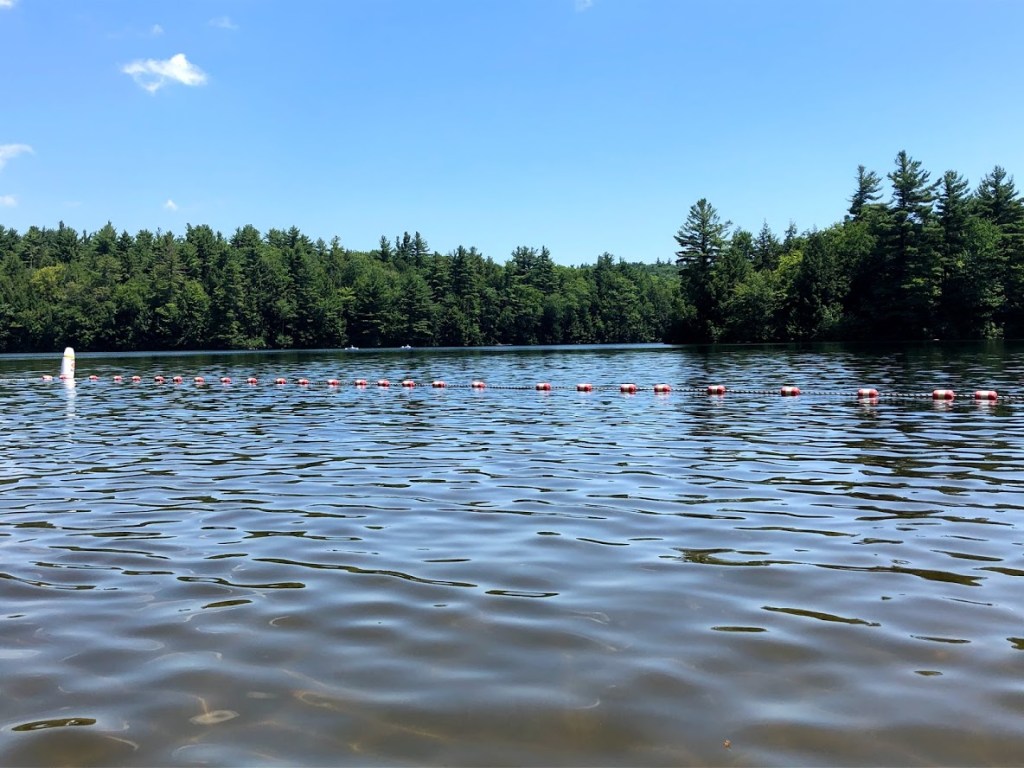
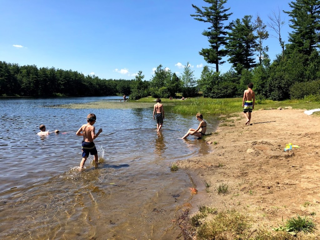
The beach is spacious and has good sand that extends into the roped swimming area, which has lifeguards on hand.
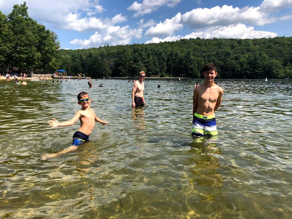
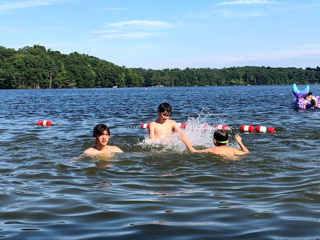
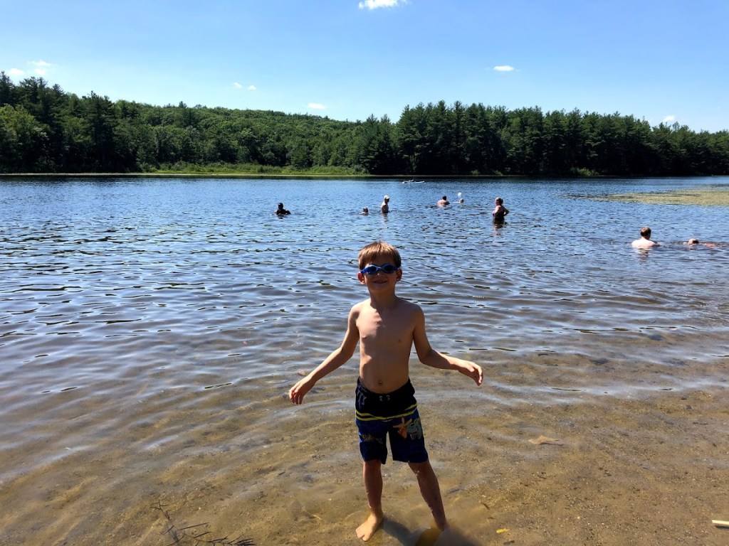
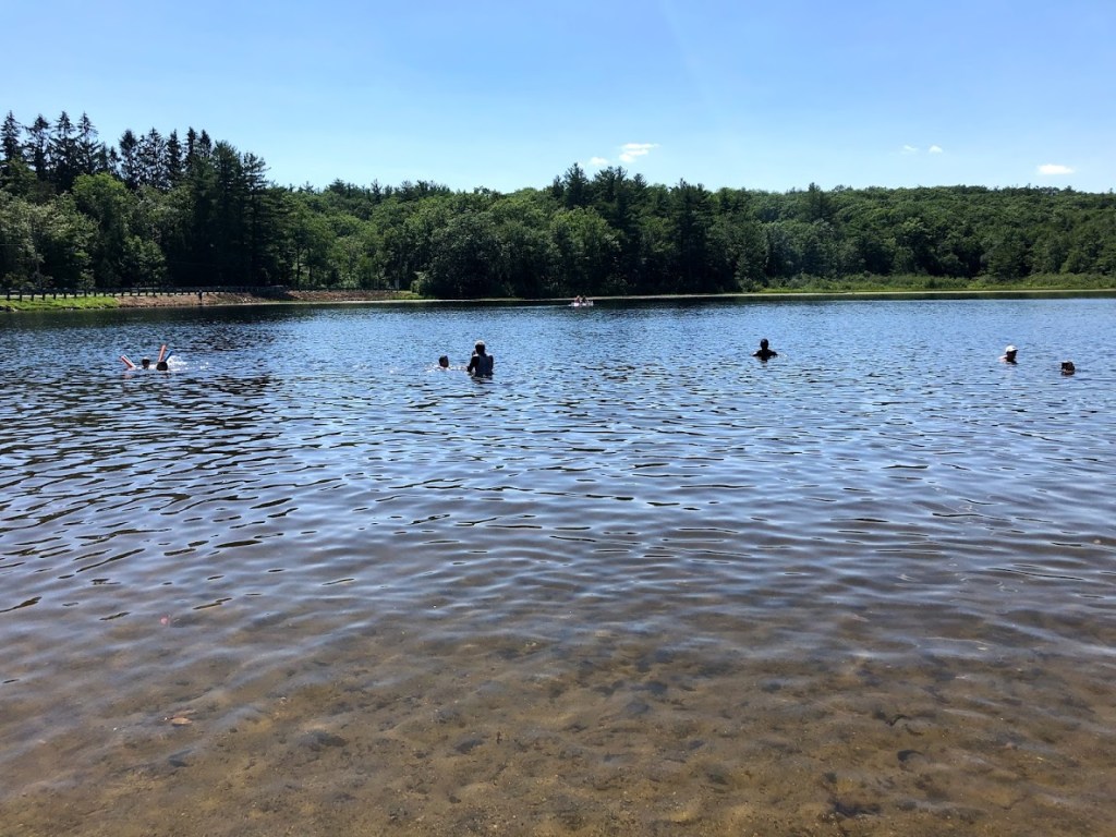
Although it was June, the water was pretty “refreshing” and took some getting used to, but we all enjoyed it. It’s a lovely lake with a peaceful vibe.
Beautiful hillside walk with mountain laurels. Swimming was refreshing in the clear water.
Going in June to see the mountain laurels. The pond is very beautiful.
The hike was pretty average and the beach was too cold. But compared to some of the others it was heaven on earth.
The hike was pretty. The beach was good but the water was cold.
The mountain laurels were pretty. The beach was pretty good, but there were bugs on the hike.
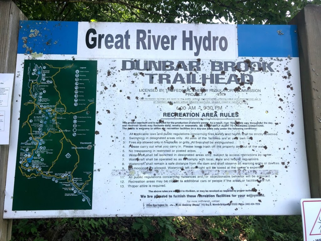
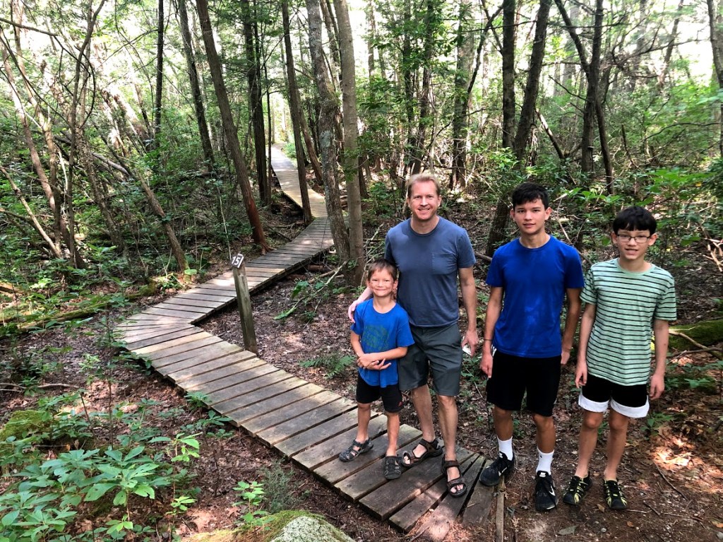
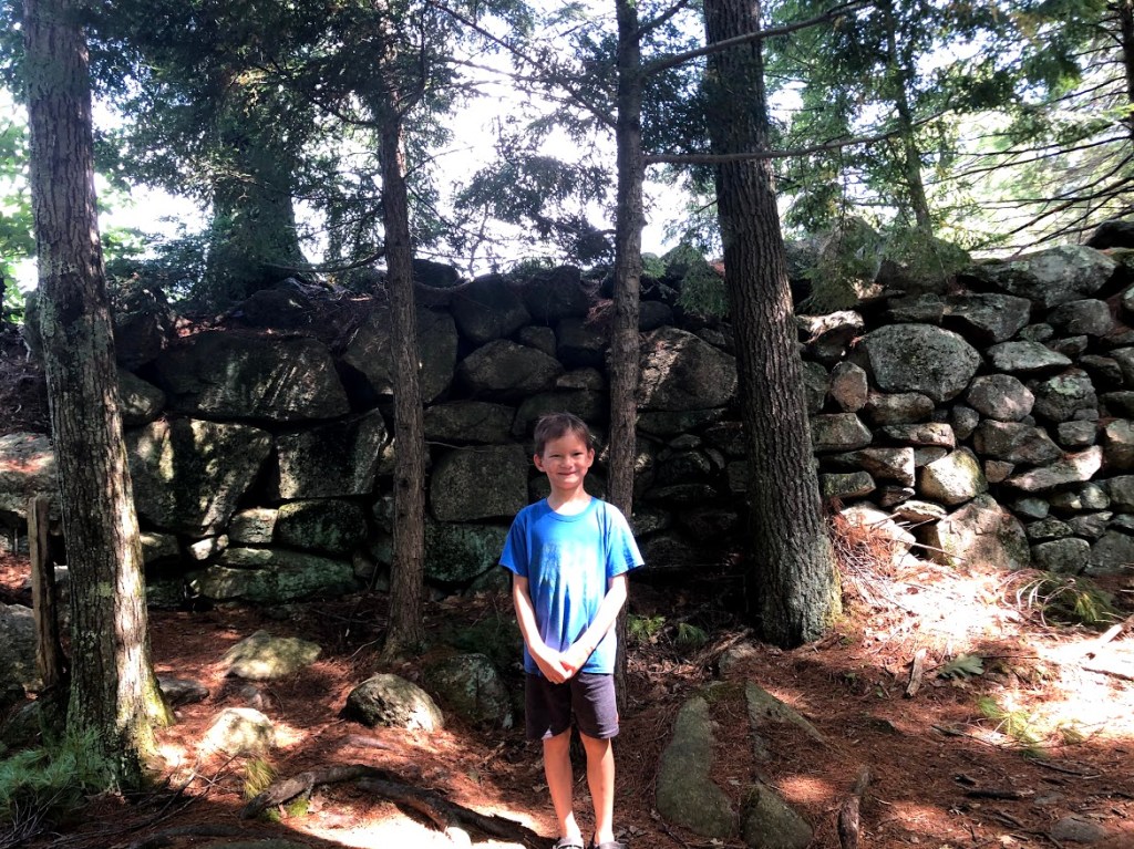
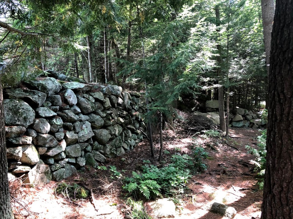
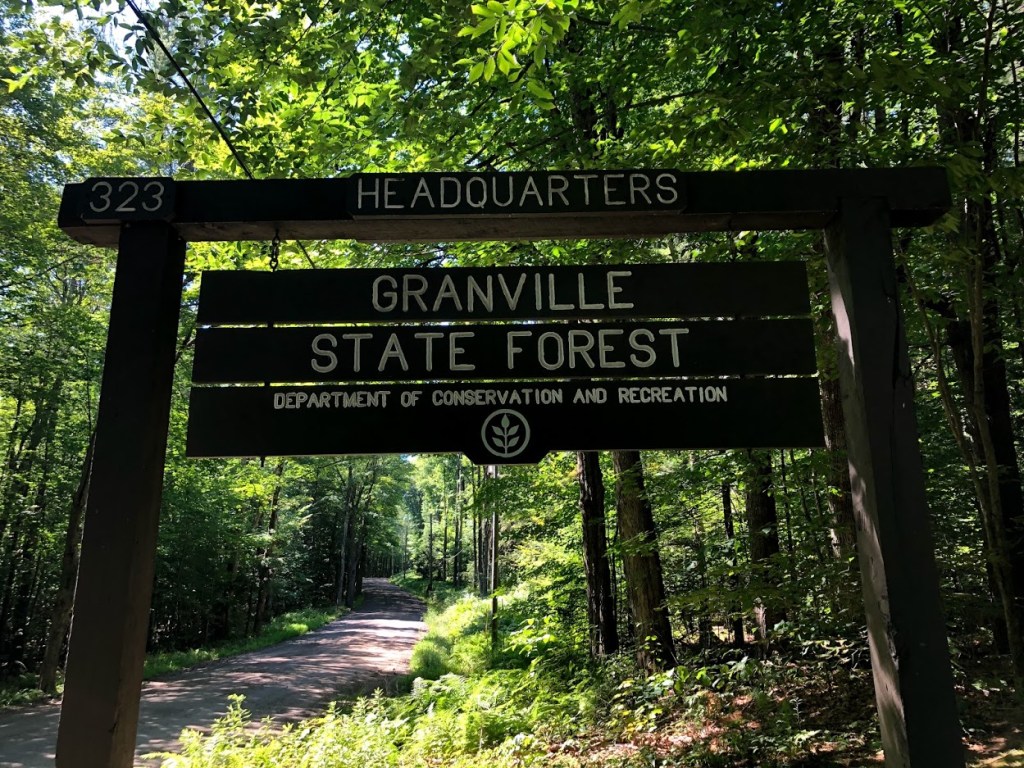
This state forest was very remote. From Route 2 near Florida, MA we descended a steep and winding road into a valley and followed the Deerfield River north to a parking area that’s near the border with Vermont.
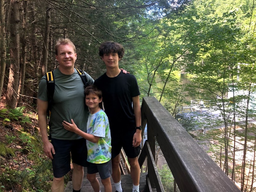
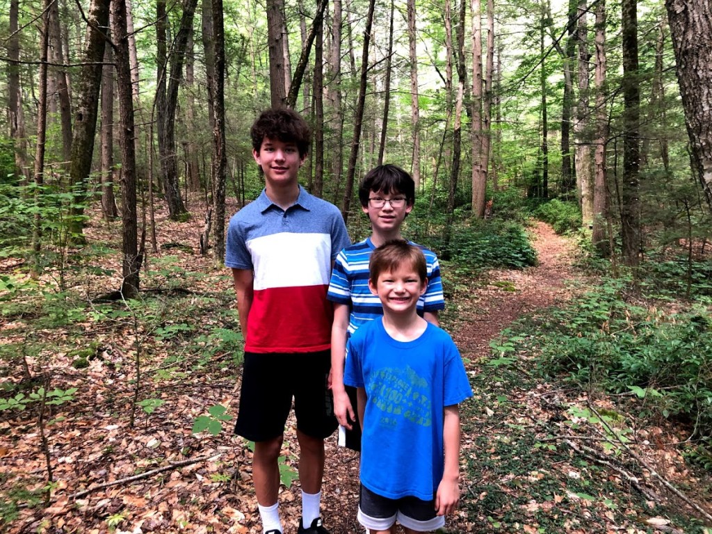
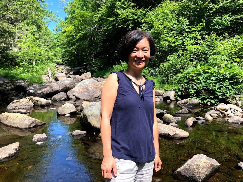
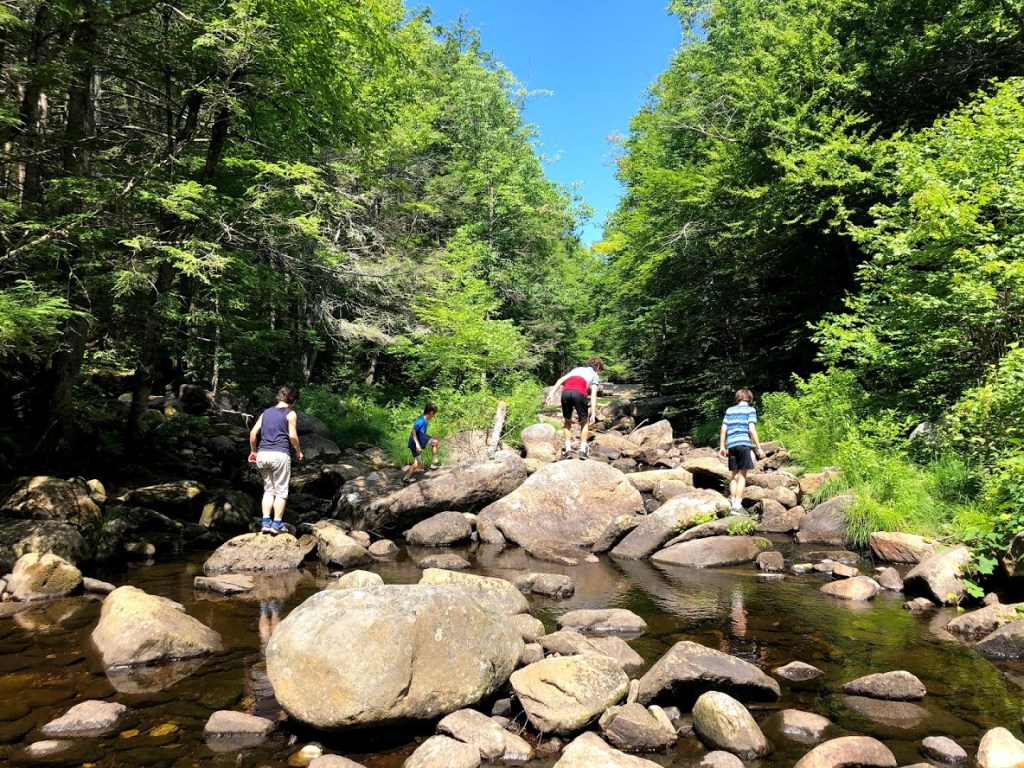
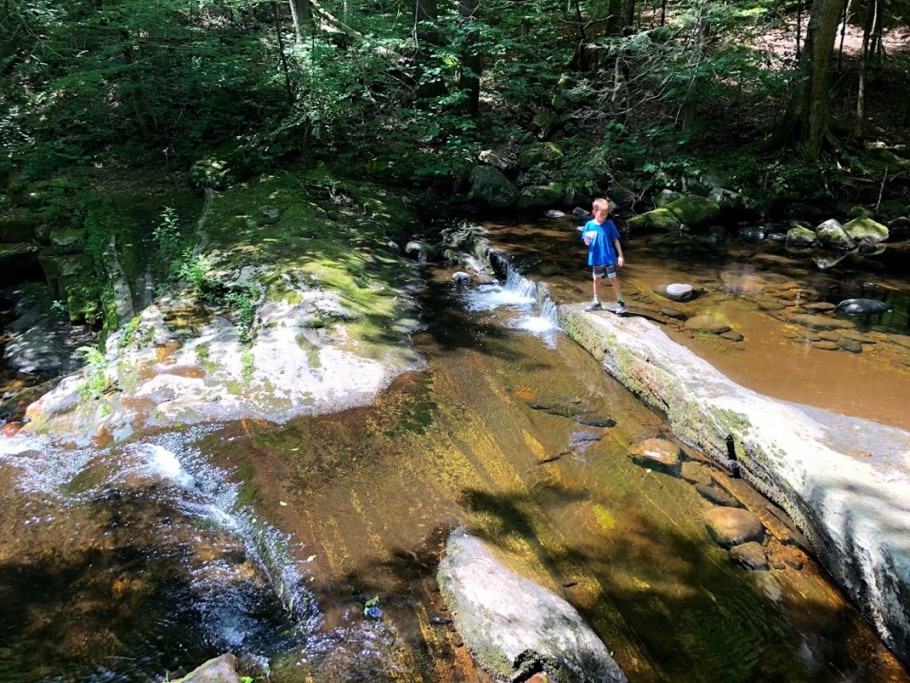
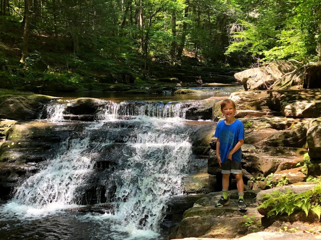
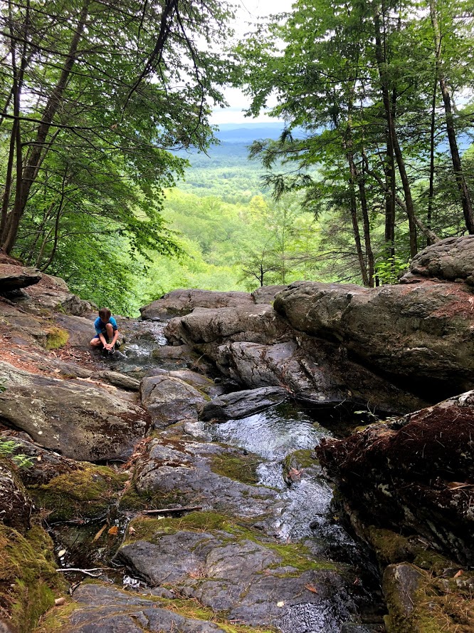
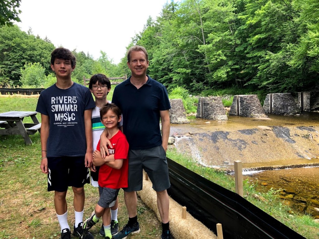
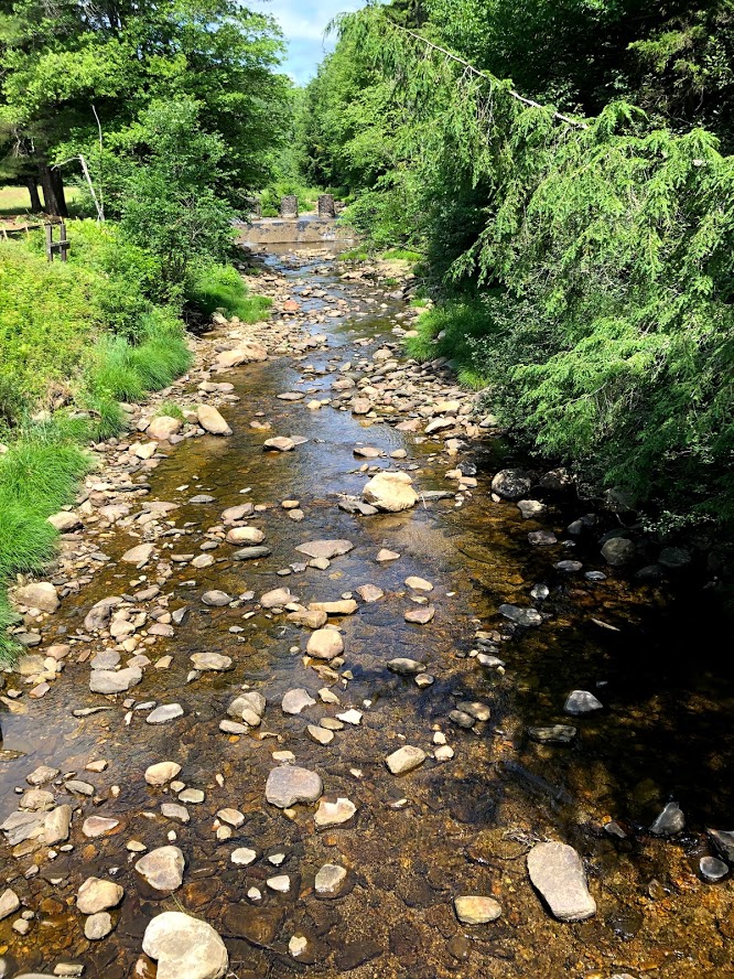
We pulled over at the Dunbar Brook Trail parking area off River Road to begin the hike. This trail was an out and back 3.2 mile trail, mostly along a wide brook.
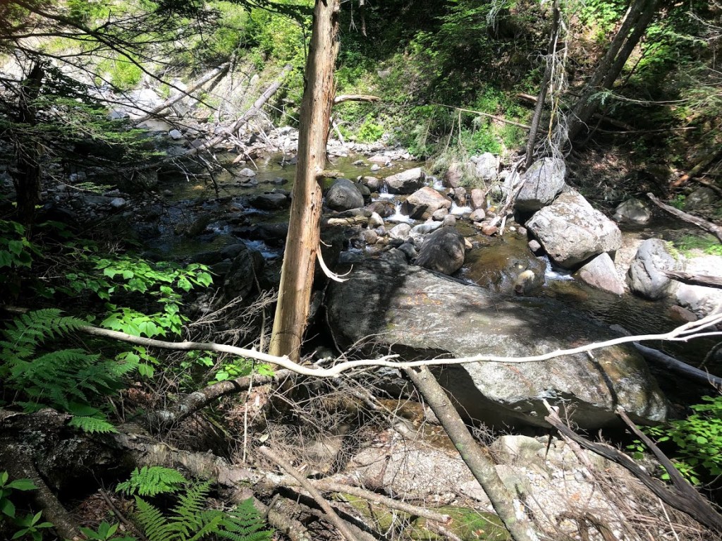
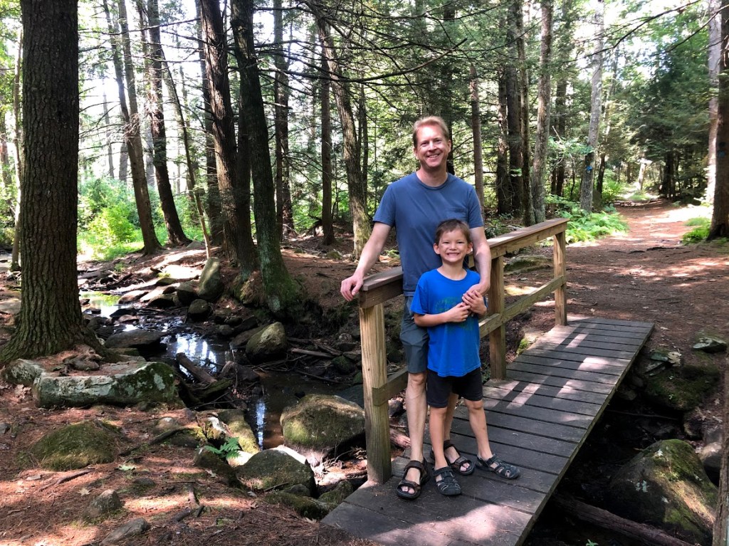
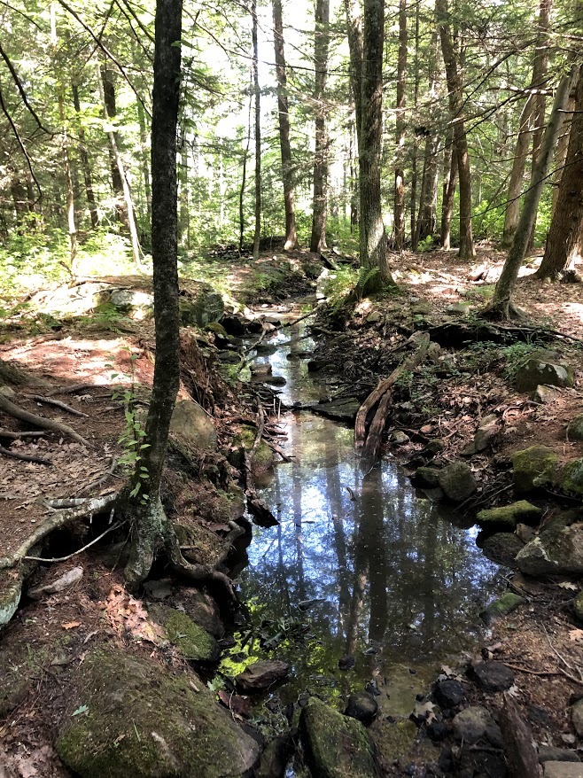
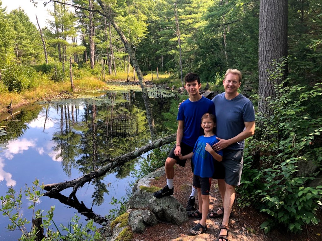
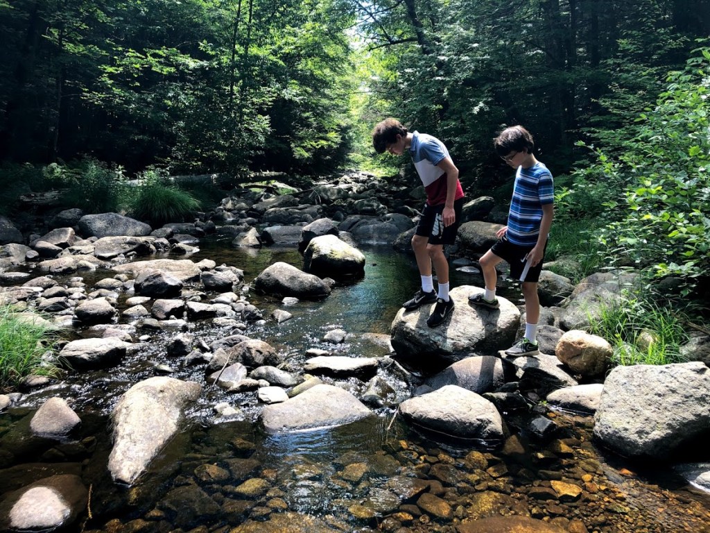
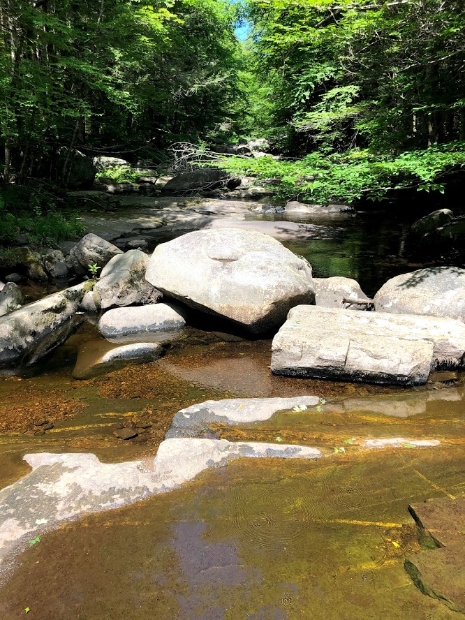
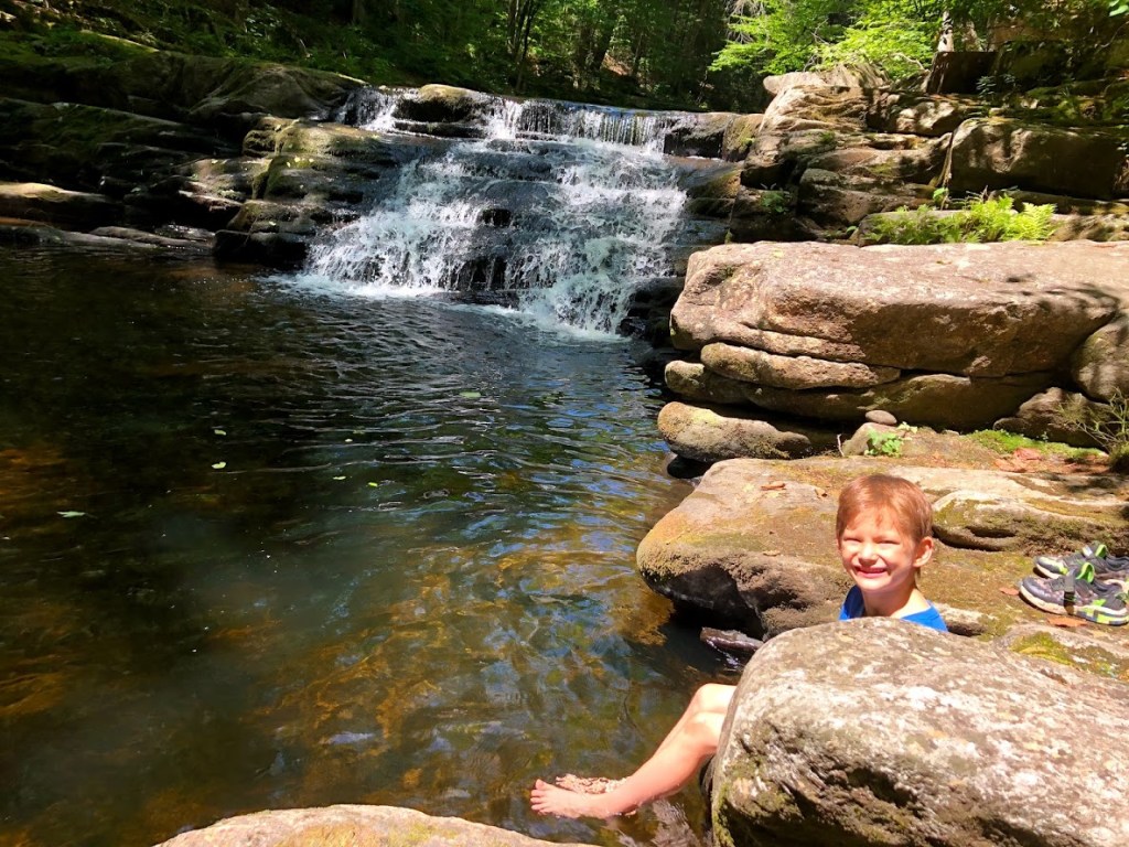
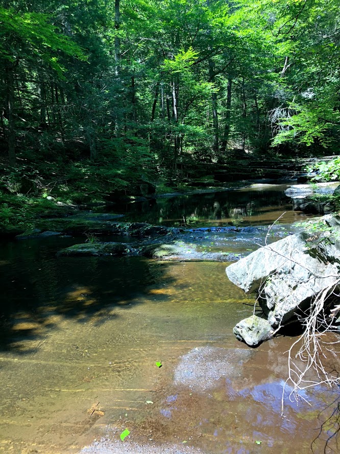
We started from the dam and continued under the shade of old-growth eastern hemlocks and northern hardwood trees. The brook is strewn with boulders and looks very wild, with occasional small falls and deeper pools.
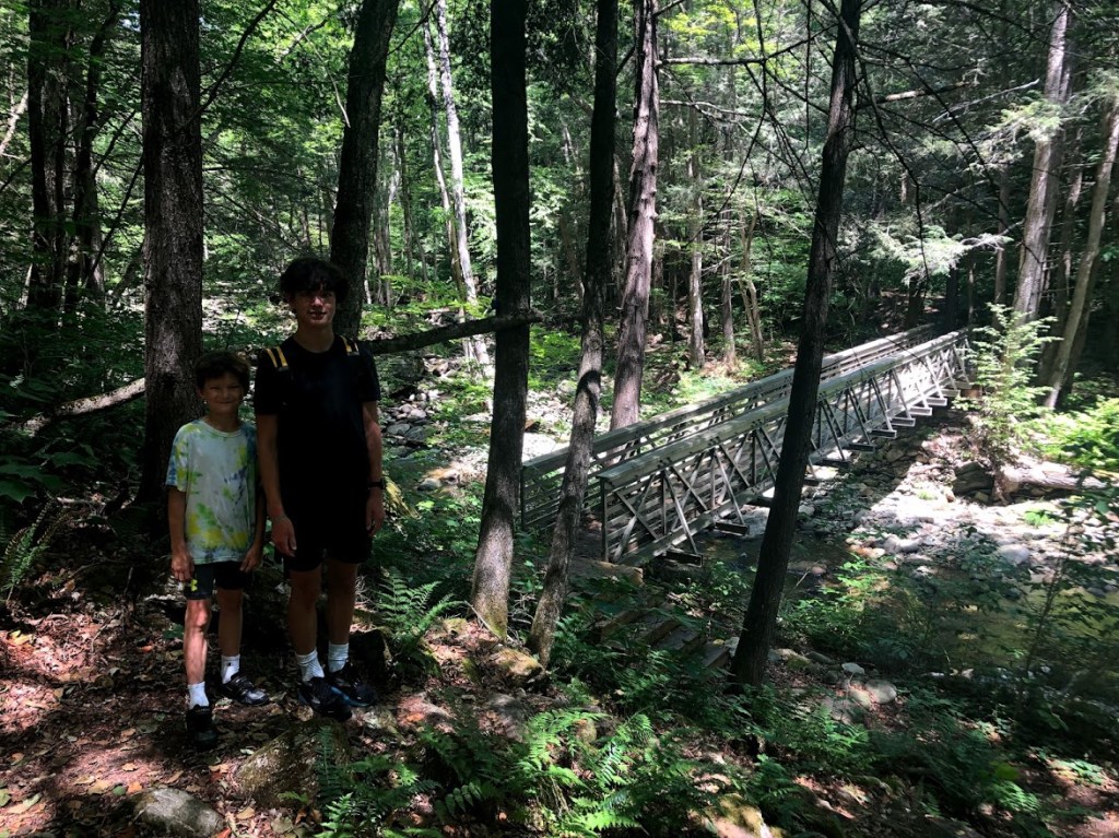
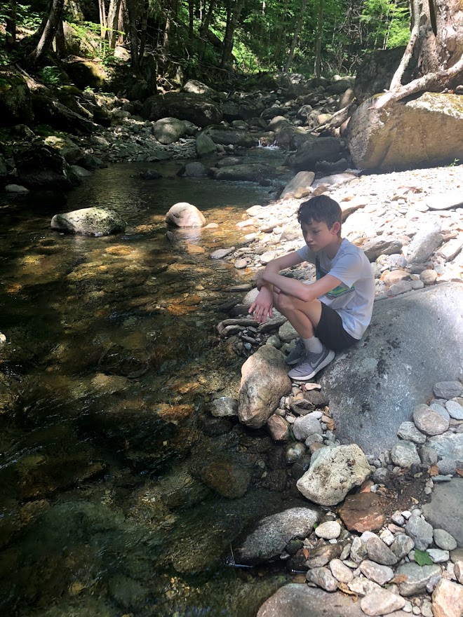
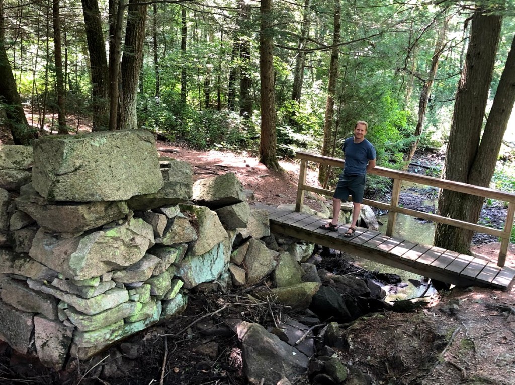
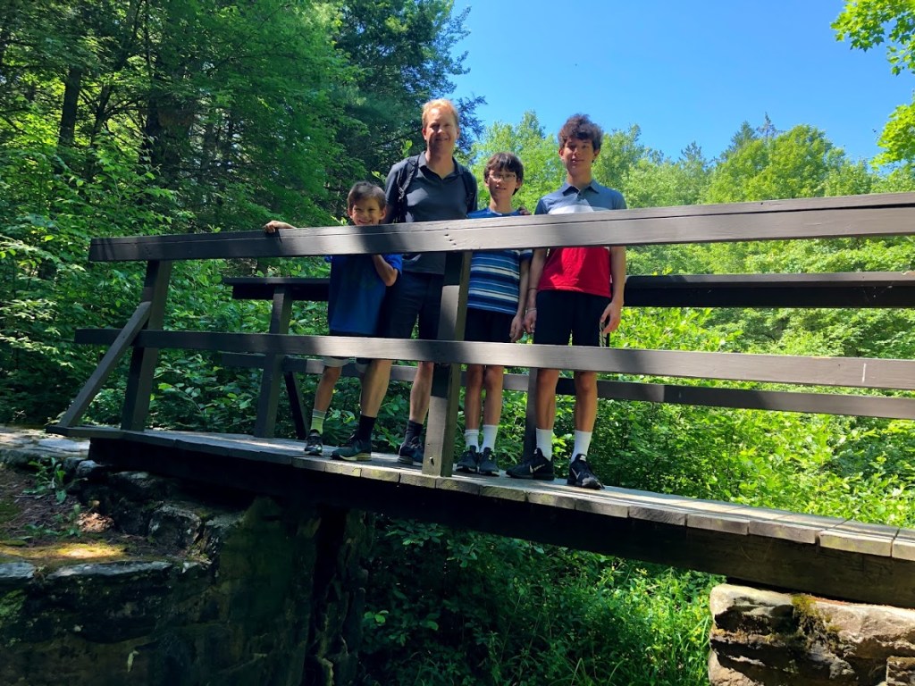
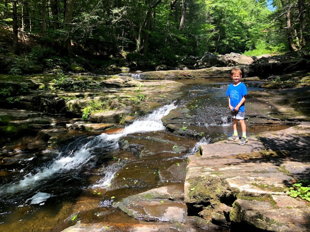
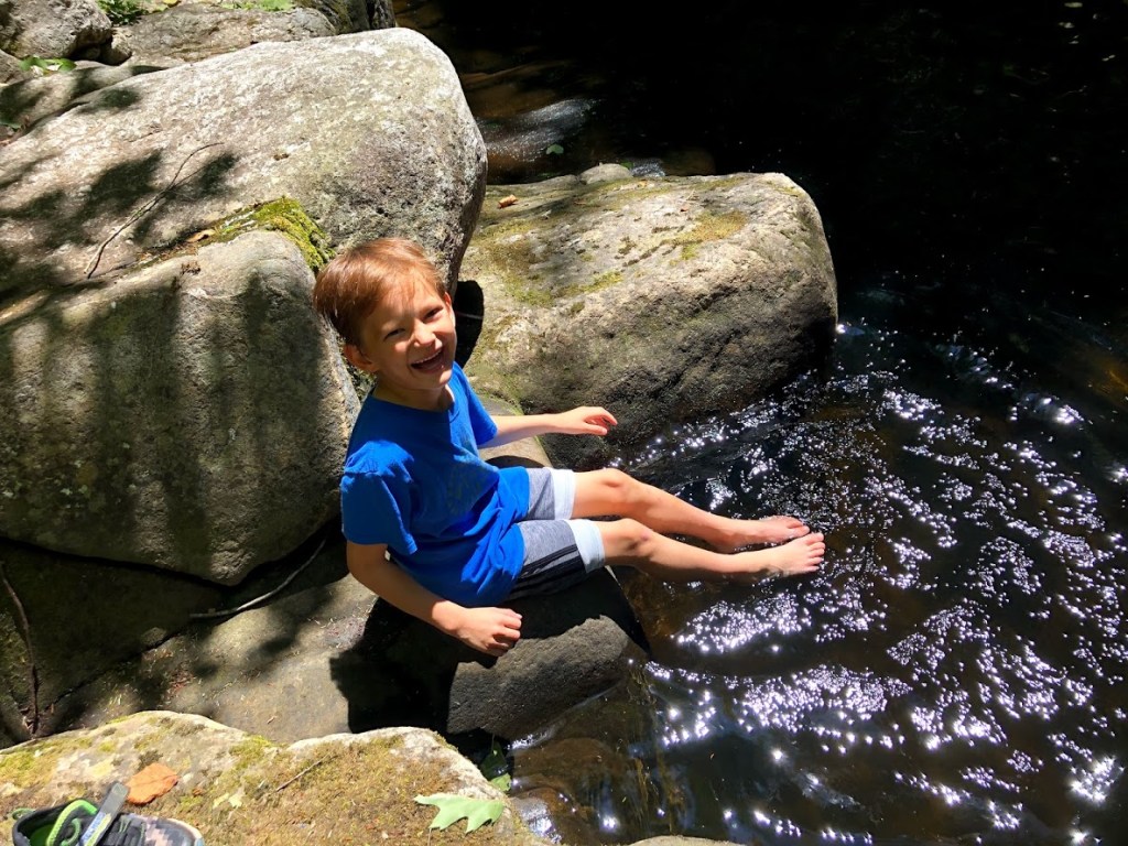
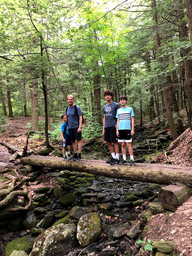
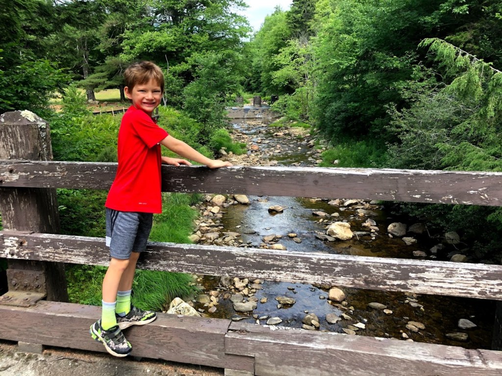
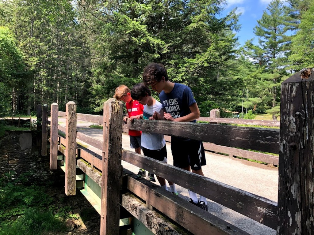
Eventually we reached a small wooden bridge and crossed to the north side of the brook, stopping for a break and to feel the cool water.
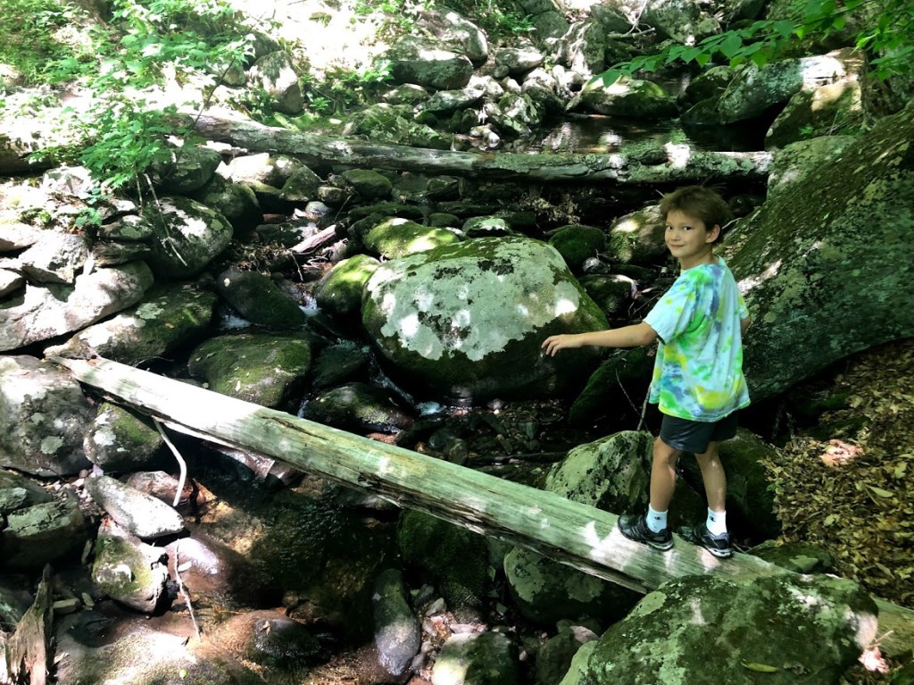
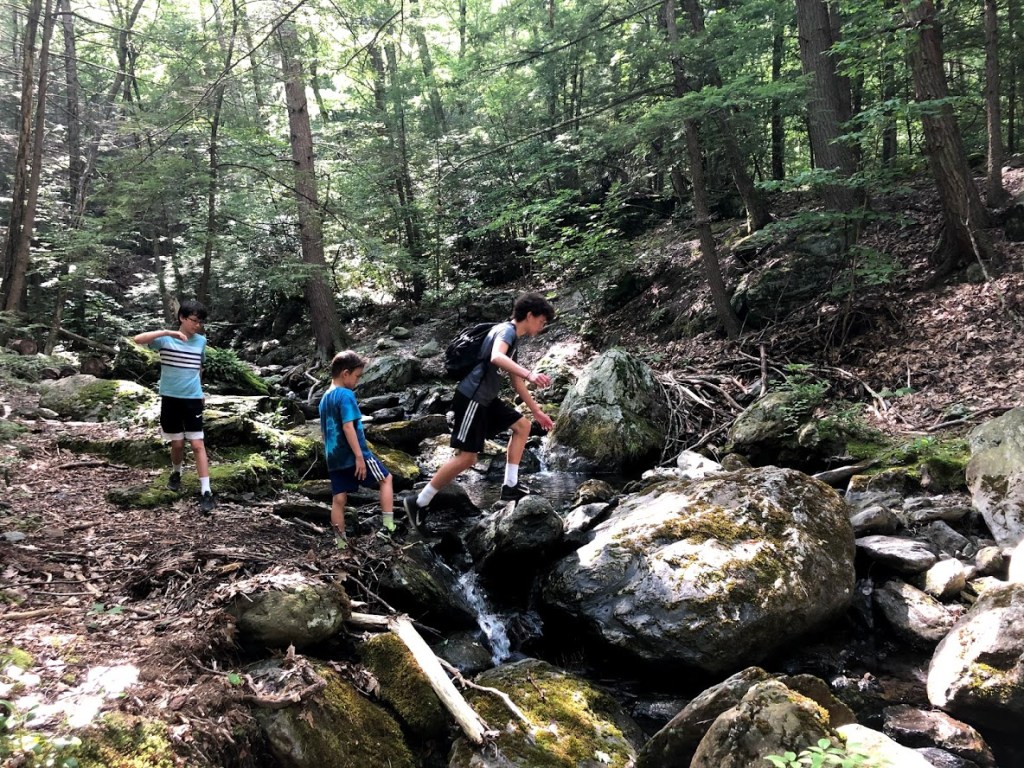
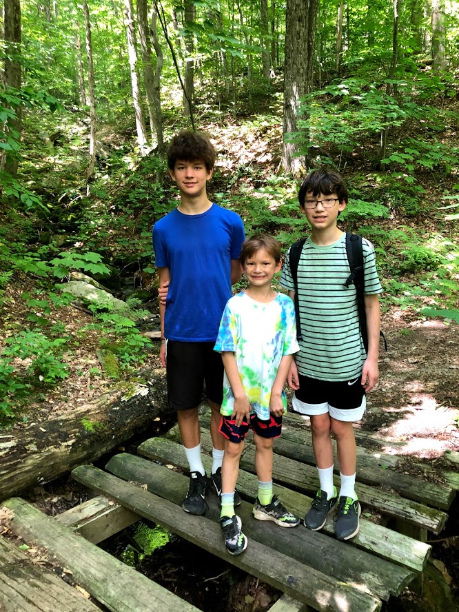
We then continued a short distance, crossing back over the brook on logs, which the kids really enjoyed.
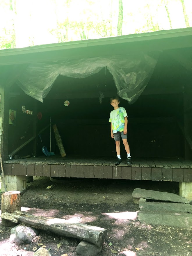
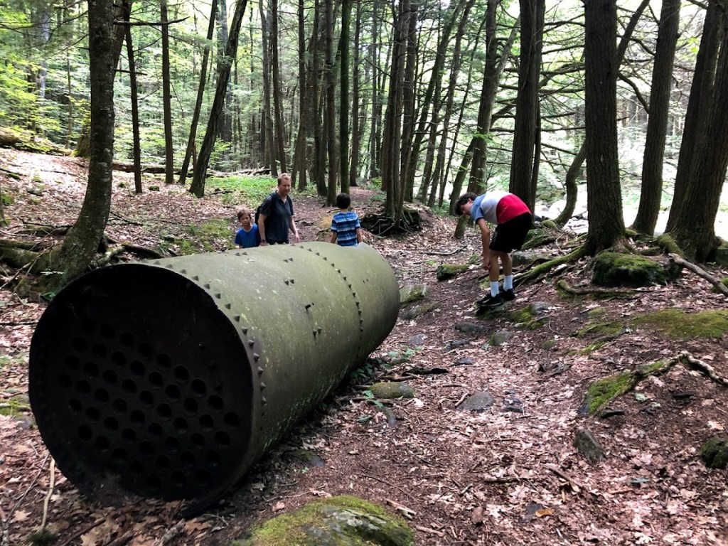
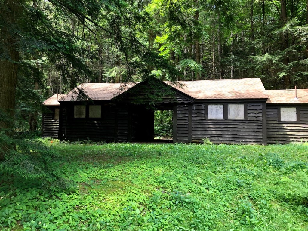
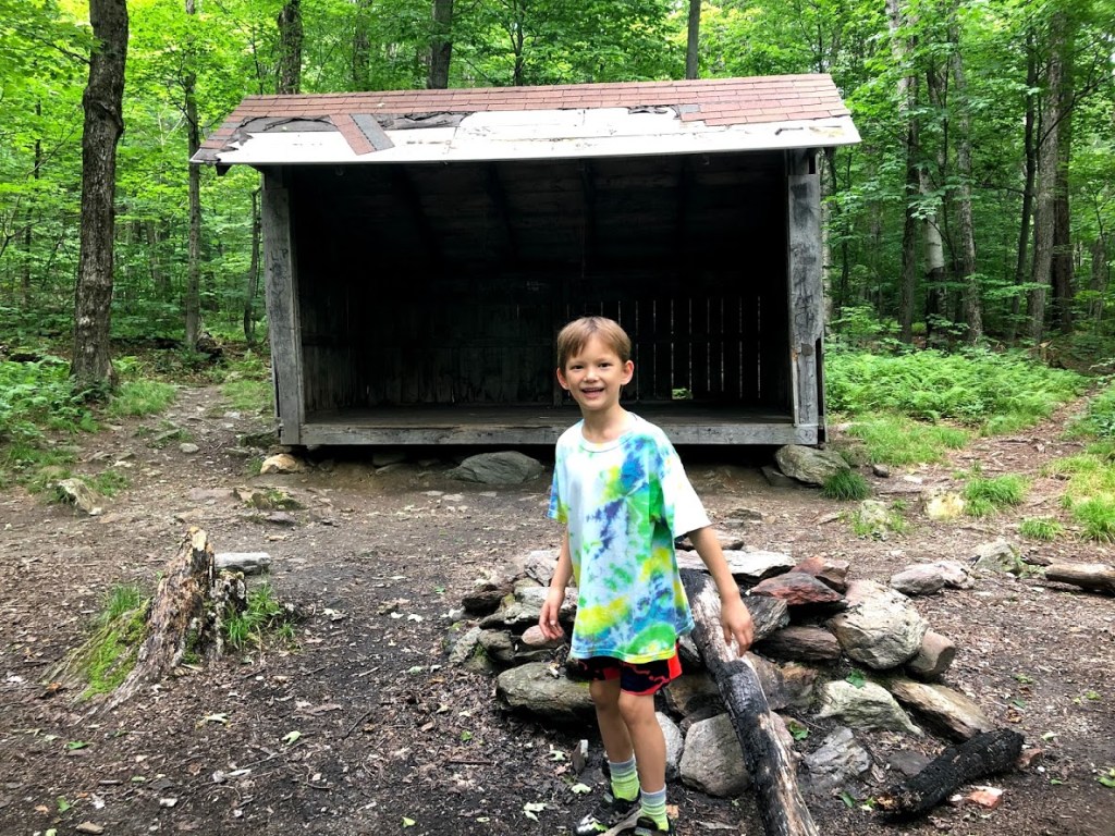
Just beyond this we found a small shelter complete with a firepit and a few supplies left by other hikers (healthy stuff like Spaghetti-Os and Jiffy popcorn). We stopped for a snack (not those supplies!) and then returned the way we came.
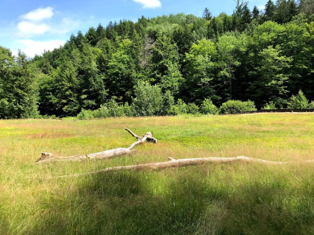
The main attraction of this state forest is the peace and solitude, but be prepared with extra fuel and have printed maps handy, since cell service is non-existent here.
The wide and rugged brook was the highlight of this. It was cool in the shade and surprisingly not buggy. A short and easy hike with a few interesting sights.
A lot of solitude, but not much else.
We did this thing where each person would take turns leading the rest of the group. Guess who led us the slowest (Hint: his name rhymes with “lion” and starts with R)
Just an average walk. There was a shelter at the end.
The brook was cool. The shelter was cool. And the walk was pretty long. Very average.
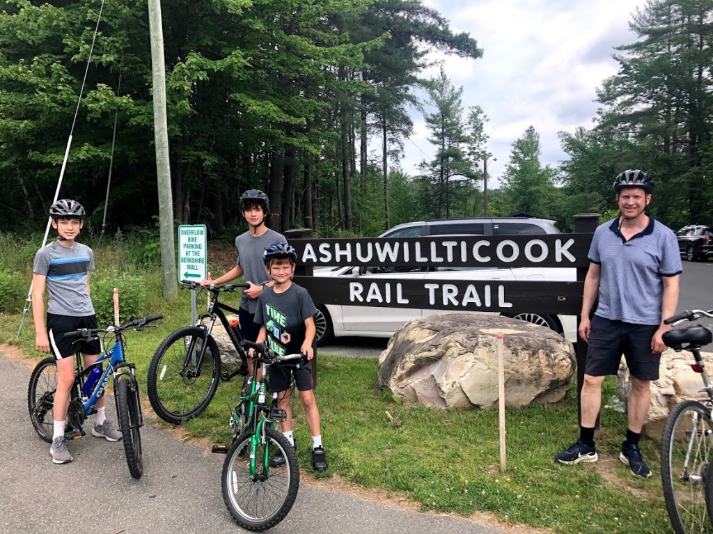
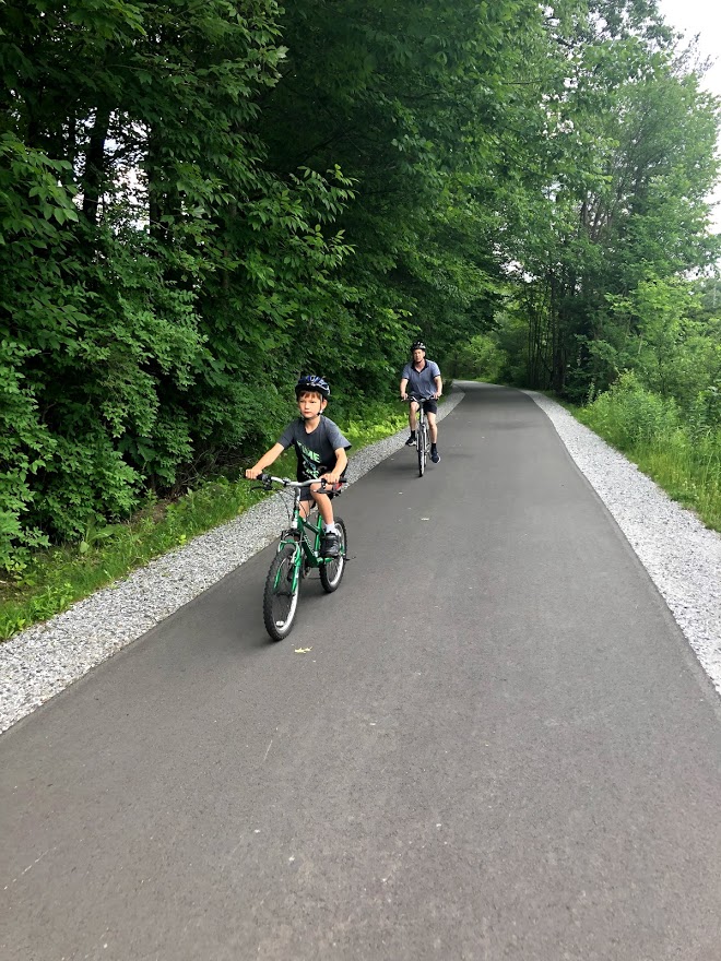
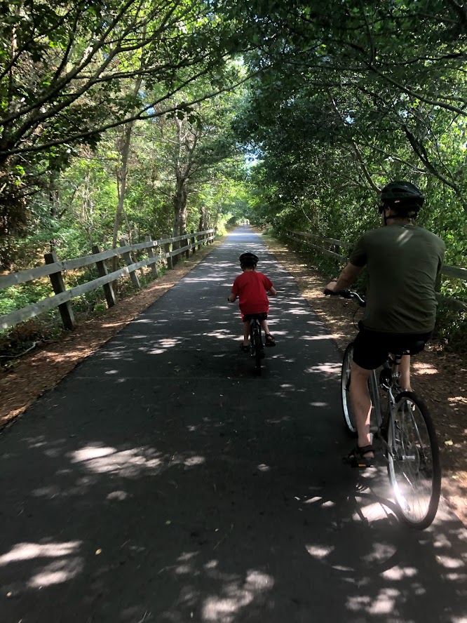
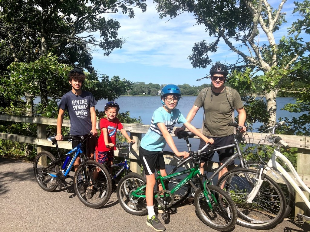
This Berkshire rail trail is 12.2 miles long and follows from Lanesborough in the south to the town of Adams in the north. It provides great views of the mountains and also of Mt. Greylock. It passes through the Hoosac River Valley and the long name means essentially “the pleasant river in between the hills.”
We started our bike ride at Lanesborough, parking in Berkshire Mall parking lot, since the main parking was a small lot that was filled to capacity by the time we arrived in the morning. The mall appears to be mainly defunct, but had a small farmer’s market on the weekends.
The trailhead has real restrooms, good signage, and also printed maps for the taking. We got underway and headed northbound.
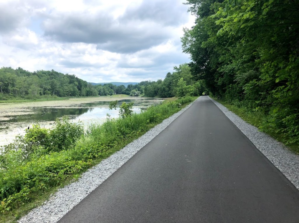
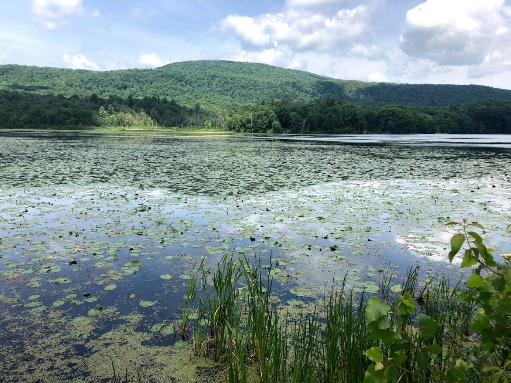
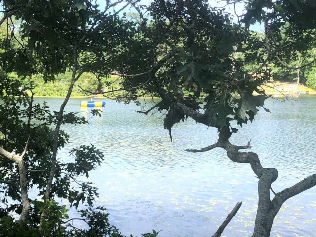
The first part of the trail is wooded, but then opens to views of the Cheshire Reservoir.
The trail has several road crossings but all are well marked.
The largest crossing had a stoplight and was at the northern part of the reservoir, where there are a few benches and awesome views of the mountain ranges. I learned later that this is also where the Appalachian Trail crosses and heads northwest up to and over the top of Mt. Greylock.
Continuing past the reservoir, much of the trail is wooded and in the shade, with views of fields or farms.
The last several miles have a gentle downslope that make the cycling fast and fun (but remember to save energy for the return).
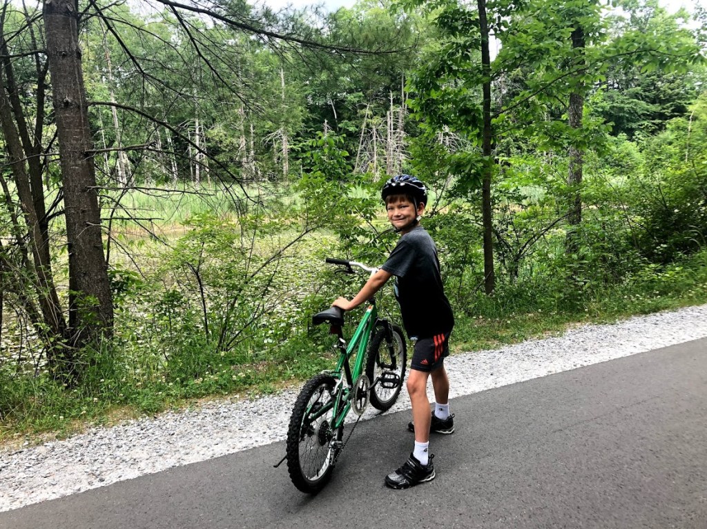
Eventually you roll into the town of Adams which has some good restaurant choices. We decided on the Daily Grind, which had subs and sandwiches as well as diner-style breakfast options.
After lunch, we made the return trip, deciding to forgo the extra mile extension beyond Adams. We were a bit slow climbing out of Adams but then gained speed. We found an ice cream stand along the way and stopped for a rest.
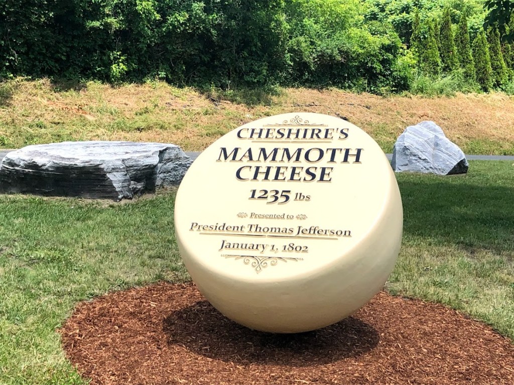
We also found a giant Cheshire cheese wheel pictured below. A giant cheese wheel of this size was actually presented to Thomas Jefferson in 1802 and you can find more details about it online.
The final stretch home was a breeze and we pulled into the trailhead, a bit tired from roughly 20 miles of riding, but very happy.
The Ashuwillticook Rail Trail is a real gem, wide and peaceful, and provides plenty of mountain and water views. It’s definitely a great option for families and we would recommend it to anyone visiting the Berkshires.
Wonderful and wide rail trail. Mostly flat and quite scenic, passing woods and water, with views of Mt. Greylock to the north.
One of the best rail trails!
The smoothest, flattest rail trail I’ve ever rode on. On the way back we were also boosted by milkshakes.
A long rail trail. There are some interesting spots and the trail is smooth.
Very fun and smooth. And a few tiny slants but overall very good.
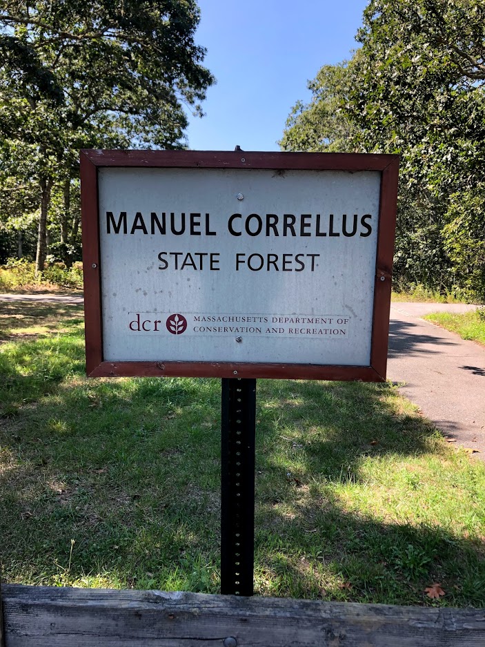
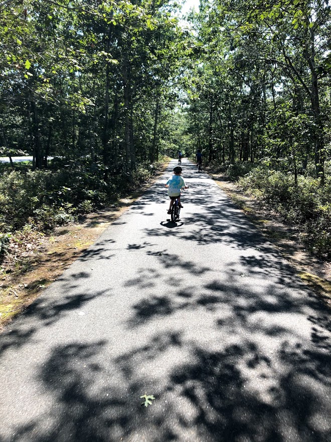
The Manuel F. Correllus State Forest is located on Martha’s Vineyard and offers 14 miles of trails for biking and hiking. It’s located adjacent to the Martha’s Vineyard Airport. It was designed, in part, as a reserve for the Heath Hen, a type of grouse. There’s even a statue honoring the Heath Hen, which apparently went extinct in 1932.
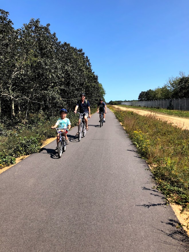
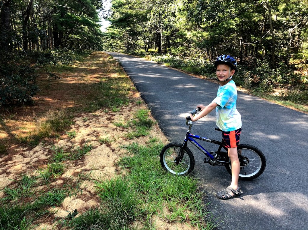
We reached the forest via an easy bike ride from Vineyard Haven, where our ferry arrived. Although the ride to this forest was somewhat hilly, the forest itself is mainly flat, with low pitch pine and oak forest.
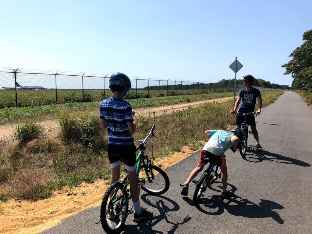
It also has a grid of both paved and unpaved trails throughout. For our ride, we stuck to the paved routes through the forest, first heading south toward the airport.
Reaching the fence, we followed west, and then at the edge of the airport fence we turned north.
Much of the forest consists of short trees with scrubby and sandy soil. We saw a few trailheads to the side but no hikers and surprisingly few riders, even on a beautiful weekend.
After about 3 miles of riding we exited the park the way we came in, and then continued onward to Oak Bluffs, which is mainly a downhill ride from this part of the island.
This state forest is pleasant enough but much of the scenery looks the same and there’s nothing particular distinctive about it. On the other hand it’s peaceful and would make a great place for younger riders to practice their biking skills.
The forest is pleasant enough but not memorable, unlike most other attractions on Martha’s Vineyard.
This park is probably the most boring part of Martha’s Vineyard.
There was a cool airport with smooth, grid-like paths. Excellent!
It was fun to ride our bikes, and the trail was flat.
The bike path was fun, and we got past the airport, and it was through the woods, and it was smooth.
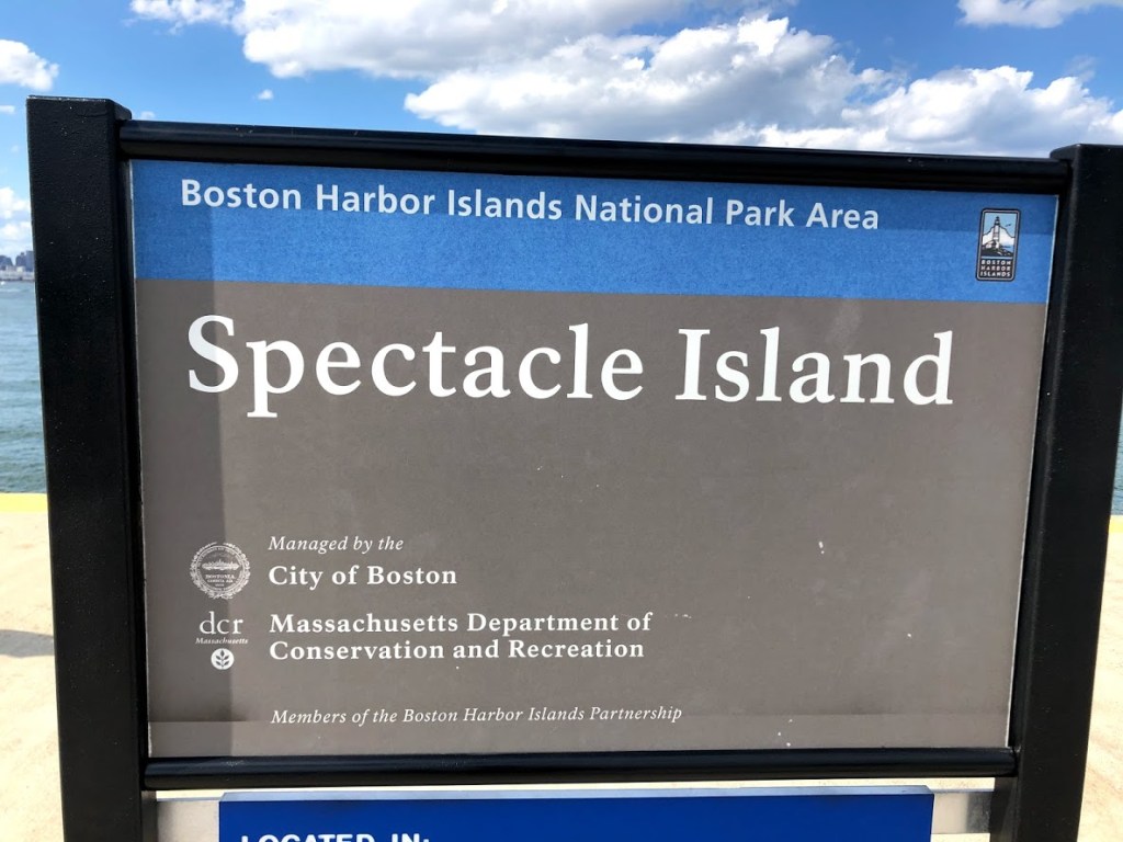
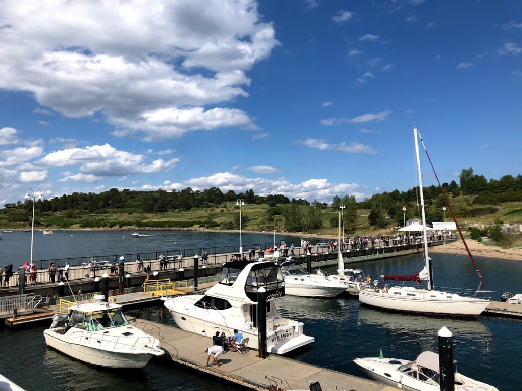
The Boston Harbor Islands consist of 34 islands, and it is both a state and national park. Normally in season you can visit 6 of the islands via the ferry, but with Covid-19 the schedule this year was reduced to just one – Spectacle Island.
We visited on a warm and sunny September morning, hoping to catch the ferry before noon, but it was sold out. So we got tickets for an afternoon ferry that still allowed a good 2 hours to explore the island.
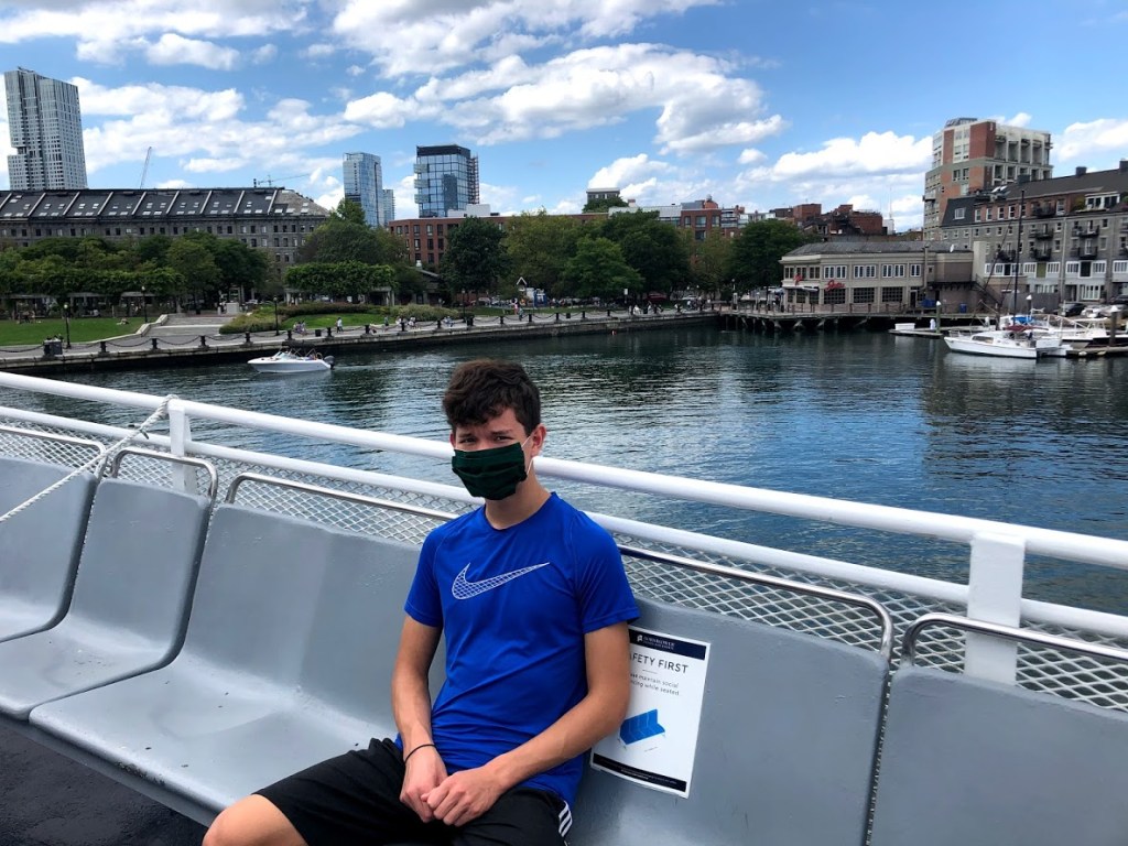
The ferry ride is about 25 minutes to Spectacle Island, leaving from the Marriott Wharf in downtown Boston. There are great views of the skyline as you pull out, as well as plenty of other motorboats and sailboats out on the water.
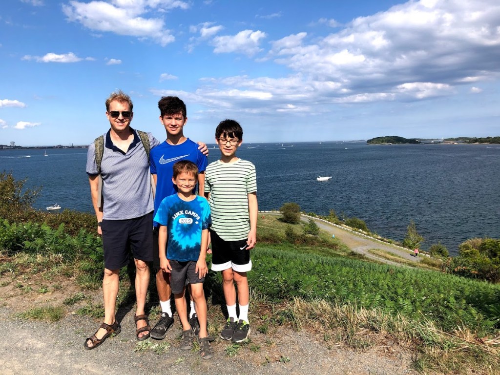
Soon we arrived at Spectacle Island and began our exploration.
We decided to take the numbered walking tour that follows around the edges of the island. The name of the island comes the rough hourglass shape, with 2 drumlins (hills) that are roughly north and south points, with a lower “saddle” between them.
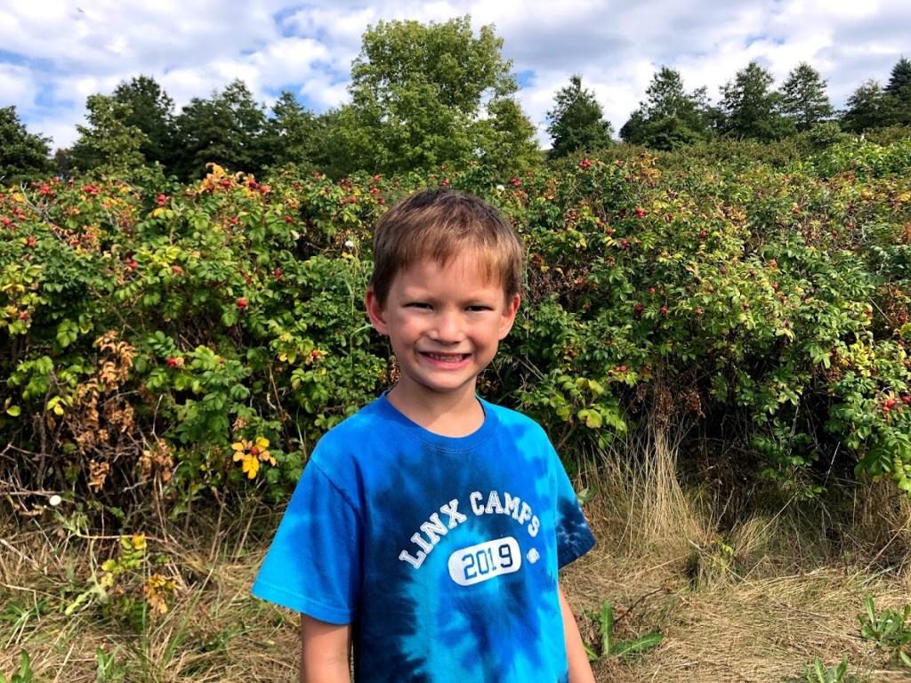
Spectacle Island has an interesting history from Native American times to the Colonial era and more recent uses – in the 1800s for gambling, then for a horse rendering plant, and in the 1900s as a incerator site. More recently, the Big Dig project added fill and dirt to the island, after which came mass plantings of trees and shrubs in an effort to restore and beautify the island.
This view is looking toward the north and to Boston. You can just see the gravel loop path on the edge of the hill.
This is where we rounded the island to face Logan Airport.
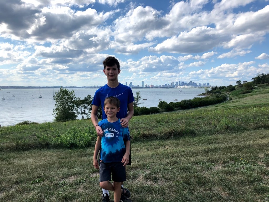
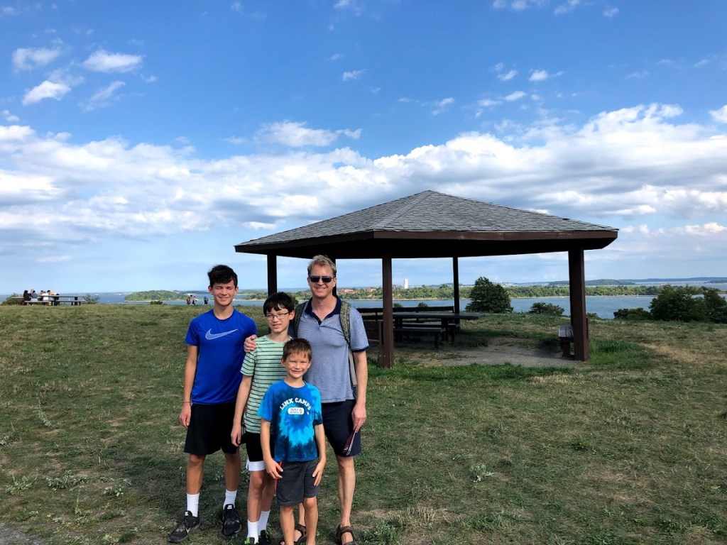
Continuing around the base of the island, we joined the spiral path that leads to the top of the north drumlin. Here’s a view to the east, looking away from Boston, and out to sea.
Pretty soon we reached the summit (only 157 feet), and enjoyed the panoramic views. There are a few signs pointing out interesting sites on the skyline, as well as some picnic tables. The most familiar sites to us were the Boston skyline, Logan Airport, and the Deer Island waste treatment plant.
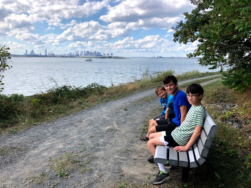
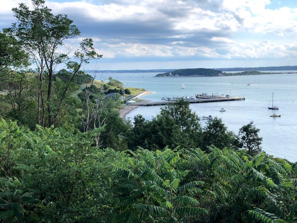
Below is the view from the summit looking south to the ferry dock and visitor center. The lower south summit of the island is hidden behind the tall trees on the left.
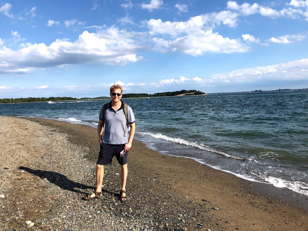
After this, we descended the hill and joined the loop path to explore the south side of the island, including a beach with lots of sea glass and other objects that have washed up (including asbestos brake pads).
The kids enjoyed exploring this beach before we finished our loop of the island and met the ferry to take us back to Boston.
The day we came, we were lucky to get the last 5:30 pm ferry off the island. With the crowds, they had to order a second ferry to take the remaining passengers.
As we pulled away, we all agreed that Spectacle Island was well worth a day trip.
Now we just need to come back (post Covid era, of course) to see all the other great Boston Harbor Islands!
Spectacle Island is a good adventure but we missed the island-hopping that’s normally possible. With the visitor center closed and limited snack bar hours, there was not as much to do and see as we hoped.
We only went to Spectacle Island. Good views but not much else to see on that one island. The ferry ride was very scenic.
The ferry ride was alright and the paths were completely boring.
The ferry ride was pretty cool but the island’s paths were boring.
The ferry was fun and the paths were long but overall it was pretty good.
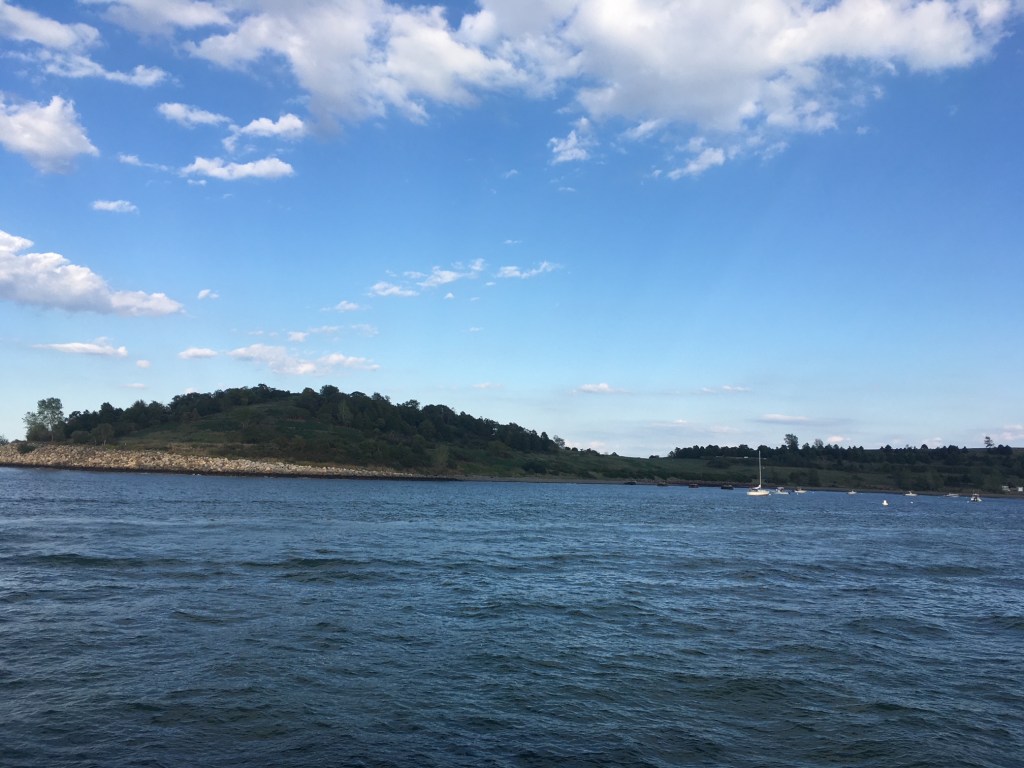
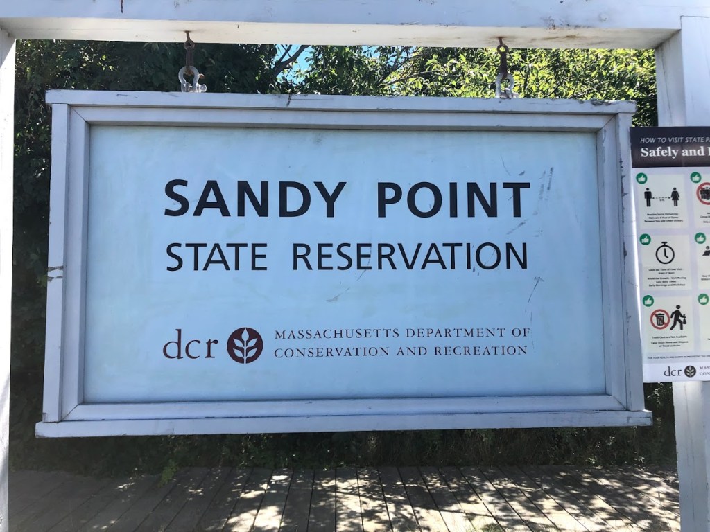
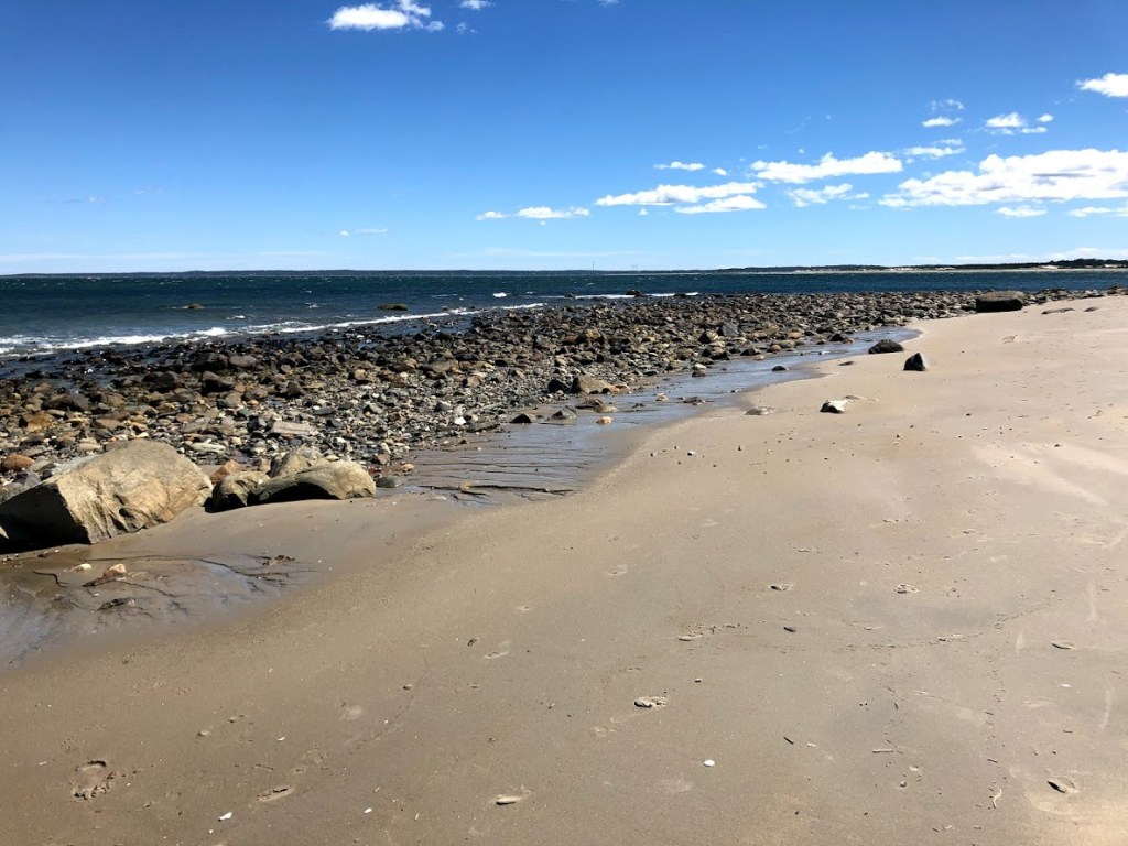
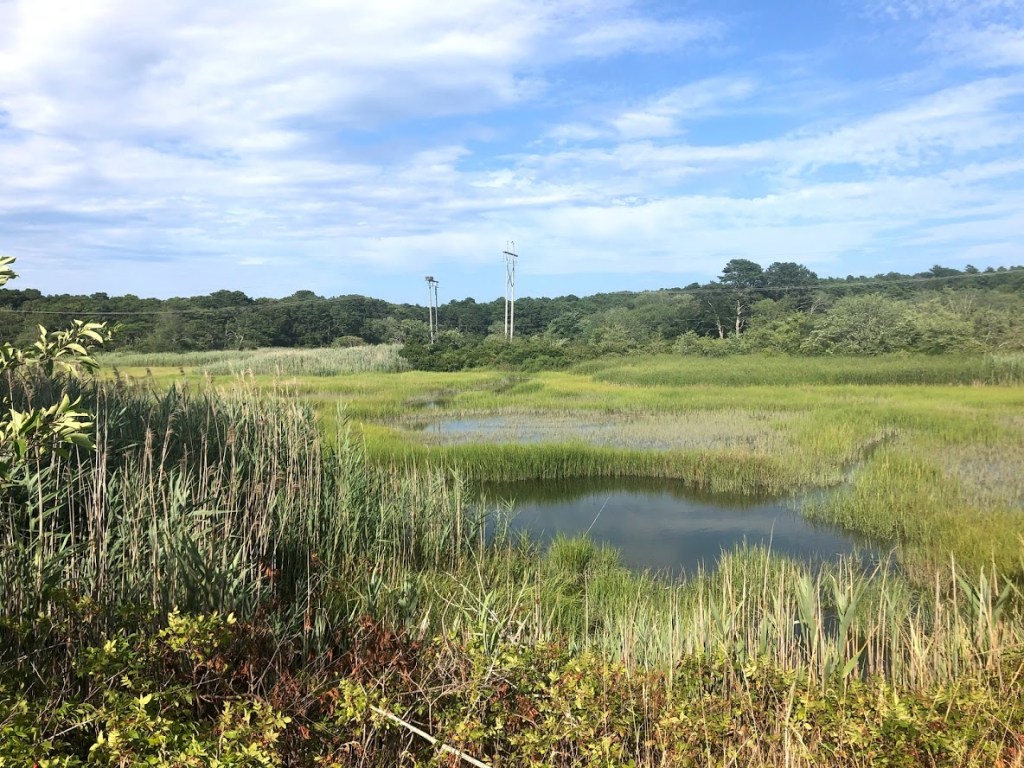
Sandy Point State Reservation is located on the southern tip of Plum Island on the north shore. Access to the Reservation is through the Parker River National Wildlife Refuge, which also charges an entrance fee. There are several parking areas in the Wildlife Refuge, but only a small parking lot for the State Reservation. Many people parked in the Refuge and biked in.
The Wildlife Refuge features beaches, sand dunes, and saltwater marshes. We first stopped by one of the beaches there and tried to have lunch. It was really windy and we had sand in our sandwiches. So we decided to drive to the State Reservation and check out the beaches there.
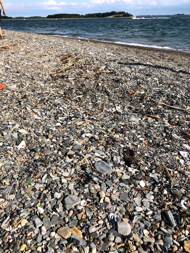
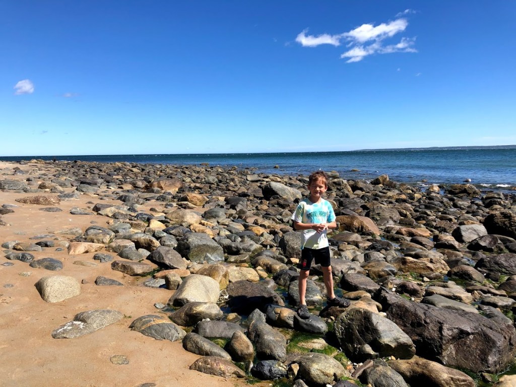
The parking lot leads directly to the beach. The beach is wide but very rocky.
This area is called the Bar Head Rocks. At high tide the rocks are hidden under water, and in the past it was a well known maritime hazard as many ships had capsized here.
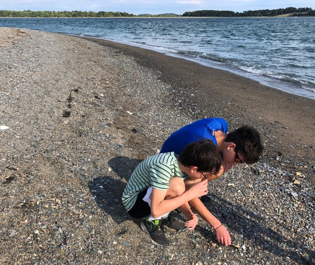
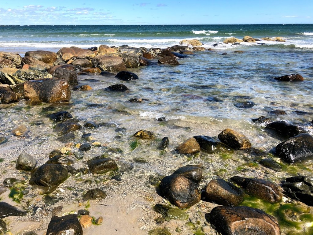
The water here was very clear. The kids enjoyed scrambling and finding crabs and other creatures under the rocks. There were fish, seagulls, and probably the famous piping plovers that come to nest there.
As we round the tip of Plum Island, the rocks gradually disappeared and we found a very inviting sandy beach.
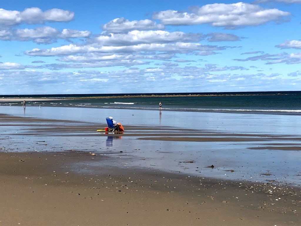
The water was chilly, as can be expected on the north shore, but the kids jumped in nonetheless, and had the water all to themselves.
From where we were, we could see Crane Beach. The views were exceptional. The beach was very beautiful with nice clear waters and fine sand. The tide was calm.
Afterwards, as we drove back through the Wildlife Refuge, we stopped at some observation towers and took some walks through the marshes.
Plum Island is such a special place, with different natural features and wildlife, that it’s worth spending a whole day exploring and relaxing.
The beach had beautiful, fine sand. The area near the Parker River outlet was very calm and shallow, great for young children, but the water was a little cool.
Beautiful beach on the tip of a wildlife sanctuary. Such a treat!
It was so windy the sand pounded against our sandwiches and made them hard. But at least the sand was nice.
It was super windy, and the water was cold, but playing in the sand was better.
The water was freezing and our subs got sandy because of the wind. But the water highways that we made out of sand were good.
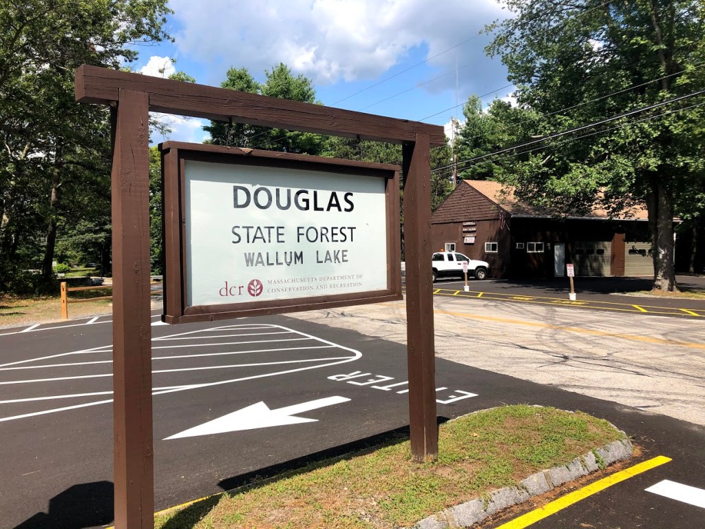
This state forest is in Douglas, south of Worcester, and straddles the border of Massachusetts and Rhode Island. The main attractions here are Wallum Lake and several short hiking trails. It can fill up early, so we made a point to arrive by 10 am to beat the crowds.
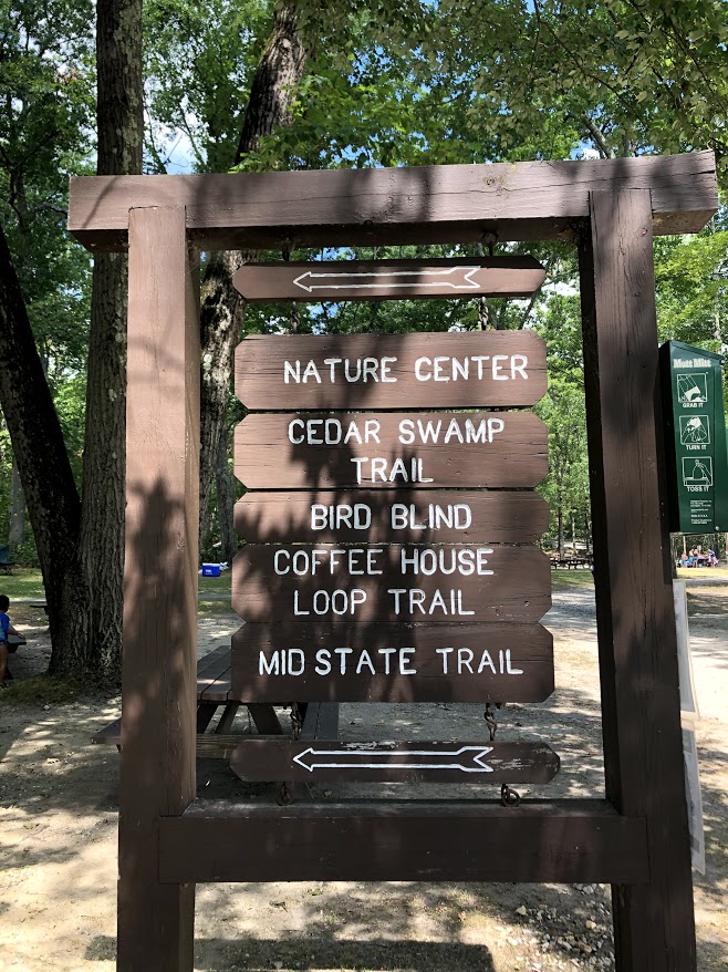
We started our visit with the “Coffeehouse Loop”, a 2.2 mile trail through forests near the lake. We also took a detour on a shorter trail to see the rare Atlantic White Cedars.
The trail starts from the parking lot and is mainly flat. We took the clockwise direction and first passed through an old quarry with massive piles of broken rubble on either side of the trail.
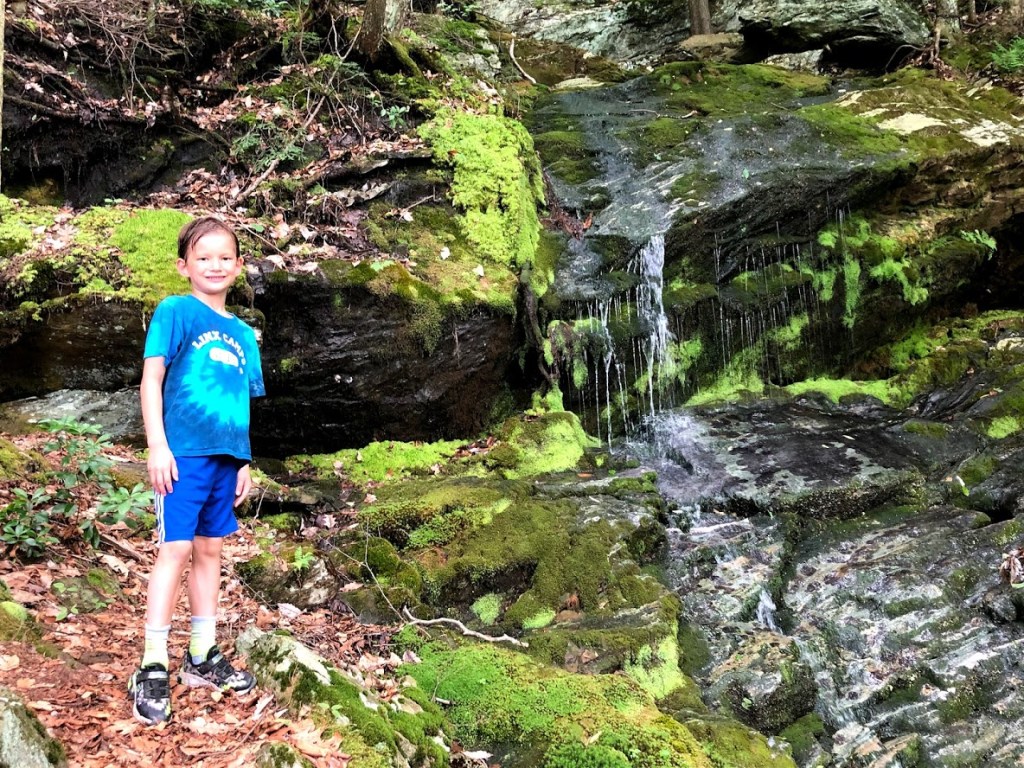
Soon after this we detoured onto the short Cedar Swamp Trail, which descended into a more swampy area with a boardwalk and numerous signposts pointing out interesting trees and flowers.
Surprisingly there were no bugs at all and very little water on the forest floor due to the locally dry conditions that continued much of this summer and especially in August.
Soon we rejoined the main Coffeehouse Loop. Most of this trail was shaded and fairly wide and soft, covered with pine needles. A few points had small brook crossings.
We also took a short detour from the loop to check out the Southern New England Trunkline Trail, which starts in Douglas and goes northeast 22 miles to the Franklin State Forest. This section of the trail appeared to be packed gravel and better maintained than the Franklin area (see our review in that post).
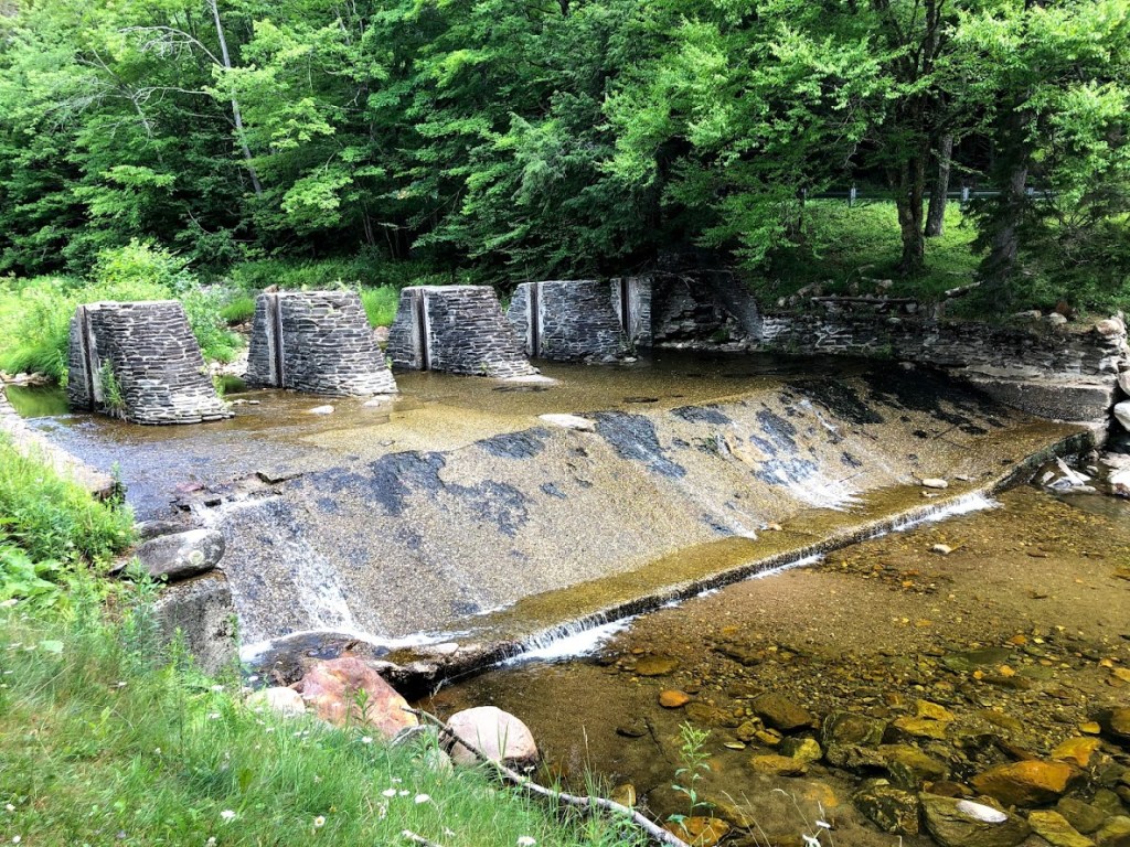
In any case, we soon came to a pond that had the remains of a former grist mill.
Although there’s not much left, we walked on the long stone wall and admired the scenic pond that once provided the power for the mill.
Here you can see the section that held the main part of the mill through which the water flowed.
The final part of the loop trail follows a large meadow, eventually returning the same parking lot.
At this point, we were ready for a swim, gathered our gear, and headed over to Wallum Lake.
It was a busy day, with an ice cream truck surrounded by young children and their parents. Most of the picnic tables were filled and the smoke from the grills filled the air. It had a relaxed, family feel. We found a spot near the beach and laid out our blanket.
The beach was wide, very clean and sandy, with several lifeguards.
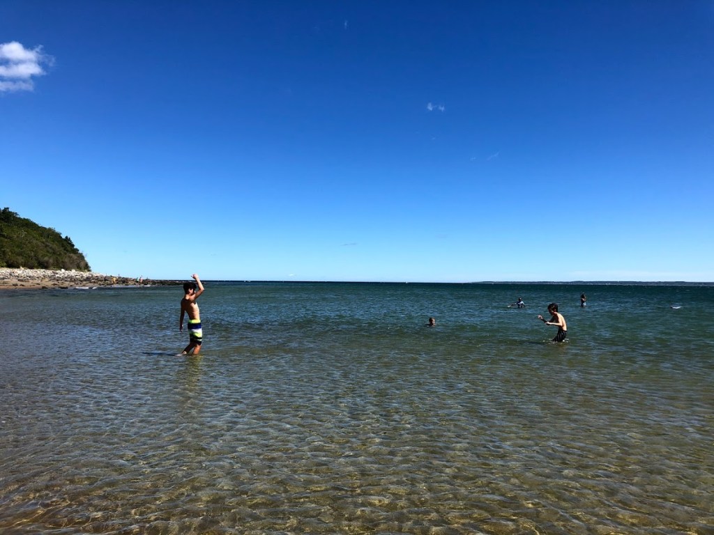
The water was a little cool but we adjusted and really enjoyed our time. It’s very clean and clear, and has a large roped area that never felt crowded. Also, the scenery is wonderful and there were few motor boats in this area, but we did see a few waterskiers go by.
After some swim time, the kids enjoyed playing on the sandy beach until lunch. All in all, this was one of the best swimming lakes we’ve been to on our journey. And this state forest also offers a few interesting hiking trails and access to the bike trail.
It’s a popular park and for good reason. I would say it’s a gem in this part of the state.
Interesting loop trail to see Atlantic White Cedars, and Wallum Lake was clear and refreshing, with a wide beach and lifeguards.
The pond is really nice. The best in the area.
The forest was pretty nice with a boardwalk and a dried-up swamp. The pond was fairly warm, very clear, and had little or no weeds. Great park.
The trail was okay. The lake was pretty shallow, and the boats that came by made waves.
The cedar swamp had an old gristmill and the lake was cold, but pretty good, because it had deep parts and I was shooting Liam with water.
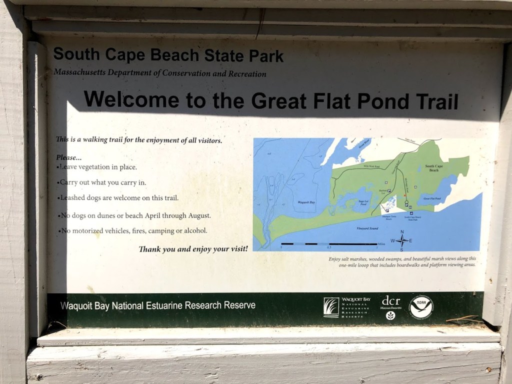
The Waquoit Bay National Estuarine Research Reserve (WBNERR) consists of open waters, barrier beaches, marshlands and uplands on the south shore of Cape Cod in the towns of Falmouth and Mashpee.
After visiting the nearby and worthwhile South Cape Beach State Park we wanted to explore some of the trails in the reserve, but had difficulty finding something suitable. We settled on a short loop called the Great Flat Pond Trail, accessed from the main beach parking lot.
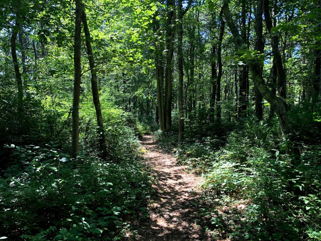
It was a short loop through dense forest on a narrow path.
Although it was only a 1/2 mile around, we realized after just a few seconds why it was so quiet here – the place was swarming with mosquitoes and they were happy to have some visitors. We quickly reached for the Deep Woods Off but also felt compelled to move quickly, which made it less than enjoyable.
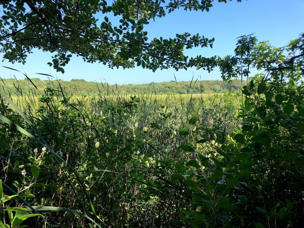
We reached the first lookout toward the pond, snapped a few quick photos, and then decided to turn around and get out of the forest.
We recommend visiting this trail out of season or be prepared to cover up and use the good stuff (DEET) to keep the mosquitoes at bay.
A buggy trail that had some promise if visiting off-season.
We couldn’t find any trails. It was very buggy and we had to turn back.
Since everyone is talking about the bugs, the trail was pretty smooth and looked nice (except for the bugs.)
This one was super buggy and bad.
We tried to walk through this one, but it was so buggy, we had to turn back.
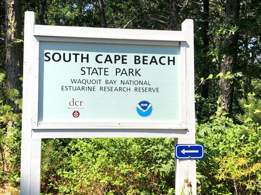
South Cape Beach State Park is located near East Falmouth as part of the Waquoit Bay National Estuarine Research Reserve. The beach faces Martha’s Vineyard and the Nantucket Sound. There is a large parking lot and changing rooms which were closed due to Covid-19.
We went there on a very hot day. A boardwalk took us to the beach. We got a good view of the white sandy beach. There are no other facilities or snack bars or playgrounds.
The sand was generally sandy, but got rockier towards the water. In fact, we thought perhaps on the west side the sand was more rocky than the east side.
Either way, the view was breathtaking. The water was slightly chilly, but was much more pleasant on this south-facing beach than on the bay side of Cape Cod. The tide was gentle, and the drop off was not too steep, making it a good spot for families.
There are also trails to the salt marshes beyond the rolling dunes. This is a good place to relax and enjoy the sun in the summer, and explore the unique estuary in the cooler seasons.
The beach had soft sand with dunes behind it. Although the beach was a little rocky, the water was refreshing and had good waves.
The beach was a little rocky. Water was a little chilly, but much warmer than the bay side.
The beach was very rocky and the water chilly, so I’m not sure why everyone else gave it 4+ stars.
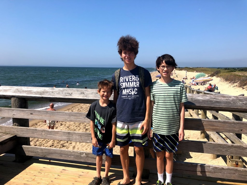
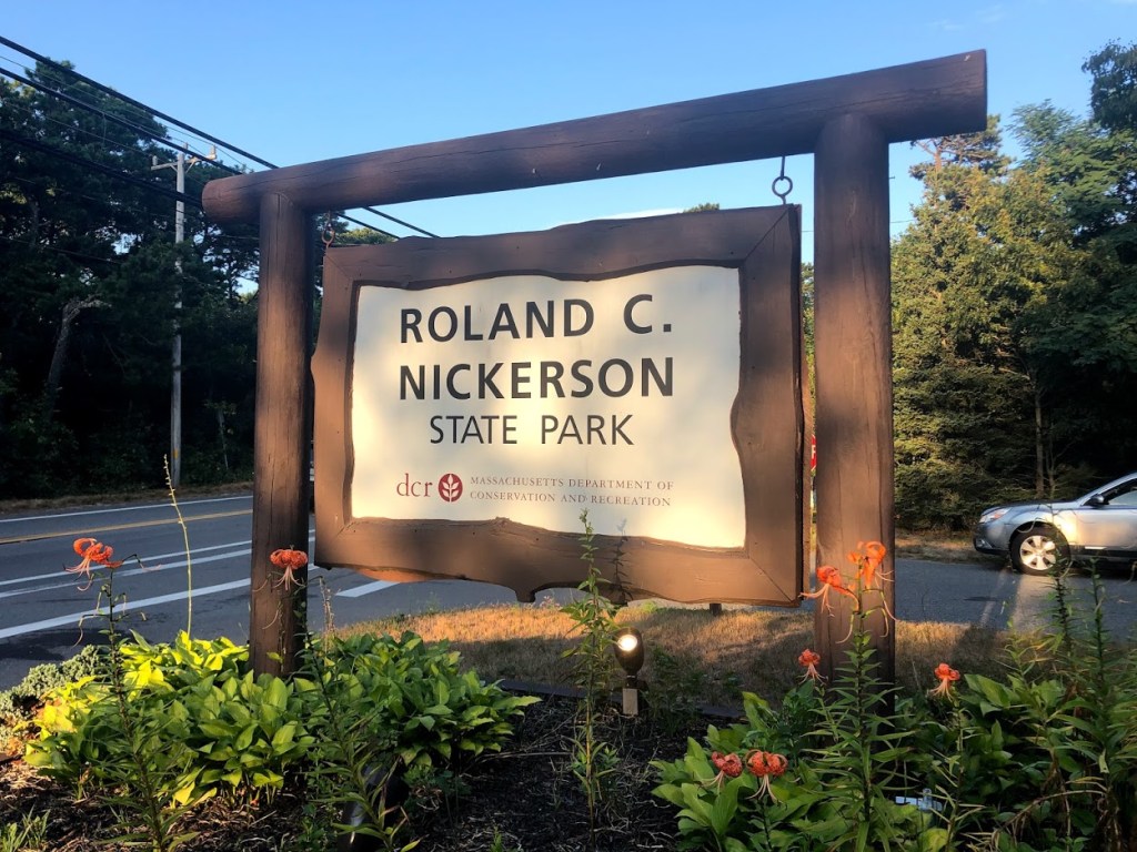
Nickerson State Park is located on Cape Cod in Brewster, MA. The forest has trails, sandy kettle ponds, and a bike trail system that connects to the Cape Cod Rail Trail.
We visited in the mid afternoon after finishing our bike ride on the Cape Cod Rail Trail to cool off in Cliff Pond. This is a “kettle pond”, which formed when a large block of ice was left behind as the glaciers retreated during the end of the last Ice Age.
The pond is round and shallow, with crystal clear waters and fine white sand on the bottom. Even in the picture below, you can see the clarity of the water.
The water seemed a little cool on this hot and humid summer day, but after a few minutes felt really warm, like a bath.
Although there are no lifeguards, the swimming area is marked and the water is shallow, reaching maybe only 5 feet toward the ropes.
The amazing thing to me was the pristine water and soft sand. There were no rocks or any pond grass so the bottom was very smooth and comfortable. We’ve visited many ponds but this was the most like a saltwater beach.
After some time, I decided to just sunbathe on the warm, soft beach area, with gentle waves lapping the shore.
Although we didn’t explore the rest of this state park, even just a swim in Cliff Pond makes it worthwhile. This state park is a real gem.
The pond is so clean and the water so clear. Wonderful spot for a swim or just to relax on the beach.
The pond was refreshing and beach was sandy. Water was super clear. What a treat!
Very warm and clear. Sandy beach.
The pond was warm, and the beach was pretty good.
The water was warm, and there wasn’t much sand, but it was good.
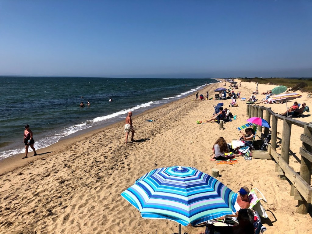
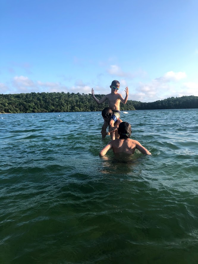
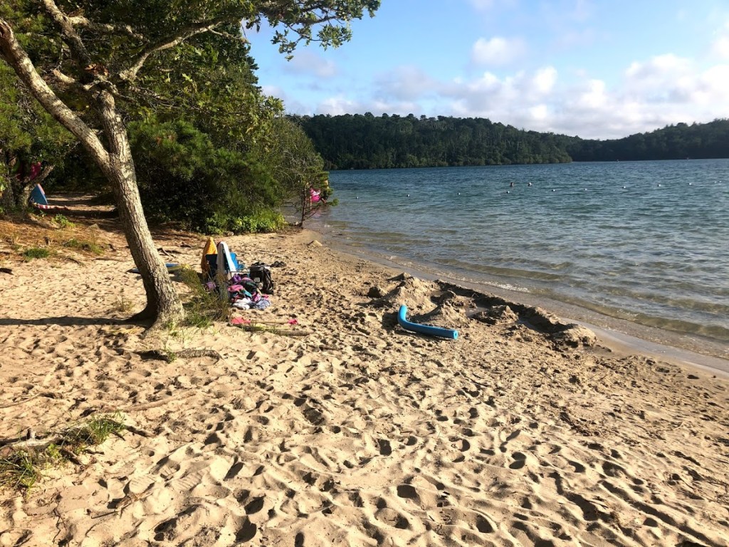
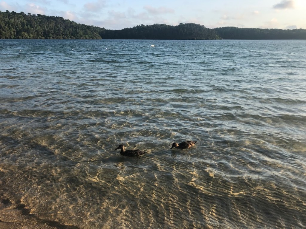
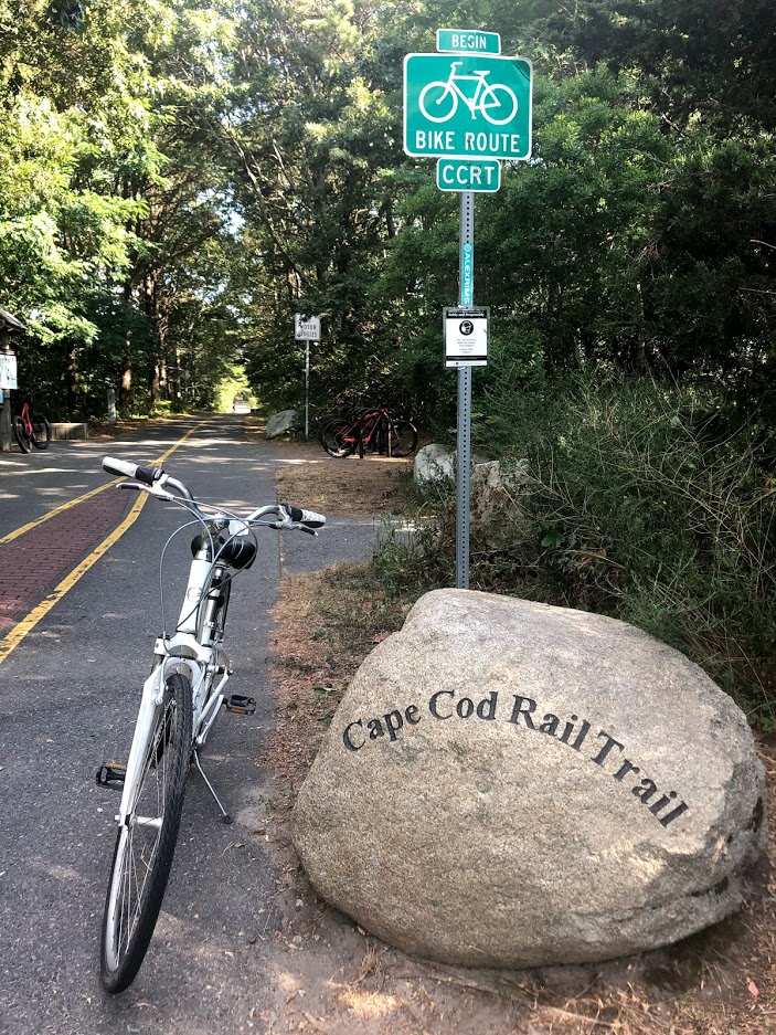
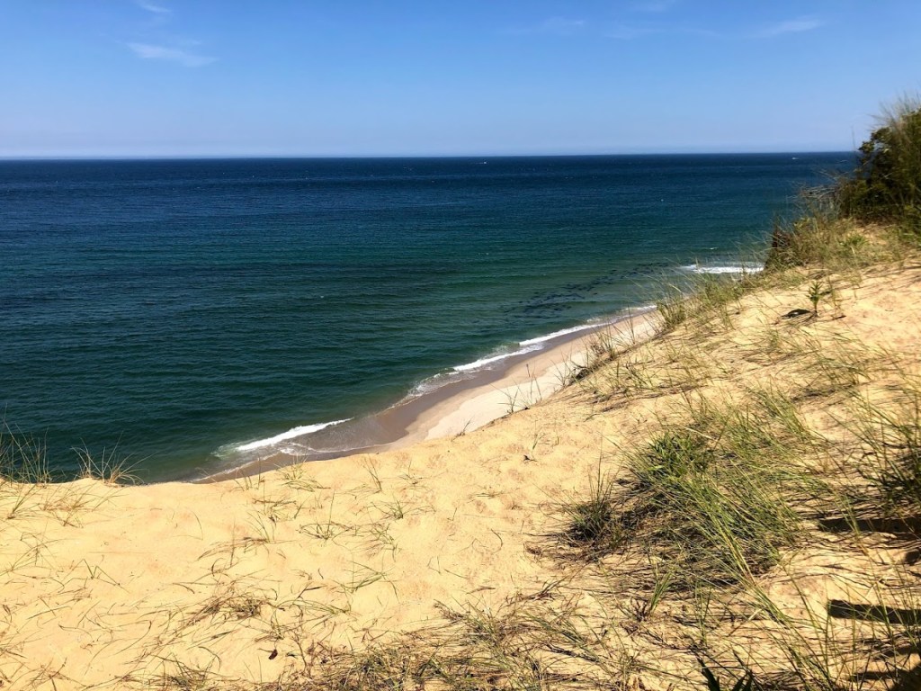
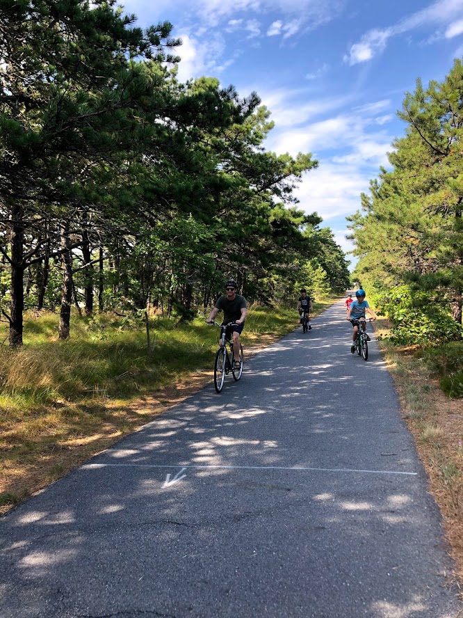
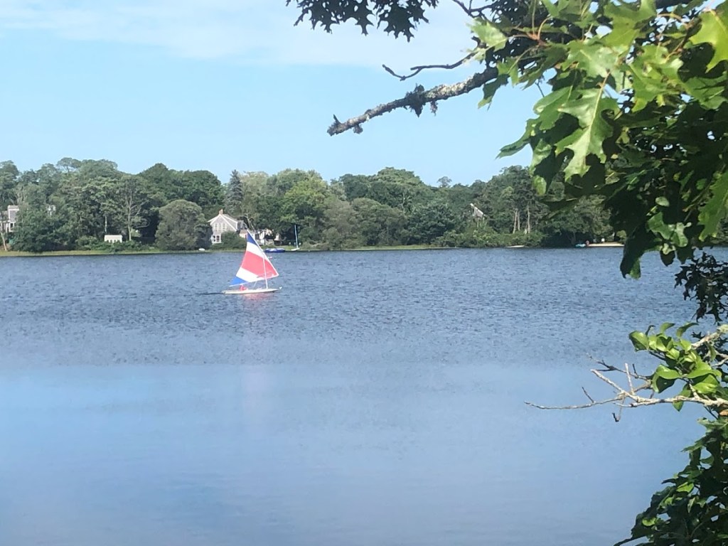
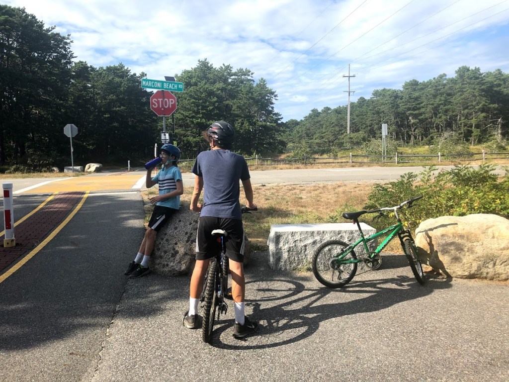
Cape Cod Rail Trail runs through 6 towns on the Cape, from South Dennis to Wellfleet, and stretches 22 miles. There are numerous parking areas and entry points to the trail. We started at the Cape Cod National Seashore, which is near the northern end of the trail. But first we stopped at Marconi Beach.
This area is named for Guglielmo Marconi, who transmitted the first wireless signal across the Atlantic in 1903 from this area. All that remains today is the concrete base of radio towers, but it’s a very picturesque spot.
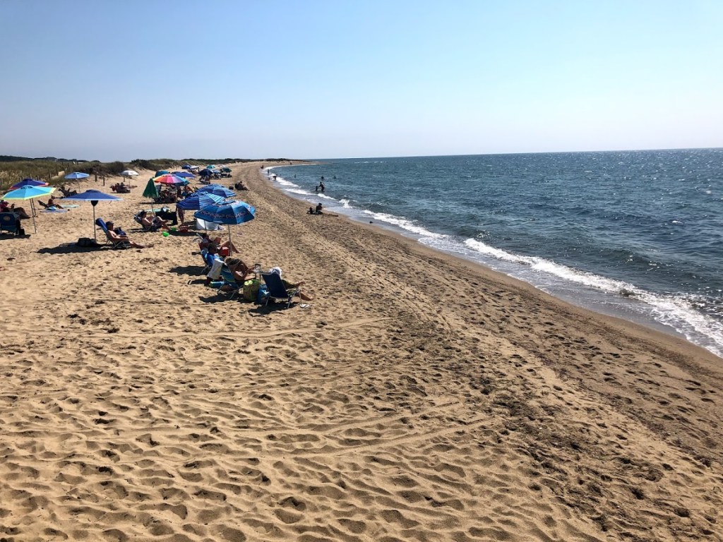
The sand here is fine and white, and the ocean very blue.
We also saw a bunch of seals just offshore. You can just see them in the photo below, above the sandy beach. They look like a mass of black dots.
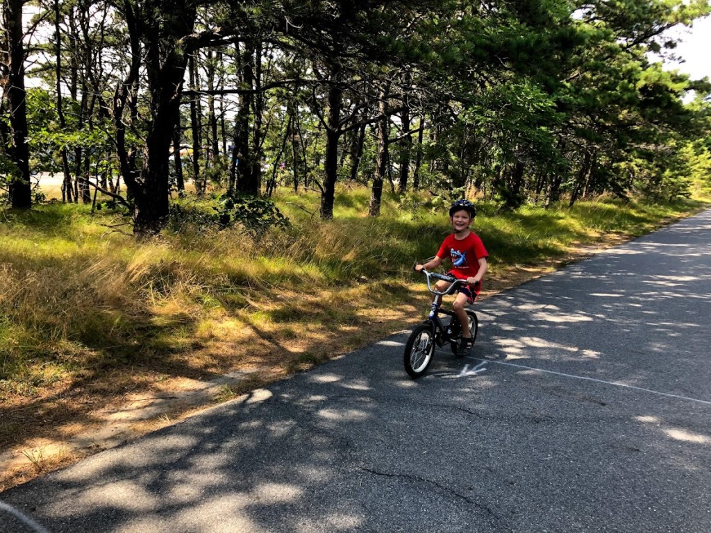
In any case, we started south on the trail from Wellfleet at Marconi Beach road (Mile Marker 21). The trail is wide, well paved, and shady. It’s also mostly flat, with minimal inclines, which makes it good for kids. The distances and road crossings are all well marked.
The day we visited (a Sunday afternoon) was surprisingly quiet for such a lovely weekend day.
Although much of the path is shaded, it opens at times to views of marshy areas.
We reached Mile Marker 15 in Orleans, where we stopped to check out some scenic ponds, Herring Pond and Depot Pond, just on either side of the bike trail.
At this point, Miles was pretty tired (having peddled the whole way on his little BMX bike) so we turned around and headed back north. Fortunately, the way back to Wellfleet was easier, with more downhill stretches that provided a little boost.
All in all, we did about 12 miles on a warm summer day, and were very happy with this bike trail. Next time, we’ll explore the other section of the trail from the start in South Dennis up to the town of Brewster.
This trail is shady, scenic, and well maintained. Highly recommended.
Long, flat, shady, with wonderful views of ponds close to Orleans. Well marked.
Ryan and Miles slowed us down the whole time, and it was pretty boring scenery.
The rail trail was fine but it was long.
A 5.5 bike trail long and fun and there was a parking lot that we saw and a pond that we took pictures that was the end.
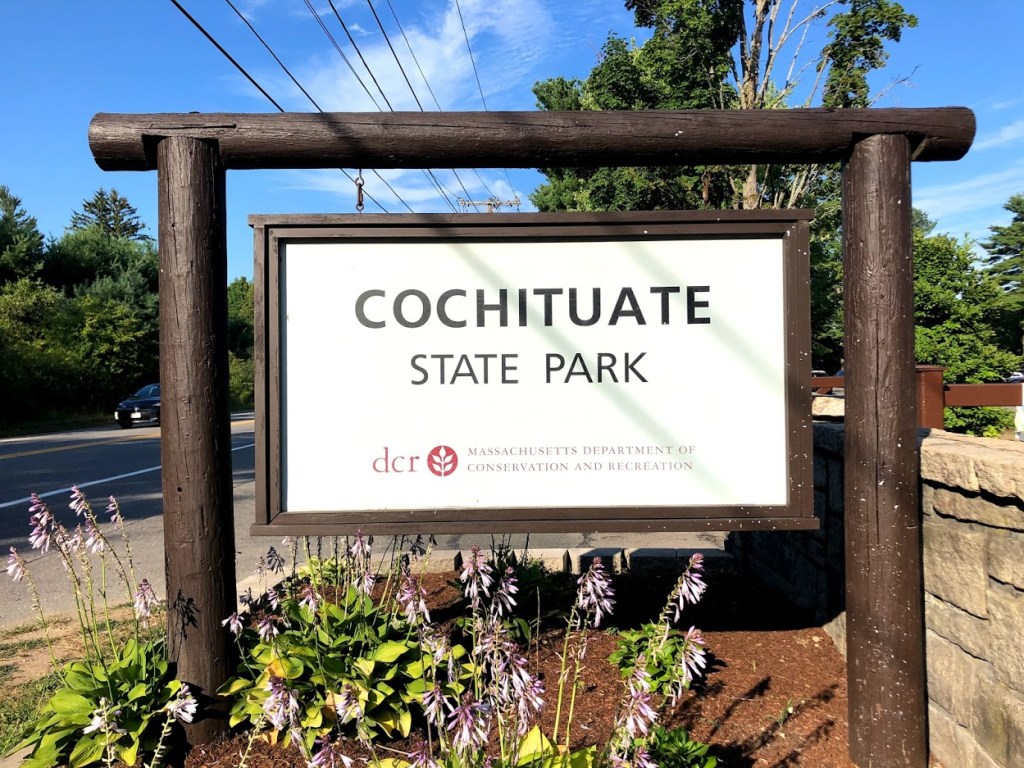
Lake Cochituate in Natick is visible from the Mass Pike and Route 9, and close to the malls. The busy Route 30 actually divides the lake into two sections. Since it is located in such a dense area, Cochituate State Park is usually very busy on summer weekends. Many days we drove past the gate and saw long lines of cars waiting to get in. This time we went on a sunny Friday afternoon and got in right away.
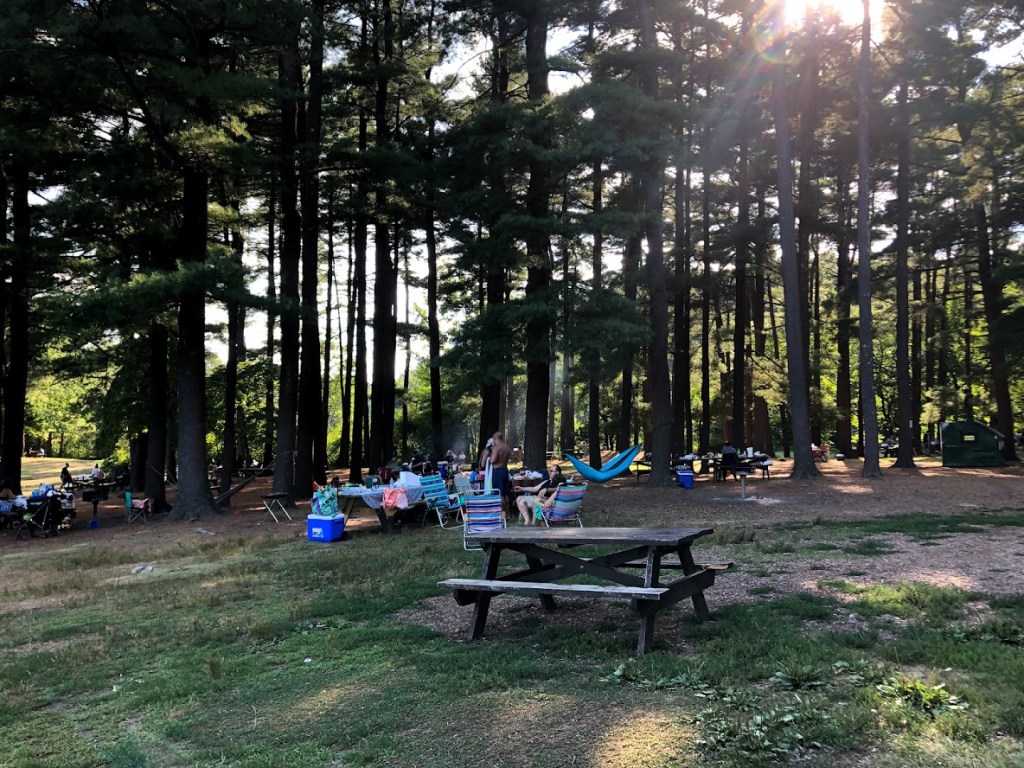
There is a large barbeque and picnic area beyond the parking lot. It was packed with families enjoying themselves. There’s loud music everywhere. Kids were running around and playing ball, adults were drinking. It was definitely not peace and quiet like some lakes.
Beyond the picnic area is the beach, which is actually quite large and wide considering it’s only a lake. The sand is fine, almost like clay. There was no lifeguard on duty that day, so we saw people swimming outside the boundaries and everywhere.
The water was surprisingly warm. It was not super clear, and there were some pond weeds. Overall it was clean enough, and best of all, the bottom is sandy. The swimming area is large and it drops off gradually, so even outside the boundaries it is shallow enough that the kids can still stand.
The kids had a blast there. They were doing flips, diving, throwing each other into the water, daring each other to swim farther out, all kinds of tricks. After they’ve had enough swimming, they came back on the beach and started digging a tunnel filled with water.
The view is natural, even though the lake is close to the highways and road noise can be heard, along with the loud music from the picnic area. People brought all kinds of floats and tubes to the swimming area, and Cochituate also has boat rentals. We saw paddle boats, kayaks, canoes. They even hold sailing lessons there.
After we dried off, we checked out the boat rentals. We would return one day to do boating.
The beach and picnic areas are large. There are pond weeds in the water. Road noise can be heard. Overall a fun place to hang out.
The beach is sandy. The music is loud. I slap my palm sideways. I wet the whole crowd.
It was kind of busy but there was clay which was cool.
There was a bunch of clay and there was a bunch of floaties and it was really busy but it was fun.
The DAR State Forest is known for the clear waters of the Upper Highland Lake. We went on an unusually hot day and the before noon the parking lot to the beach was quickly filling up.
There was a small grassy area with picnic benches and grills. Families were clearly planning to spend a good part of the day there. We found a picnic bench in the shade and had some sandwiches we bought from the Goshen General Store, and then we changed. The bathrooms were clean, and there were outdoor changing areas as well.
The beach was wide and sandy. When we first got there the lifeguards were conducting a safety check. They were essentially looking for trash or dangerous things left in the water.
We found the water to be very clean and free of pond weeds. It was very well maintained. The water was a bit cold, but felt very refreshing on a hot day.
The kids had a fun time splashing around. The swimming area was quite large, and it got a little deep for Miles at the boundary. The beach started to get more crowded, and there were more and more people in the water, making social distancing very hard.
Outside the swimming area, there were many kayakers and boaters. Some of these people jumped in the water, but the lifeguards repeatedly called and warned them to not swim outside the swimming area.
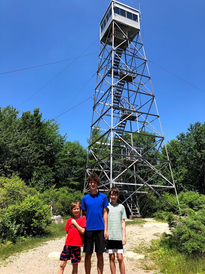
After spending a few hours by the lake, we decided to drive up Moore Hill Road to the Fire Tower. We parked on the side of the road, and took a short side trail.
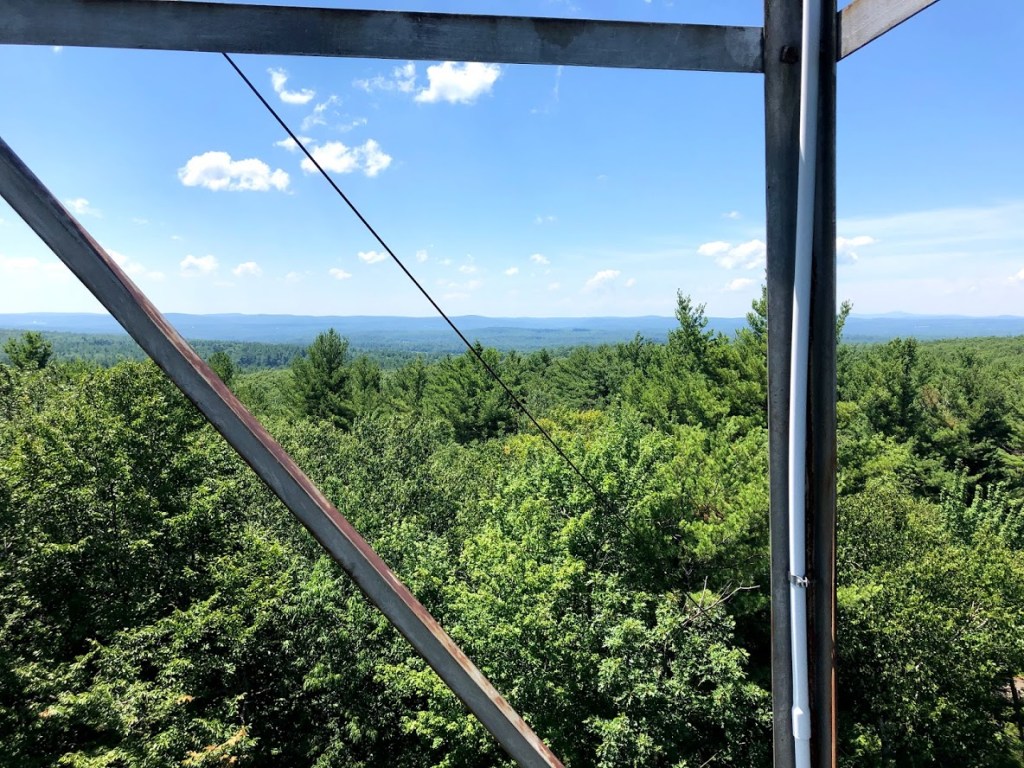
There was a “No Trespassing” sign but no fence around it. We climbed up the tower. It was a little rickety and some of us felt kind of scared (not the kids, of course). The cabin at the top was closed. We sat on the top steps and took in a great view of the surrounding areas.
This was a special treat to a great day on the beach.
Clean beach with clear and refreshing water. Plenty of shaded picnic tables to enjoy the lake. Fire tower had good views.
Nice beach. Clean. Fire tower is fun.
Great beach, clean water, amazing fire tower. I’d come back here 10/10.
The lake was fun and I made a water de-purifier (with sand).
The water was cold but it was pretty good because I was hot, and I found a friend and it was pretty fun. And the fire tower was closed at the top but we got to go really high.
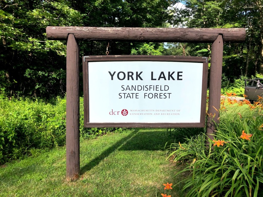
The main attraction in Sandisfield State Forest is the man-made York Lake, which is well regarded for fishing and is stocked with trout three times a year. The lake is surrounded by rolling hardwood forests.
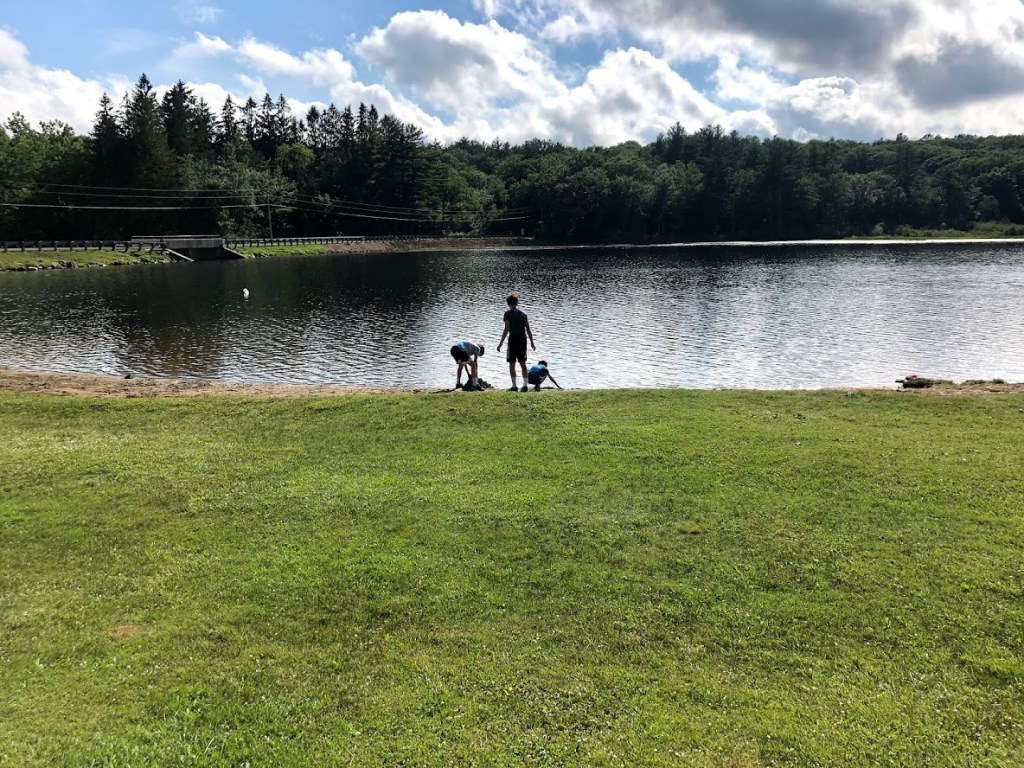
The lake itself has a small and narrow sandy beach, backed by a large grassy area.
There are some picnic tables with grills to the side, a few of which are shaded. It also has a very clean and well-managed restroom with changing area, seen in the background here.
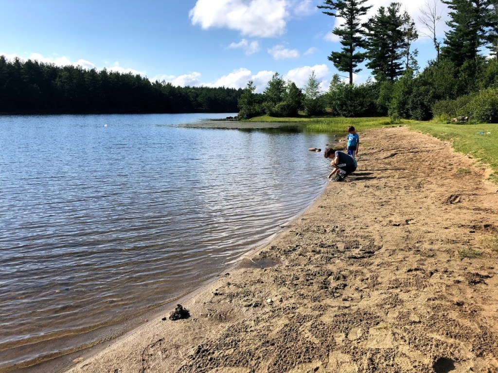
The water was very clear and refreshing on a hot summer’s day. And the lake near the shore has a sandy bottom with a very gradual slope.
There are no lifeguards or roped swimming area but it’s not really needed here. It felt very safe for the kids.
Although it’s possible to swim across the lake, some people may be uncomfortable with kicking through some weedy areas.
Mostly the kids and other visitors just enjoyed splashing around and playing on the small beach. Many people were here just for reading and sunbathing as well.
This lake is in a beautiful setting, very family oriented, and good for younger kids.
Very clean and clear water but the beach is narrow. Good facilities and family friendly.
Clean facilities but very small beach. Water is weedy.
We (I) dug out rocks from the beach. Then the wasps moved in, and I moved out.
We dug out some rocks from the beach. The water had seaweed.
There were some fish and a small beach, but we dug out three pretty big rocks. And the water was warm.
This state forest is located in a remote area in the southwest part of the state near the border with Connecticut. It offers camping, hiking, and fishing, among other activities. It was the site of the Tunxis Native American tribe’s hunting and fishing grounds several hundred years ago. On the Connecticut side of the border there’s a Tunxis State Forest.
This area is pretty remote and there are no cell signals so be prepared and have a paper map or downloaded version of the trails at your side.
We were originally planning to follow the Hubbard River Trail the whole way, but had trouble finding the trailhead when we arrived. We ended up parking at the Halfway Brook Campground, which looked very pleasant.
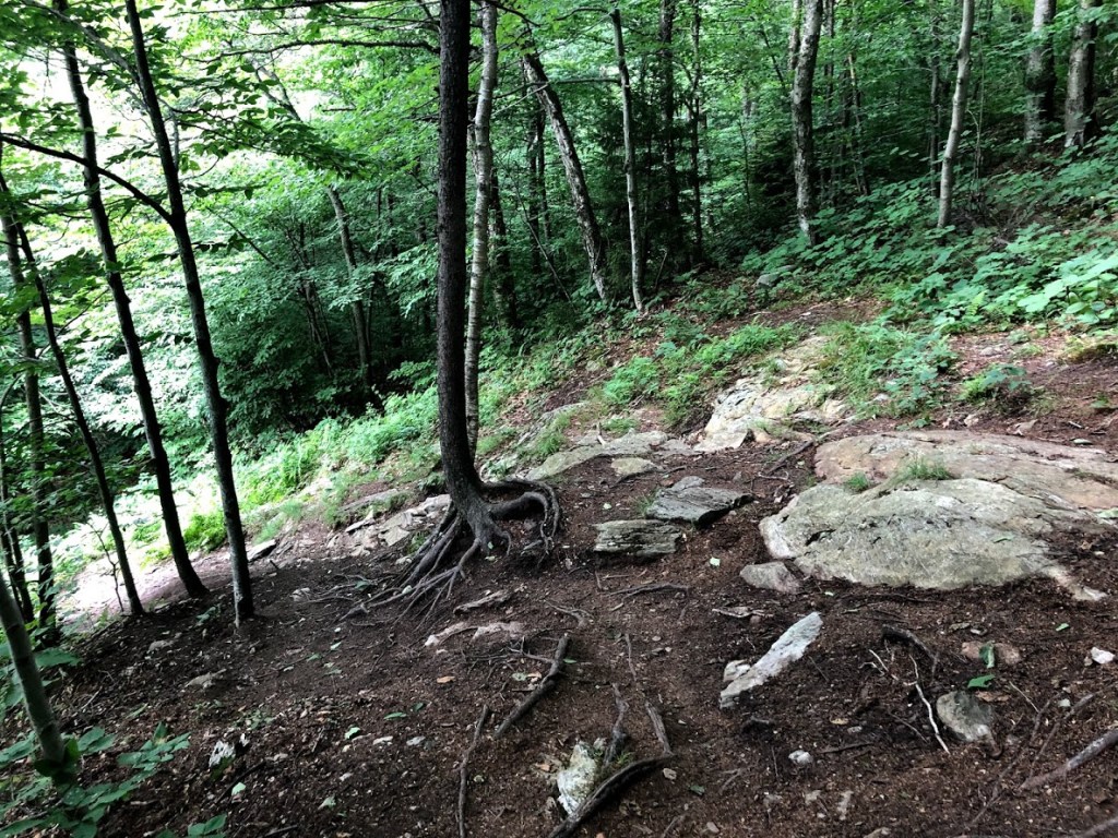
We started on the Halfway Brook Trail, which we knew would join up with the Hubbard River Trail. Crossing a bridge from the campground, the trail descends gradually through a thick forest along a small brook strewn with boulders.
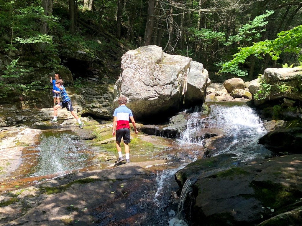
After about half a mile, we joined up with the Hubbard River. The water was a little low, but it offered a lot of boulders to hop around. We spent about 10 minutes here just exploring.
From here, we followed the river downstream on a shady and soft path. It drops about 450 ft in 2.5 miles, and our walk covered a good portion of this.
One interesting artifact we saw was an old “tank” of some kind, abandoned along the trail. How it got to this remote area and what it was remains a mystery.
The river forms a series of small cascades, pools, and other rock formations.
Since the trail is right along the river, it was easy for the kids to explore sections that interested them. This was one of the first sections that caught our eye.
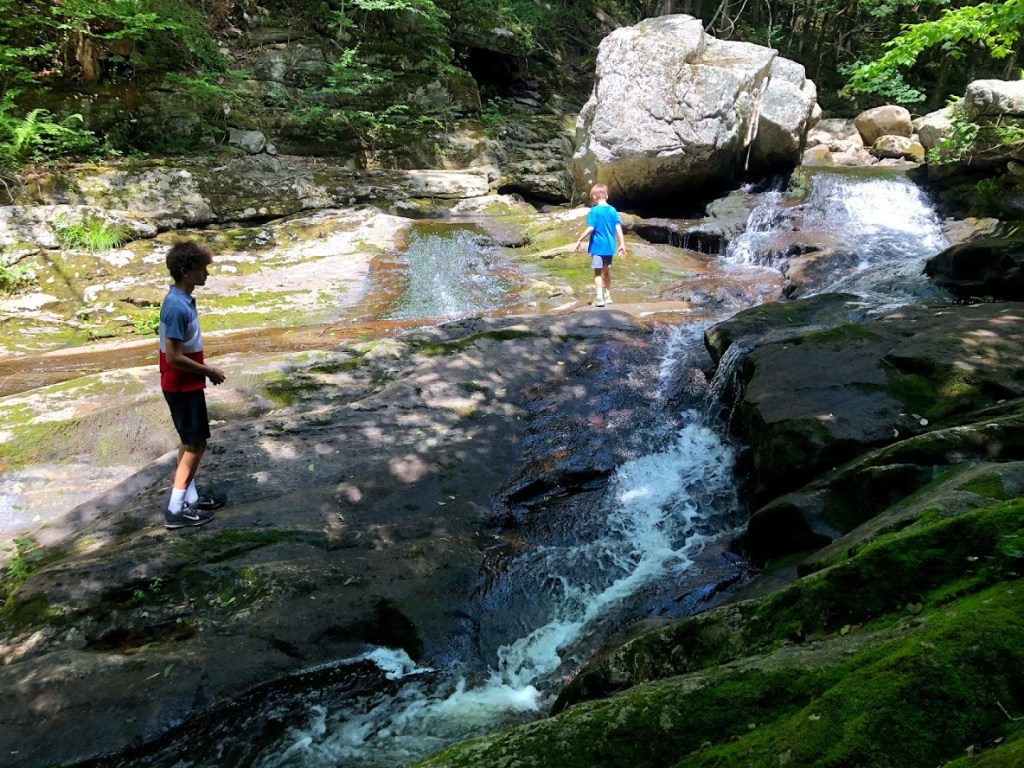
A little farther down the river we found this enormous boulder with a cascade around it.
And farther still, near the point we turned around (by the Ore Hill Trail) we found a small waterfall over a series of steps.
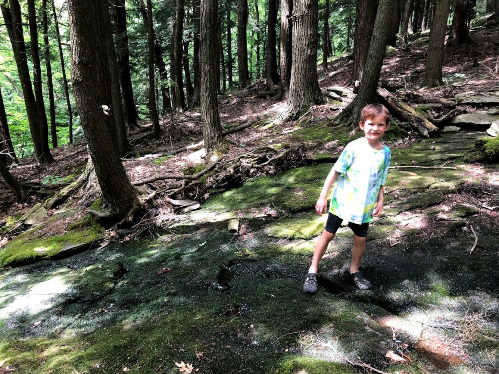
Miles stopped to rest and dip his feet in the cool water, while the other kids walked back up the river, jumping from boulder to boulder to stay dry. We saw a few other people playing in the water as we followed the trail back.
Our family really enjoyed this state forest. The Hubbard River is really scenic and remote, with much more variety than I expected. I had never heard of this forest, but it’s a real hidden gem, and has a nice campground as well.
Interesting river with cascades and pools of clear water. A hidden gem.
Walking along the river is really fun.
Ryan was going to step on the tadpoles. Shame on you Ryan
There was a stream, and I jumped on the rocks.
There was a brook and it was fun to jump on the rocks. And there were some places we played on the rocks. But it was pretty steep going back.
Mount Everett State Reservation is in the far southwest corner of the state in the towns of Mount Washington and Sheffield. The mountain itself is 2,624 feet tall and offers views into Connecticut and New York. The Appalachian Trail also crosses the reservation here.
It was clear that some of the hikers we encountered were geared up for some camping, with plenty of water and supplies.
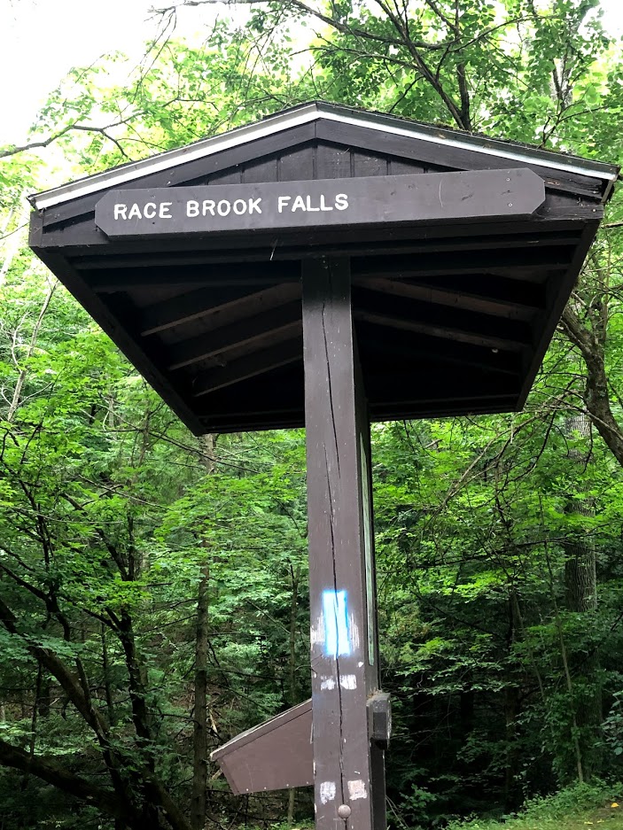
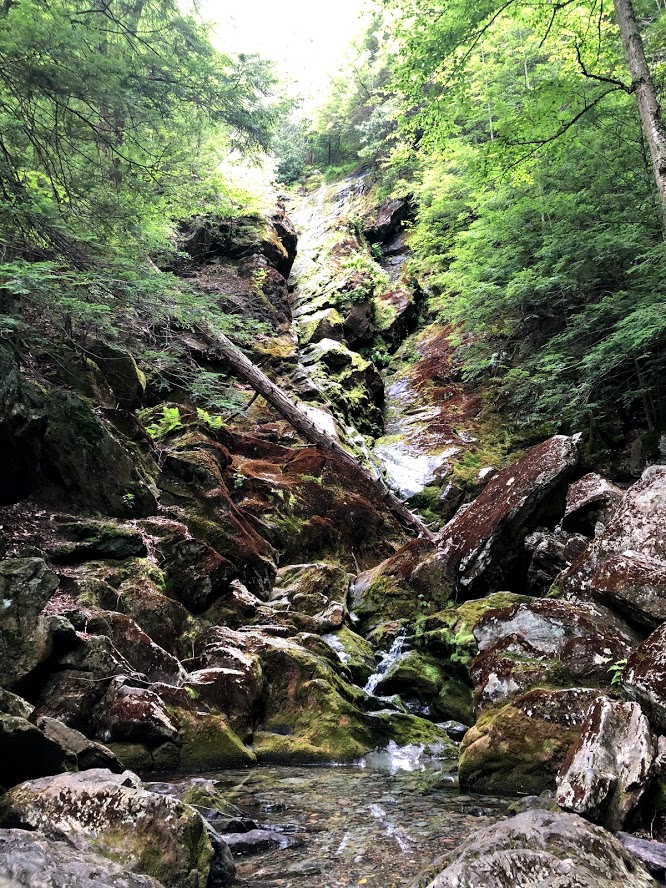
We decided to just go part way up the mountain to visit Race Brook Falls, a series of waterfalls on the side of the mountain. The trail starts out pretty flat in some deep woods.
At the first main intersection we took the trail leading to Lower Falls (0.3 miles distance on a moderate trail).
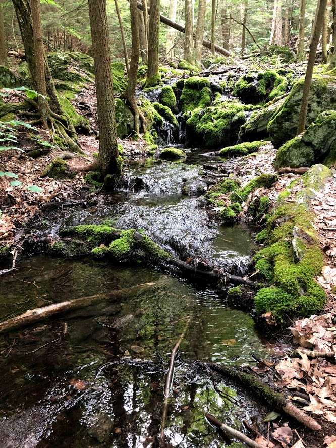
The water flow was very light, despite some recent storms that had passed through the area (but apparently not right here). We scrambled around a bit on the rocks at the base. Then instead of backtracking, we took a steep shortcut up the left side of the waterfall to reach the top of the Lower Falls.
It was the dry season, so not muddy or slippery, but it could be difficult if the trail’s wet.
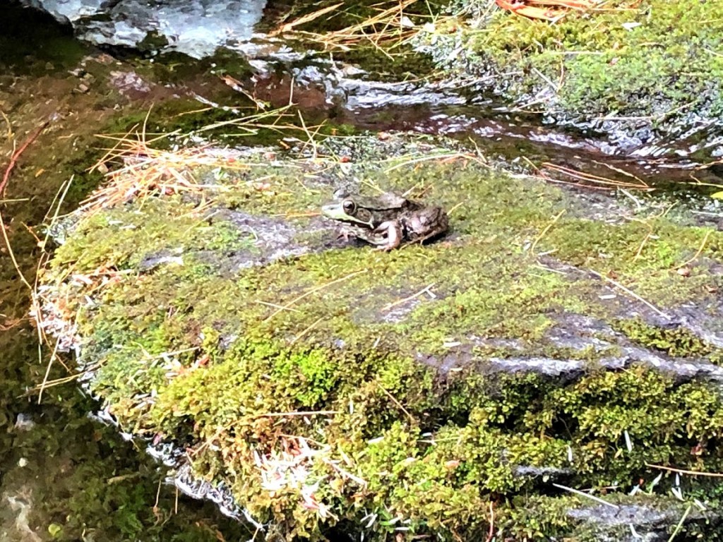
Stopping here to rest, we found a great view of the Berkshires and a few big frogs on the mossy rocks. We water was very clear and cold.
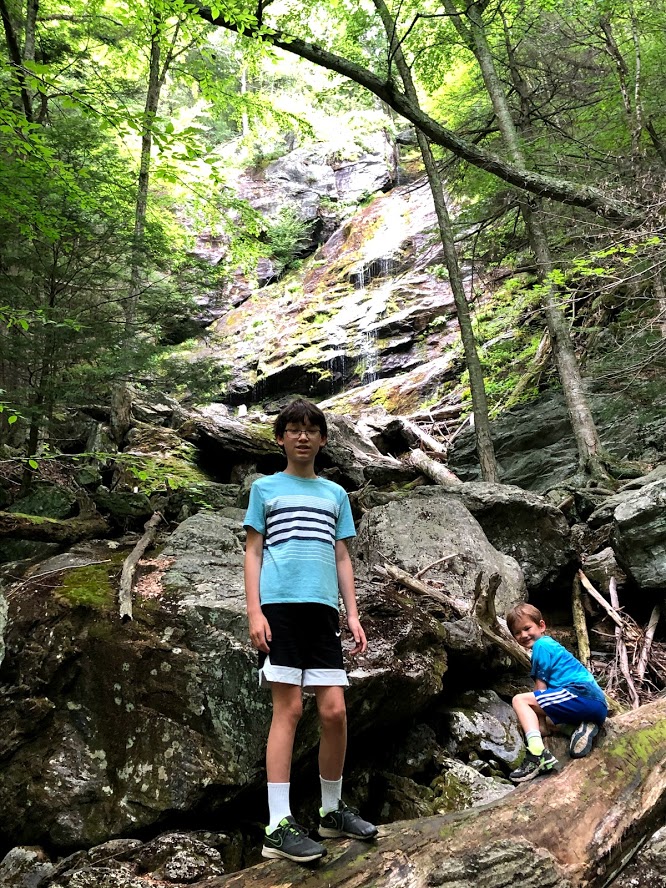
Now we joined the main trail and made our way to the Upper Falls but there was still very little water. But the Upper Falls looked pretty dramatic from the base.
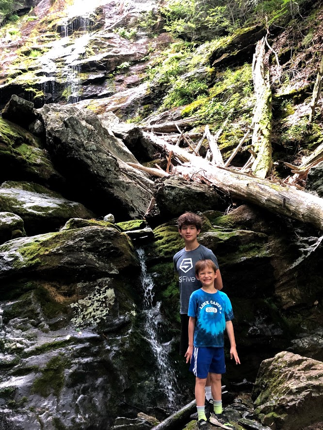
At this point, we continued on a trail that was a steep climb to a ledge for a good view of the mountains and then continued to the top of the Upper Falls.
We followed the brook on a level path away from the waterfall toward the campsites. After reaching that area, we turned back and stayed near the waterfall for a rest. The kids explored and played in the brook, then we crossed the bridge and descended the trail.
This time, we took the blazed path that skirts around the waterfalls and eventually returns to the brook, leading down toward the start of the trail.
The waterfall was “low flow” but still scenic and dramatic. Although this state park is somewhat remote, this corner of the state offers a peaceful retreat and some quaint little towns to check out.
Although there wasn’t much water flowing, the falls were scenic and hiking alongside the waterfall was new and challenging.
Waterfall is dry. A disappointment. Hiking up the waterfall is pretty exciting.
This was like the third time we hiked up a mountain only to find no water. Very disappointing!
There was barely any water on the waterfall!! what an outrage!!
We were climbing up the mountain and it seemed really long but it was just a mile and we could jump on rocks and that was super fun and there were frogs.
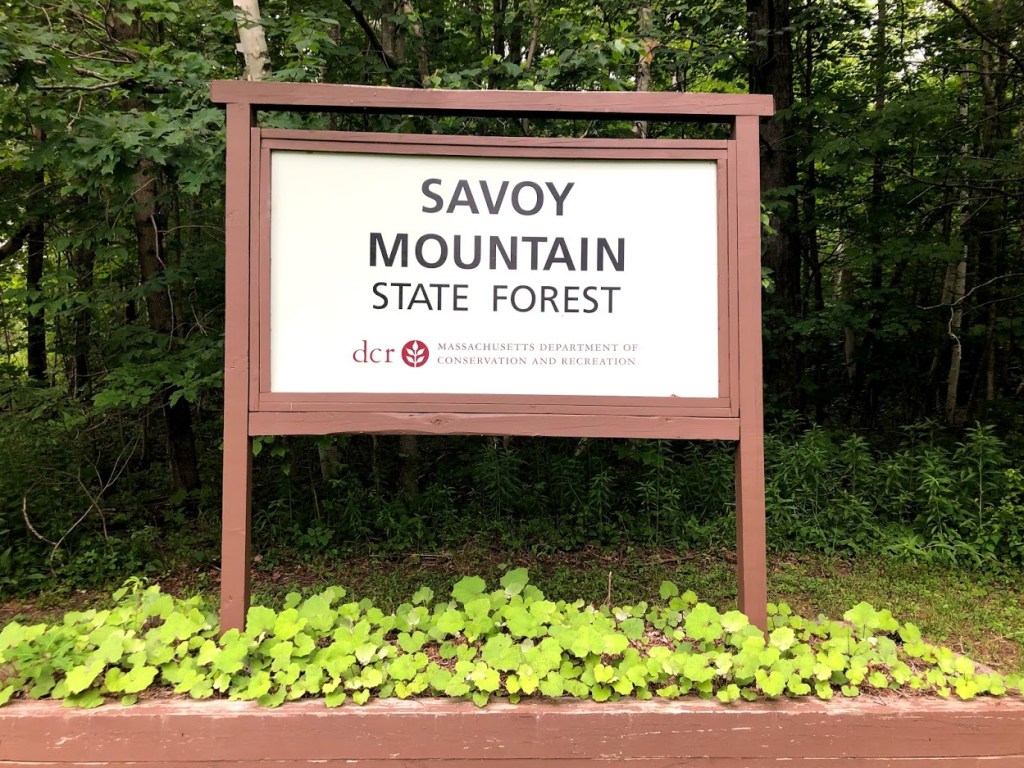
Savoy Mountain State Forest is a fairly remote forest located partly in the towns of Savoy and Florida in the northwest part of the state. It has several ponds, hills, and waterfalls within its boundaries.
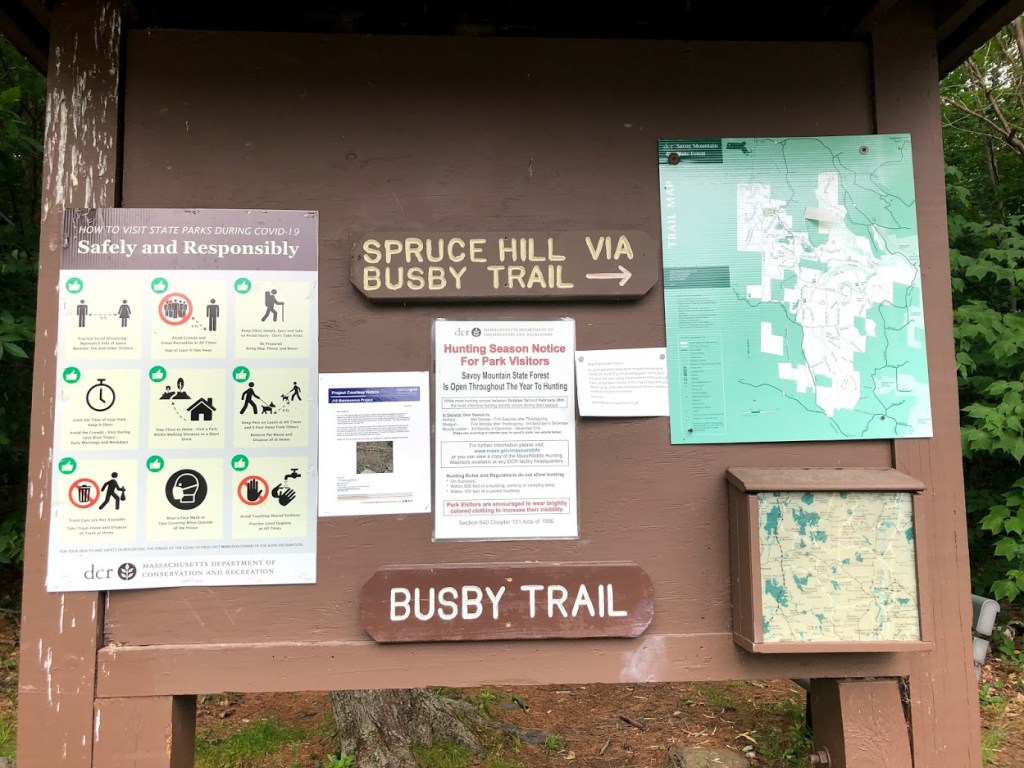
We took the Busby Trail up Spruce Hill (2,566 ft.) since we read that it offered really spectacular views for modest effort.
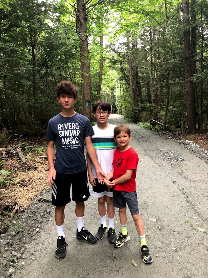
This trail is 3 miles roundtrip, and the first section is a flat gravel road to a powerline crossing, after which it enters the woods.
After entering the woods, the trail climbs only modestly.
The trail then turns south and climbs more solidly for the last 1/2 mile.
At some point we passed an old cellar, which seemed an unusual location, partly up the hill.
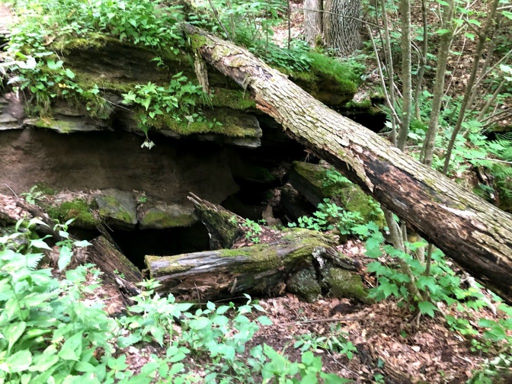
At another point, the trail has signs warning of dangerous ice, just above some “caves”.
The last half mile was much steeper. We crossed over the trail to Lost Pond, which we didn’t visit. We had heard it was very difficult to follow and was washed out/moved by beavers. Hence the name “Lost Pond”.
The last part of the hike had a series of rock steps up to the summit.
Finally we reached the summit (or one part of it). Even at this point you start to have some pretty expansive views.
We then found a huge rock in a clearing, with fantastic views toward Mt. Greylock and the Taconic Mountain Range in New York state. Mt. Greylock is the high peak on the left side (at 3,491 ft), with the town of Adams and North Adams below it. You can even see the war memorial tower on the peak of Mount Greylock State Reservation from here. Really the views are nearly 360 degrees.
View to the west with NY state in background
After enjoying the super views, we headed back down the Busby Trail to the car.
On this trail we saw only one other hiker and had the top to ourselves. The whole family really enjoyed Spruce Hill and agreed it provided big rewards for very modest effort.
A rewarding view of the Berkshires for very modest effort. Great views of Mt. Greylock.
This is a good short hike to a great view on top. A gem.
The view was really good, we could see a cemetery and a quarry (plus a few irrelevant mountains).
The hike was not to long and the view was really good.
When you go up the mountain there was a bench and we had trail mix at the top and the view was really good so it was fun.
This is a state forest in Windsor, MA, in the northwest part of the state. We visited with plans to see the “cascading waterfall as Windsor Jambs”, which was listed on the state site, along with an impressive-looking picture.
GPS took us to northern section of the forest (Bush Rd and Rt 116). The initial point seemed to be down a narrow, rocky road, so we tried to find an alternate route. Roads through the forest were mainly gravel and some were closed.
We drove across the park on Bush Road to Bush Cemetery Road, which was all unpaved. There were very few signs but finally passed a small cemetery within the forest (the Bush Cemetery).
Within the park there were no cell signals, so plan accordingly and bring a good map.
Eventually we came to a main intersection where a man was working and just getting into his pickup truck. Fortunately for us he confirmed that we had indeed arrived at Windsor Jambs. But he didn’t know anything about the huge gorge and waterfall. He did say that maybe 20 years ago the water flow was much better and this was a sort of local swimming hole.
We saw a small brook crossed by a bridge, with a parking lot beyond. Since the gates were closed we just got out of our car to take a look.
There was no gorge or waterfall here, but just some ruins of a dam. We also found an old park building with a payphone on the side, and another one abandoned by the side of a meadow. There were also a few picnic tables.
It turns out the park has been closed since 2009 due to budget cuts and is only just now being restored (hence the worker we met in this area).
After a few minutes we got into the car and headed south to see if we could find anything but just exited the park. Turning back we headed north through the park but did not see any more signs or indications of the gorge and waterfall.
There were campgrounds along the river but they were closed.
Looking online later, it turns out that we had missed the short hiking trail to the gorge, which was east of our location, off of Schoolhouse Road. As I said, make sure that you have a detailed map when you enter the forest. Apparently the waterfall and gorge are a hidden gem. Well, there’s always next time.
This park is undergoing revitalization. Not much to see at present and facilities are not really open.
The park is just getting restored. It’s not open. DCR should add warning on its web site so visitors know to avoid it at the present.
This was the worst park ever. There was nothing here and it was all overgrown.
There was almost nothing at this state park, but that means we didn’t have to walk much.
We didn’t have to walk so that was good and there wasn’t much signs either.
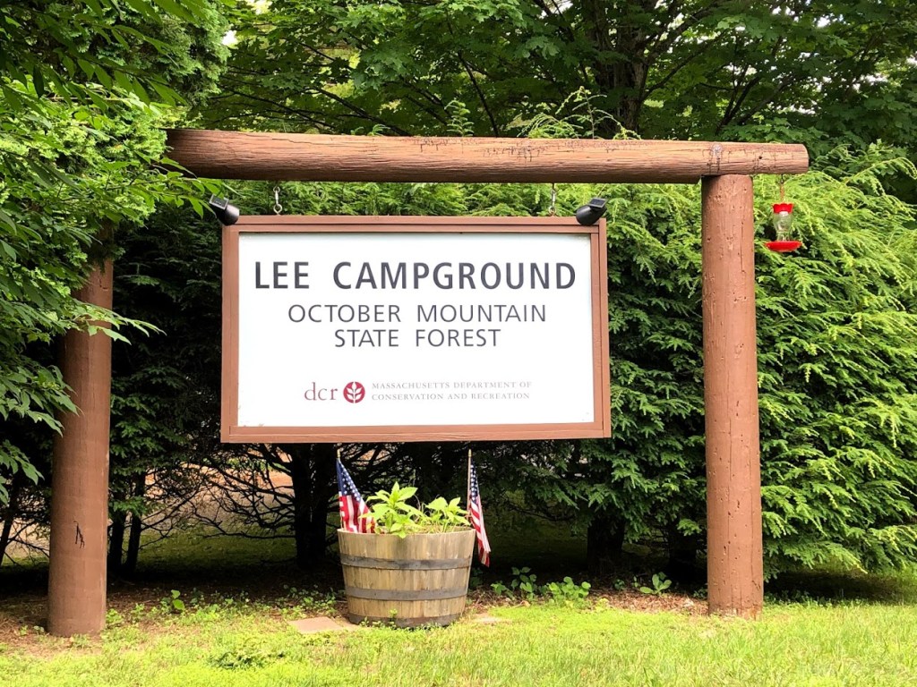
October Mountain is the largest state forest in Massachusetts, and has parcels in the towns of Washington, Becket, Lee, and Lenox.
We had originally planned to go to the Washington Mountain Marsh trail, but could not find a route there as the Washington Mountain Road on our route was blocked off.
We ended up at the Lee Campground on the south side of the forest instead, where we asked for directions, and were told by the ranger that some bridges were broken in that area. They suggested several trails that started from the campground such as the Ledge Trail (a 2 mile loop) as well as the Gorge Trail.
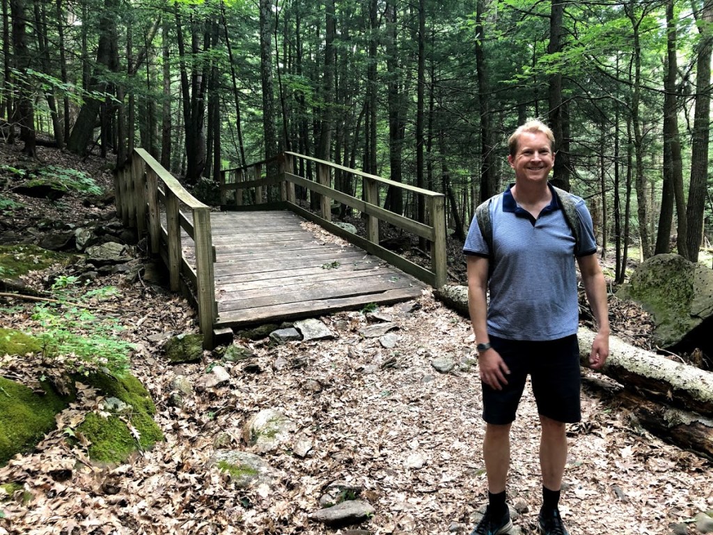
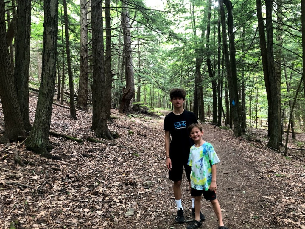
For this hike, we decided on the Ledge Trail, which was fairly rough and rocky. The forest was quite dense and dark from the start, with some pesky mosquitoes. Thankfully we had our Deep Woods OFF.
The trail climbs gently at first and crosses a bridge. After this it turns and ascends the side of a ridge. There were many downed trees just to the side of the path all along the way.
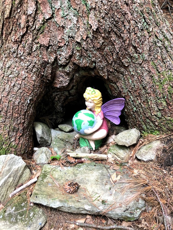
But we did come upon a whimsical tree with an interesting fairy.
Continuing up the ridge, we hoped to find a waterfall at Flat Rock Falls, but the falls were dried up and moss covered, as you can see below. I guess we’ve been in a drought this summer.
After hiking along the ridge for a short time, we searched for but didn’t encounter any views of surrounding mountains, which was disappointing. The trail then turned left and descended pretty steeply off the ridge and back toward the campground.
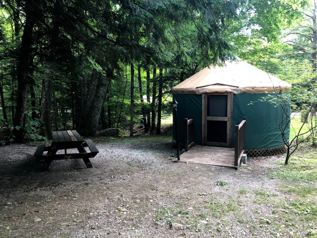
The campground itself was a mix of standard campsites and yurts, and was nearly empty. We peeked inside one of these, and it had a cozy interior with 2 bunk beds (sleeps 4 max) and a picnic table. I’m not sure they would permit a family of 5 there, since you’d need an extra sleeping bag or mattress, but it looked fun.
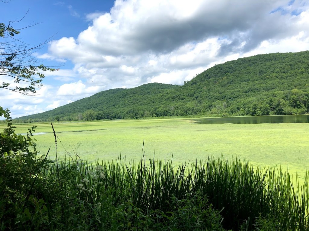
After the hike, we decided to drive the forest roads, heading around the western side of the park and then into the interior. A flat gravel road soon led to a pond (Woods Pond) covered with algae and surrounded by mountains. We saw geese on the pond.
Continuing around the far side of the pond on Lower Tower Road into the park was an adventure. The gravel roads were rutted and rocky at points, and definitely more suited to a pickup truck than a lightweight SUV driven by city slickers. It was slow going and we had to watch the road carefully to avoid hitting rocks too fast.
In any case, we climbed for a few miles and eventually reached a really scenic pullout, with no signs of humans or road noise. It also had great views to distant mountains to the west.
We didn’t go to any other trails in the park as every side trail is reached by driving on even poorer unpaved roads. After many more miles we found our way on back to the paved county roads.
October Mountain is a really rugged park and great for finding solitude. Just make sure you are prepared with good outdoor gear and enough fuel.
The ledge trail was pretty buggy and lacked any views. Great place for solitude.
This park is very rugged and wild.
There were a lot of bugs, and it was pretty steep.
There was a lot of bugs, but the trail was okay. The view was good.
There was a bunch of bugs, it was steep, and we had to go on a bumpy road and it was weird.
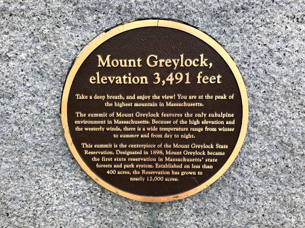
Mt. Greylock at 3,491 feet, is the highest peak in Massachusetts. We parked near Adams, Mass. and took the Thunderbolt Trail up and the Bellows Pipe Trail down.
The hike was about 5.5 miles roundtrip, with an elevation gain of over 2,200 ft., making it one of the hardest trails we attempted as a family.
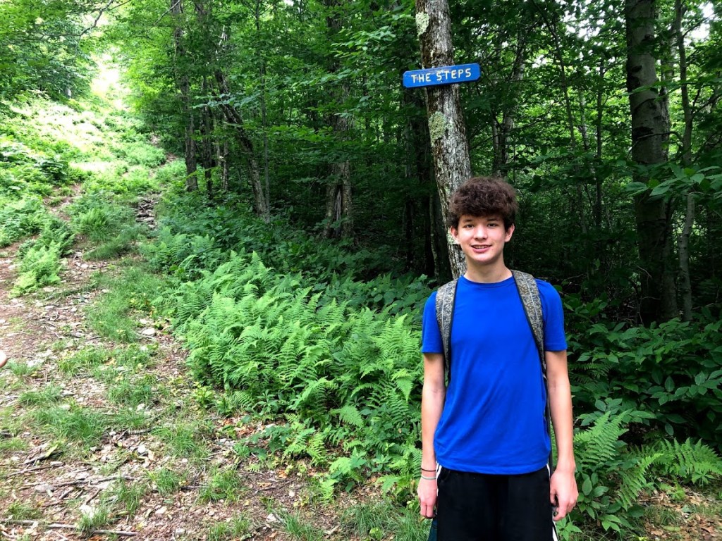
We parked at Friend Street, on the east side of the mountain, which is the parking area for Thunderbolt, Bellows Pipe, and Gould trails. Thunderbolt has sections with nicknames like The Steps, Big Bend, and The Dump, which we were interested to check out.
The trail starts on a wide and flat gravel path for a few minutes.
Pretty soon the trail narrows and begins to climb steadily alongside a brook.
After the split with Bellows Pipe trail, Thunderbolt swings to the left and gets very steep, heading straight up the mountainside in a clearing that’s a ski trail during the winter. The first part of the trail was narrow but very lush, with a thick carpet of ferns.
Although it’s difficult to see here, the angle is steep, and it really gets your heart pumping. We (the parents) had to rest at several spots to catch our breath and sip water. Meanwhile, Liam and the other kids wanted to race ahead.
After a relentless climb, we started to get some views to the north and east.
The next section, The Steps, lived up to its name. It seemed to consist of a short climb, followed by a level section, and then more climbing. Several parts of the Thunderbolt were named this way.
At the top of The Steps we continued onto Big Bend for a final steep push. This was rewarded with our best views so far, and we sat for a couple minutes for a snack break.
After this, the last part of the trail was less than 1/2 mile to the top and had a moderate climb.
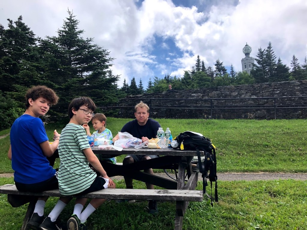
After crossing the auto road to the summit and pushing up a final hill, we reached the main parking lot and picnic area just below the summit, where we stopped for lunch.
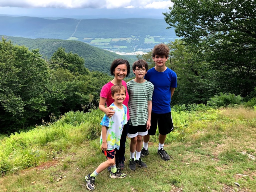
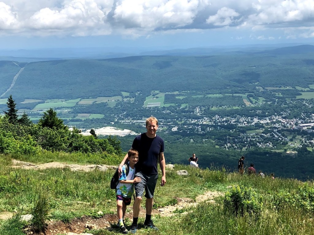
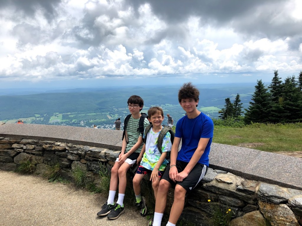
Finally we reached the summit of Mt. Greylock and its stunning views (the below picture is looking east).
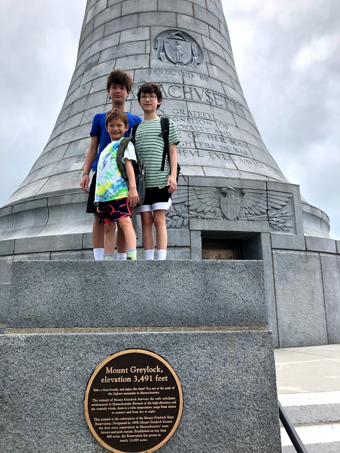
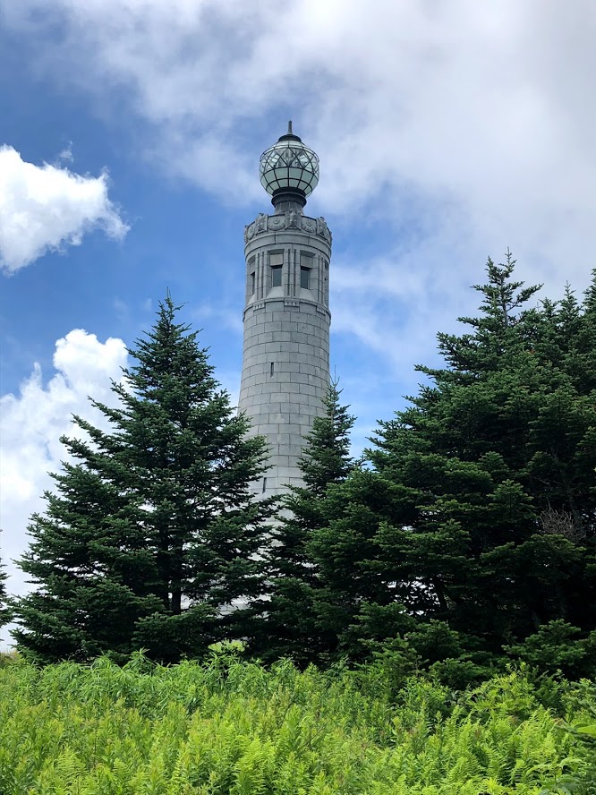
After taking in the views, we walked around and up to the war memorial on the actual summit.
This granite memorial, dedicated in 1933, is called the Massachusetts Veterans War Memorial Tower and stands 93 feet tall. Unfortunately, it was closed to visitors in 2013 due to structural issues and was not a victim of the Covid pandemic.
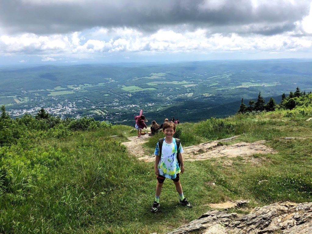
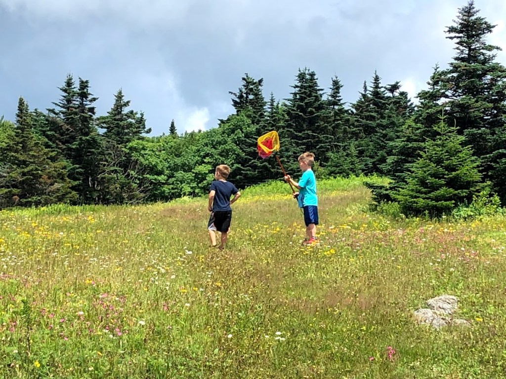
We also learned that Greylock has the only sub-alpine environment in Massachusetts. You can see this unusual terrain in the picture below, where we watched some young boys chasing and catching butterflies in the meadow. It looked like The Sound of Music!
Another interesting note is that the Appalachian Trail crosses the mountain and continues northward into Vermont.
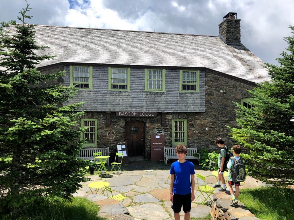
We also checked out the Bascom Lodge, built in the 1930’s. Although the cafe was closed (on Mondays and Tuesdays) when we visited, it was a great spot to take in the sub-alpine views and relax in the sun. The lodge even has a few guest rooms where you could stay the night.
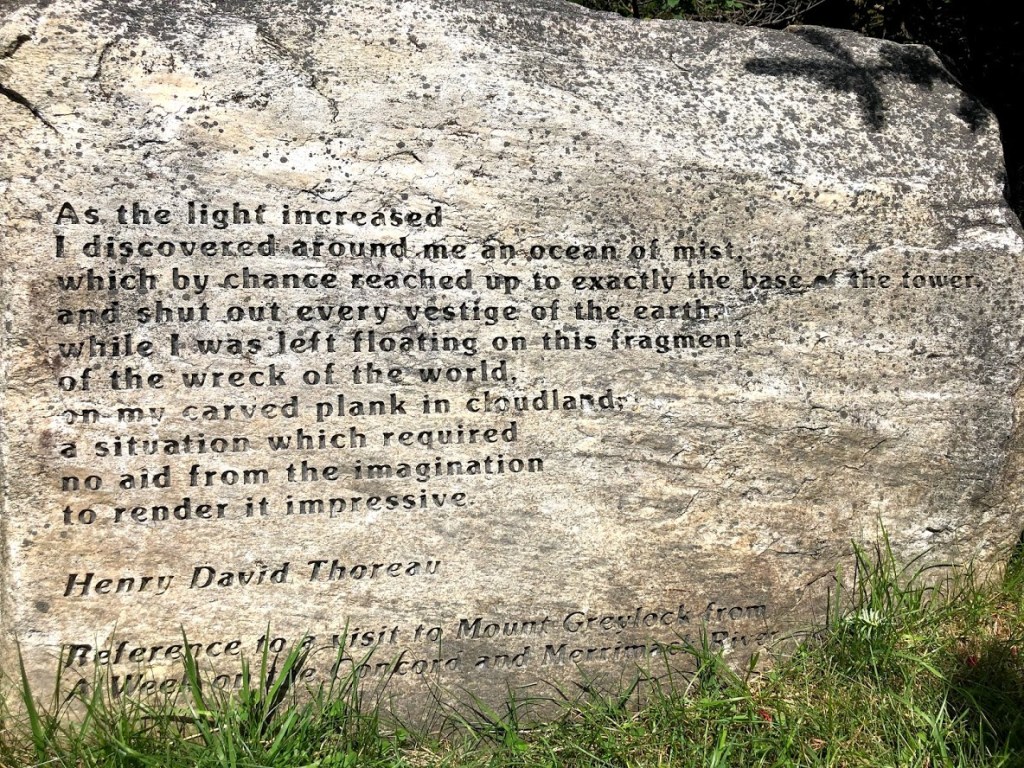
On our way around the summit just before out descent, we found a marker engraved with words from Henry David Thoreau on his visit the mountain.
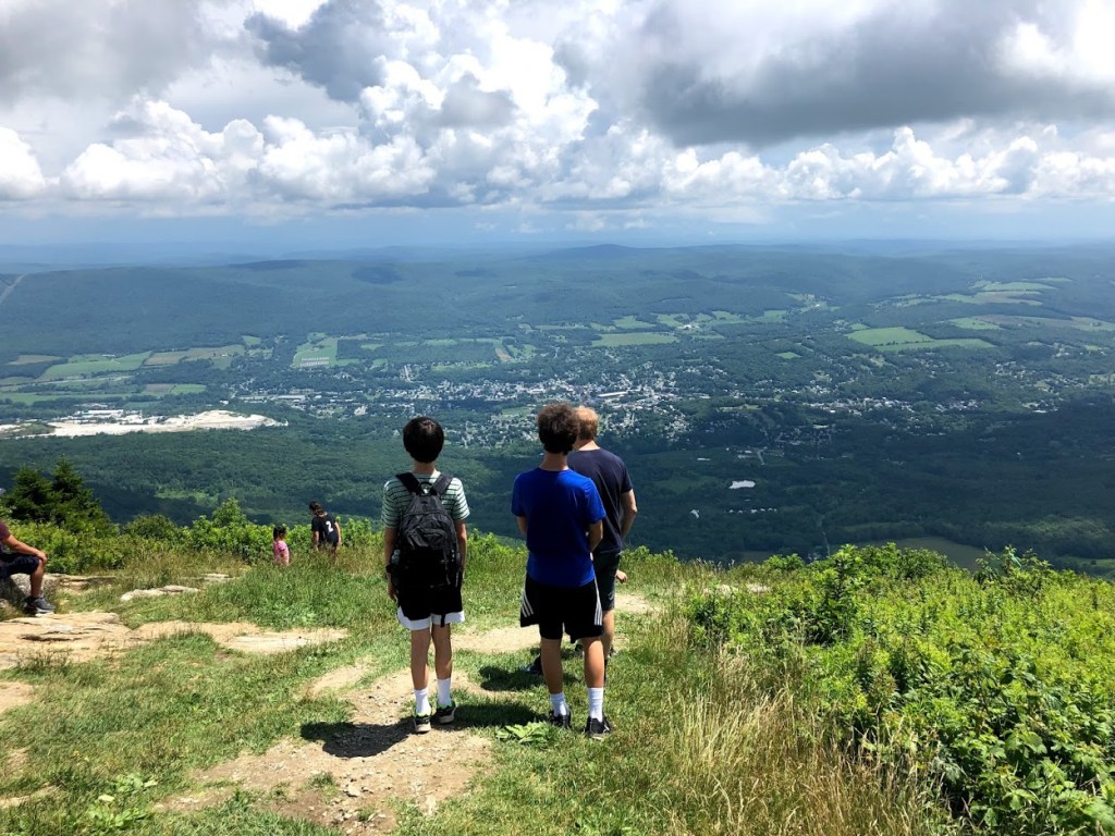
Reaching the east side of the mountain, we stopped one last time to take in the views. We were able to spot Mt. Monadnock from here (a popular mountain to hike in southern New Hampshire).
Looking back, the sky was clearing and we got a great view of the tower.
We descended the mountain on the the Bellows Pipe trail, which was less steep than Thunderbolt.
As we reached lower elevations we found a lean-to for backpackers.
The trail crossed back and forth over a stream and some minor waterfalls, each of which had a helpful little bridge.
Eventually we rejoined the Thunderbolt Trail and the final descent to the wide gravel path and the parking lot.
A relentless climb but rewarding summit, with beautiful views and sub-alpine terrain on the mountain top.
Very challenging hike, but the views on top are worth it. Very rewarding!
The hike was really long but Ryan made it longer with his pointless word games.
The hike was super long and steep but it was fun going down the mountain.
The Thunderbolt trail was super duper duper steep but it had a lot of ferns and then there were steps also so it was easier to get to the top.


 Beautiful hillside walk with mountain laurels. Swimming was refreshing in the clear water.
 Going in June to see the mountain laurels. The pond is very beautiful.
  The hike was pretty average and the beach was too cold. But compared to some of the others it was heaven on earth.
 The hike was pretty. The beach was good but the water was cold.
 The mountain laurels were pretty. The beach was pretty good, but there were bugs on the hike.